NASA
Nasa: Callisto 3 Images
This site from NASA provides a complete collection of images during orbit 3 of Jupiter's moon Callisto. Also links to data released from all Galileo orbits to date. Check the "Family Portraits" of the Galilean moons and other images at...
NASA
Nasa: Galileo Image Gallery: Jupiter Great Red Spot
NASA provides images of Jupiter's Great Red Spot to share with the public the excitement of new discoveries being made via the NASA/JPL Galileo spacecraft.
National Snow and Ice Data Center
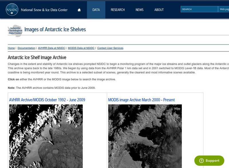
National Snow and Ice Data Center: Images of Antarctic Ice Shelves
View satellite pictures of 19 different areas of the ice shelves surrounding Antarctica. Each picture is labeled and can be viewed in the thermal or visible parts of the spectrum.
Science Education Resource Center at Carleton College
Serc: Shrinking Forest Growing Problem
In this learning module, students will examine images of Brazil's Amazon rainforests that were captured by satellites between 1994-1996, to observe and measure the impact of deforestation over time. A download of a public domain software...
Other
Adb: How Remote Sensing Technology Improves Efficiency of Irrigation Systems
With the increase of free satellite data combined with scientific algorithms and cloud computing capacity, developing affordable operational monitoring systems for irrigation management in Asia is now feasible. The use of virtual field...
NASA
Nasa: Ganges River Delta
View a satellite image of the Ganges river delta. Click on the image to see a more detailed picture.
NASA
Nasa: Astronomy Picture of the Day: Above the Eye of Hurricane Ivan
A satellite image of the eye of hurricane Ivan, one of the deadliest hurricanes to date.
Other
France 3: Meteo
Resource provides weather reports from France - different cities, regions and other French possessions overseas are accessible. Satellite images and air quality indexes are also available.
Science Buddies
Science Buddies: Catching Stardust
How do astronomers collect stardust? They design and build satellites that are launched into space to collect particles on specially designed panels. Satellites can be sent to orbit around an object of interest: a planet, moon, or comet....
NASA
Nasa: Cobe: Cosmic Background Explorer
The Cosmic Background Explorer, or COBE, satellite began its space mission in November of 1989. Its task was to measure radiation levels from the early stages of the universe. This site explains the mission goals, COBE's specialized...
Science Buddies
Science Buddies: Observatory Satellite Measures Motion of Coronal Mass Ejection
The sun sometimes releases huge bursts of electrified gases into space. These bursts are called coronal mass ejections (or CMEs). When CMEs are directed towards Earth they can generate auroras, the spectacular atmospheric displays also...
NASA
Nasa: Image Science Center: Ask the Space Scientist
A NASA scientist, Dr. Sten Odenwald, answers many students' questions. Topics include planets, galaxies, black holes, the origin of the universe, and common misconceptions about space.
Curated OER
Geology.com: Kazakhstan Map Kazakhstan Satellite Image
Check out this great satellite image of Kazakhstan from Google Earth. Scroll past the informative political map to see the image. There is more information about the country below the satellite map.
Curated OER
Geology.com: Kyrgyzstan Map Kyrgyzstan Satellite Image
Check out this great satellite image of Kyrgyzstan from Google Earth. Scroll past the informative political map to see the image. There is more information about the country below the satellite map.
Curated OER
Geology.com: China Map China Satellite Image
Check out this great satellite image of China from Google Earth. Scroll past the informative political map to see the image. There is more information about the country below the satellite map.
Curated OER
Geology.com: Kuwait Map Kuwait Satellite Image
Check out this great satellite image of Kuwait from Google Earth. Scroll past the informative political map to see the image. There is more information about the country below the satellite map.
Curated OER
Geology.com: Albania Map: Albania Satellite Image
Check out this great satellite image of Albania from Google Earth. Scroll past the informative political map to see the image. There is more information about the country below the satellite map.
Curated OER
Geology.com: Angola Map Angola Satellite Image
Check out this great satellite image of Angola from Google Earth. Scroll past the informative political map to see the image. There is more information about the country below the satellite map.
Curated OER
Geology.com: Lesostho Map Lesotho Satellite Image
Check out this great satellite image of Lesotho from Google Earth. Scroll past the informative political map to see the image. There is more information about the country below the satellite map.
Curated OER
Geology.com: Madagascar Map Madagascar Satellite Image
Check out this great satellite image of Madagascar from Google Earth. Scroll past the informative political map to see the image. There is more information about the country below the satellite map.
Curated OER
Geology.com: Malawi Map Malawi Satellite Image
Check out this great satellite image of Malawi from Google Earth. Scroll past the informative political map to see the image. There is more information about the country below the satellite map.
Curated OER
Geology.com: Namibia Map Namibia Satellite Image
Check out this great satellite image of Namibia from Google Earth. Scroll past the informative political map to see the image. There is more information about the country below the satellite map.
Curated OER
Geology.com: Zambia Map Zambia Satellite Image
Check out this great satellite image of Zambia from Google Earth. Scroll past the informative political map to see the image. There is more information about the country below the satellite map.
Curated OER
Geology.com: Ireland Map Ireland Satellite Image
Check out this great satellite image of Italy from Google Earth. Scroll past the informative political map to see the image. There is more information about the country below the satellite map.
Other popular searches
- Satellite Imagery
- Hurricane Satellite Images
- Infrared Satellite Imagery
- Image Satellite
- Aerial and Satellite Imagery
- Satellite Images of Erosion
- Science Satellite Imagery
- Satellite Imagery Weather Maps
- Octagonal Image Satellite


