Association of American Geographers
Project GeoSTART
Investigate the fascinating, yet terrifying phenomenon of hurricanes from the safety of your classroom using this earth science unit. Focusing on developing young scientists' spacial thinking skills, these lessons engage learners in...
Curated OER
Keep In Touch: Communications and Satellites
Fourth graders explore communications by reading assigned space science text. In this satellite lesson, 4th graders identify the concept of orbiting and examine gravitational pull by viewing diagrams. Students are assessed based on...
Curated OER
Explore Surface Types on a Journey Around Earth
Students explore satellite data. In this technology cross-curriculum math and world geography lesson plan, students locate specific map areas using a microset of satellite data. Students use technology and math skills to determine...
Curated OER
Comparing the Satellite and Broadcast Radio Landscapes
High schoolers research the development of satellite technology over the last 50 years students explain how the enactment of the Telecommunications Act of 1996 changed the rules for corporate ownership of multiple media outlets.
Curated OER
Our Eye in the Sky: The TIROS Weather Satellite
Students investigate the political context of the creation of a weather satellite. For this technology and society lesson, students explore the historical, technological, and political context of the TIROS weather satellite. They write a...
Curated OER
Eyes in the Sky
Middle schoolers examine the use of satellites. For this research lesson, students discuss the history of satellites and how we use the information today. They will conduct interviews with older adults who have lived in the changing...
Curated OER
Satellite Images- Night Time
Fourth graders study the geography and population distribution of various places on earth. They utilize actual satellite images of the night sky (lights showing heavily around area of dense population) to study and make observations...
Curated OER
Satellite Maps
Students examine contemporary satellite and digital maps. They explore new mapping technologies have transformed the field of cartography. At the same time and analyze how mapmakers' 'interests' are still present in digital maps.
Curated OER
Lesson 6: Crowded Skies
This is a treasure-trove of multimedia resources to help your scholars analyze transportation methods. They discuss different forms of movement, utilizing several infographics to spur conversation deeper and get visual learners engaged....
Curated OER
Can You See What I See?
Students gain an understanding of the methods used to explore the earth's surface. Students create a time line leading to the first satellite image of the Earth that includes the various methods utilized to observe the earth's surface.
Curated OER
GPS Worksheet
In this GPS worksheet, students complete 6 fill in the blank questions about GPS satellite signals, receiver units and the acronyms used in GPS technology.
Curated OER
Geography from Space
High schoolers explore geography as seen from space. In this web-based lesson, students brush up on geography skills by identifying geographic locations based on satellite or aerial images and a brief clue.
Curated OER
A Bird's Eye View Of Your Community
Students locate and identify their community by using a satellite image from the Internet. Students locate and identify common land structures within their community. You may want to include structures such as roads/streets, houses and...
Curated OER
How Much Water is Available in the Atmosphere for Precipitation?
Students explore the relationship between the amount of water in the atmosphere available for precipitation and the actual precipitation observed by satellite. They examine seasonal changes in precipitation. They practice using Internet...
Curated OER
From Pirates to Pilots to Spies
Sixth graders enjoy this introduction to the world of map projections, globes, aerial photographs, and satellite images. This lesson instructs students on the advantages and disadvantages of each earthly representation.
Curated OER
Roaming Biomes
Students use the Internet to research the capabilities of earth-observation satellites. Using the information, they write a report on how remote-sensing technology is used to measure the impact of climate change. They identify the...
Curated OER
Tropical Atlantic Aerosols
Students analyze NASA data from the Multi-angle Imaging Spectroradiometer. In this NASA data activity, students access an assigned website to examine information from the MISR on the Terra Satellite. They determine how desert dust...
Curated OER
Search for Ice and Snow
Students use satellite images to locate areas of ice and snow on the globe. They create a table showing the information they gathered. They present their information to the class.
Curated OER
Trekking to Timbuktu: The Geography of Mali -Teacher Version
Learners investigate the geography of Mali. They locate Mali on a satellite map, explore various websites, describe the landscape and climate, label a map, and write an essay about the Niger Riger.
Curated OER
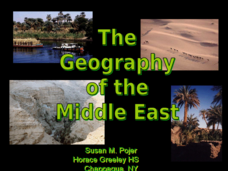
The Geography of the Middle East
Topographic, political, and satellite maps establish the world of the Middle East for your class- a land about which they have heard quite a lot, but might not really understand. This presentation would be a good introduction into a unit...
Curated OER
Google Earth Scavenger Hunt
Students complete activities to learn how to use Google Earth and study Alaska. In this Google Earth lesson, students complete a Google Earth scavenger hunt to find facts about Alaska. Students complete two worksheets for the topic.
Curated OER
I Know Where You Are!
Students study what a GPS is and use it to challenge themselves and find positions on a map. For this investigative lesson students find various points on a map using a GPS system and answer questions on a worksheet.
Curated OER
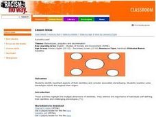
Satellite Self
Students identify important aspects of their identities and consider associated stereotyping. They examine some stereotype cliches and explore their origins.
They address the importance of individuals self-defining their identities and...
Curated OER
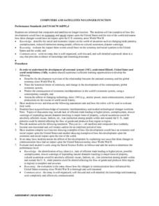
Computers and Satellites No Longer Function
They describe the development over time of the relationship between the national economy and the global economy since World War II. They trace the historical forces of continuity and change in the development of the contemporary global...
Other popular searches
- Artificial Satellites
- Falling Satellites
- Natural Satellites
- Orbiting Satellites
- Space Satellites
- Weather Satellites
- Soho Satellites
- Satellites Voyager
- Yohkoh Satellites
- Global Positioning Satellites
- Satellites and Orbits
- Centripetal Force Satellites


