Maths Revisions
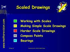
Scaled Drawings
Your carpenters will enjoy learning scaled drawing techniques and applying their new knowledge to make some real-life scale drawings of gardens. Your carpenter scholars will be reviewing some basic skills in a warm-up section of problems...
Scientific American
Life-Sized Drawing
Ocean explorers or mathematicians research the wreck of the CSS H.L. Hunley. They investigate the actual dimensions of the Hunley using math and measuring skills. Afterward, they sketch a large scale drawing of the submarine outdoors on...
Curated OER
Map Adventures
Students explore the relationship between a scale drawing and actual distance. In this mapping instructional activity, students use an amusement park map to determine distances and what they would be like in real life.
Curated OER
Scale Skills
In this mapping skills activity, students read an excerpt that describes three different types of scales and how to calculate distance on a map. They respond to two short answer questions using the map provided on the sheet and to...
Curated OER
Designing a Hiking Trail
Put your students' map skills to the test with this engaging cross-curricular project. Given the task of developing new hiking trails for their local community, young cartographers must map out beginner and intermediate...
Curated OER
Mapping Central Park
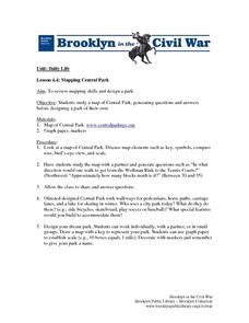
Students use the mapping skills to explore New York's Central Park. They examine a map of Central Park to discover its features. After discussing the characteristics of the park, students design their own dream park and draw it to scale.
American Institute of Architects
Architecture: It's Elementary!—First Grade
Build an interest and appreciation for architecture in your young learners with this fun 10-lesson art unit. Engaging children in using their five senses, the class first observes the environment around them, paying...
Curated OER
Map Scaling
Second graders use a map scale to determine distances between cities in the state of Florida.
Curated OER
You Are Here
Students map local places and learn to use scale and distance. In this mapping lesson, students map their school and a favorite place. Students recreate their maps showing distance and scale sizes. Students locate their...
Curated OER
A Walk on the West Side
Students comprehend what makes up the physical community. Read and construct scale drawings and models. Explore the history of infrastructures and how the contributions of science, math and industry have led to the development of their...
Curated OER
Mercalli Scale Illustrated
Students study the Mercalli Scale and analyze how it is used to rate earthquakes. They construct a booklet with drawings that represent each rating of the scale. They study why engineers develop rating scales for earthquakes.
Curated OER
Thematic Maps of Your School
Students are able to list the essential elements of a thematic map, understand and use scale effectively to represent a geographic area, use research skills to develop a body of information, plan and draw an accurate thematic map based...
Curated OER
Everyone can explore architecture
Students draw like an architect. In this interdisciplinary lesson, students research and draw several examples of different forms of architecture through societies, cultures and times, then present them to the class.
Curated OER
Pyramids
Young scholars explore the pyramids of ancient Egypt. They travel back in time to recreate scale drawings of the Great Pyramid and discuss the inside of the Great Pyramid. They research and find out about the mummification and burial...
Curated OER
Mr. Pitonyak's Pyramid Puzzle
Students determine how much it would cost to build a pyramid using modern materials and ancient methods. They design scale drawings, models and submit final cost bids in an attempt to get the job of building a pyramid.
Curated OER
Building A Nation
Learners build their own nation in groups where they create a name, flag, declaration of independence, form of government, mathematical layout, and more. In this nation lesson plan, students also provide a scale drawing of their nation...
Curated OER
Drawing A Map
Students discuss any information they already know about maps. As a class, they draw a map of a park following written directions making sure to include a compass rose and key. They are graded based on a rubric and discuss the need for...
Curated OER
A Walk Through Time
Students investigate the types of footwear worn during ten periods of history. In this secondary, art/math/social studies lesson, students view documentaries and popular films to study the time periods. Students research the...
Curated OER
Problem-Solving Decisions: Reasonable Answers
In this problem solving worksheet, students answer 6 questions pertaining to a story problem about a tabletop scale model of the Nile River.
Curated OER
Let's Go Golfing
High schoolers bring their visions for golf courses to life. In this scale model lesson plan, students research golf courses online, plan golf courses on grid paper, and then create scale models of the courses they planned.
Curated OER
Map Making/Floor Plans/Map Reading
Students apply their knowledge of scale when mapping the classroom. They determine the use of a map legend and orient a map using a compass. They create the classroom maps using transfer graph paper.
Curated OER
The Gold Rush
Students identify the routes involved in the Gold Rush on a map. In this map skills lesson, students use a United States map to locate the routes used to travel to California during the Gold Rush. Students demonstrate how to use the map...
Curated OER
Cattle Trails
Students identify and locate cattle trails on a globe. In this map skill lesson plan, students use a marker to locate Texas and Montana and use the map scale to calculate the distance of the cattle trail.
Curated OER
Battle of Clontarf 2
In this Battle of Clontarf worksheet, learners read about the battle, answer short answer questions, draw a picture, and estimate the population. Students complete 4 activities.
Other popular searches
- Construct Scale Drawings
- Scale Drawings and Maps
- Creating Scale Drawings
- Scale Drawings and Models
- Scale Drawings Using Grids
- Life Size Scale Drawings
- Geometry Scale Drawings
- Flags Create Scale Drawings
- Scale Drawings Worksheet
- Bearings Scale Drawings
- Scale Drawings Aircraft
- Understand Scale Drawings
