Curated OER
Exploring Biomes Lesson 1: Mapping Biomes
Environmental science learners examine satellite imagery of temperature, vegetation, precipitation, and productivity. They use these maps to understand how scientists divide the planet into major biomes. As part of a larger unit on...
Curated OER
Using Satellite Imagery to Discuss the Science Behind Brazilian Deforestation
Students can delve into earth science by using satellite imagery to learn about the deforestation of the Brazilian rainforest.
Curated OER
Image Classification
Students explore what are "multi-spectral" or "multi-band" images? They investigate how landscapes change over time- at least over the time-span of satellite imagery, particulary due to human influences. Students explore how to train...
Curated OER
Upwelling in the World Ocean
Here is a fascinating topic: the upwelling of ocean waters. Oceanography pupils learn what mechanisms cause upwelling, types of upwelling, and the effects on marine life. Colorful satellite imagery and informative diagrams bring this...
Curated OER
Ocean Circulation
In this physical oceanography PowerPoint, viewers learn about ocean circulation, sea surface temperatures, and salinity. Relationships among these aspects are explained, as well as their impact on the atmosphere and climate. Each slide...
Curated OER
Storm Clouds-- Fly over a Late Winter Storm onboard a NASA Earth Observing Satellite
Students study cloud data and weather maps to explore cloud activity. In this cloud data lesson students locate latitude and longitude coordinates and determine cloud cover percentages.
Curated OER
Satellite Sense
Students look at data to understand how it is interpreted by scientists. In this satellite sense instructional activity, students complete worksheets based on radar and satellite images. Students work in groups of two to diagram a...
Curated OER
Interpreting Satellite Images
Students identify differences between photography and satellite imagery space.
Curated OER
A Comparison of Cloud Coverage Over Africa
Students use a NASA satellite data to contrast amounts of cloud coverage over different climate regions in Africa. They explore how Earth's major air circulations affect global weather patterns, and relate to local weather patterns.
Curated OER
A Comparison Study of Water Vapor Data to Precipitation over North America
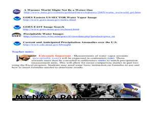
Students use NASA satellite data to compare water vapor over the United States. In this data analysis lesson students use an Excel spreadsheet to map their data.
Curated OER
The Adventure of Echo the Bat
Pupils compare different habitats based on satellite imagery. They identify land features in the satellite imagery.
Curated OER
Cities and Seasons
Students explore how satellite images show seasonal changes in seven cities in North and South America. Through a sequence of images, they study the green-up and brown-down of the seasons and how seasons change over time. Afterwards,...
Curated OER
Measuring Distance and Area in Satellite Images (College Level)
Pupils are able to download, install, and use Image J image analysis software to quantify change over time in satellite images. They access and download satellite images for specific locations and times. Students set a scale (spatial...
Curated OER
Volcanoes in Space
Young scholars research volcanoes on the Internet to compare/contrast the volcanoes on Earth to the ones found on Io, a moon of Jupiter. Students list the similarities and differences in science journals, and illustrate pictures of the...
Curated OER
So, What's it Doing Today?
Students describe short-term variations in oceanographic parameters in the Gulf Stream. In this ocean habitats lesson students use satellite imagery to obtain information in the Gulf Stream.
Curated OER
EWOC2006-Make your own weather forecast - WEST
Students explore making their own weather forecast. They view and discuss a forecasting PowerPoint presentation. Students analyze radar and satellite imagery. They compile many ways to observe clouds.
Curated OER
Seasons and Cloud Cover, Are They Related?
Students use NASA satellite data to see cloud cover over Africa. In this seasons lesson students access data and import it into Excel.
Curated OER
Tracking the Weather
Students use satellite imagery and forecasting maps as a storm moves through the United States. In this weather lesson students track storm systems and chart the systems on a map.
Curated OER
Global Greenup
Students utilize satellite images to track the life cycle of vegetational growth over a large area. Animal migratory patterns are compared to this cycle.
Curated OER
Keeping Watch on Coral Reefs
Students investigate the dangers Coral Reefs face by investigating satellite images. In this environmental protection lesson, students utilize the Internet to discover the types of satellites and sensors used to provide oceanographic...
Curated OER
Fostering Geospatial Thinking: Space to Earth: Earth to Space (SEES)
Students locate and access data to help them with their science inquiry. In this geographical positioning lesson plan students evaluate and compare data sets.
Curated OER
Analysis of Atmospheric Conditions for a High Mountain Retreat
Students examine the relationship between altitude, atmospheric pressure, temperature and humidity at a particular location. They practice science and math in real world applications. They write reports detailing their scientific...
Curated OER
Using Maps To Make Public Health Decisions Case Study: Wildfires in Mexico 2000
Students study environmental health. Using actual NOAA satellite imagery, students investigate the basic concepts of mapping. They explore the relationship between monitoring satellite images and public health decision making.
Curated OER
Going for the Green
Pupils use satellite imagery to obtain information on chlorophyll concentration at selected locations in the Earth's oceans.Students explain the relationship between chlorophyll concentration and primary production.Studen


