Curated OER
Australian Aboriginal Art And Storytelling
Students explore Aboriginal storytelling traditions through the spoken word and through visual culture. They listen to stories of the Dreamtime told by the Aboriginal people and investigate Aboriginal storytelling in contemporary dot...
Curated OER
Australia: the Land Down Under
Young scholars give a solid history and geographic explanation of the country of Australia and explain why it is important. They use some creativity in designing their own island, by using the physical features of this particular country.
Curated OER
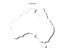
Australia Outline Map
In this Australia and Oceania outline map worksheet, students make note of the major landforms and bodies of water located within this region.
Curated OER
Australia and Oceania: Physical Map
In this Australia and Oceania physical map instructional activity, students make note of the major landforms and bodies of water located within this region.
Mr. Head's 6th Grade Classroom
Absolute Location
How do we know where we are in the world? A presentation for middle schoolers explains absolute location and other geography terms such as relative location. It also gives scholars the opportunity to practice finding absolute location on...
Curated OER
Labeling a Map of Australia
Third graders label a map of Australia. Using the internet, they research the history and maps of the continent and print a blank map. They review on how to use a compass rose and legend. In groups, they create a brochure to share...
Curated OER
Choropleth Mapping Skills
In this geography worksheet, students identify and describe how to apply choropleth mapping skills. They examine the map given and convert it into a choropleth map through coloring. Then students use those colors to shade in their key...
Curated OER
Cultural Mapping
Young scholars are introduced to the cultural diversity in Australia. Using new vocabulary, they define multiculturalism and explore their own cultural backgrounds. In groups, they complete a series of worksheets to develop a better...
Curated OER
Australia
Students participate in activities in which they discover facts about Australia. They examine its climate and history. They complete a worksheet to end the lesson.
Curated OER
Australia Shape Book
In this Australia shape book worksheet, students use a map shape of Australia to make a shape book after printing as many pages they will need for their projects. They fasten the pages together for use in reports, vocabulary words or...
Curated OER
Orienteering: Map Skills
Students discover orienteering. In this orienteering lesson, students search for six specific landmarks. Students brainstorm how maps and landmarks are helpful.
Curated OER
BOLTSS Map
In this geography instructional activity, students identify the six features always used on maps. They identify each of these features by the acronym BOLTSS. Students examine the Melbourne Cricket Ground shown and respond to the 4...
Curated OER
Australia
In this map of Australia worksheet, students research and study a map of Australia. Students label Australia's regions, major states and important landmarks.
Curated OER
Global Lesson: Social Studies On-Line Global Lesson: Social Studies On-Line Continents
In this geography PowerPoint a simple world map on which each continent is represented by a solid green landform is the background for each of the nine slides. The continent names appear in a list on the first slide, followed by one...
National Museum of Australia
Telling Our Indigenous Stories
How far back is 40,000 years? Scholars research the first indigenous people in Aboriginal Australia. Using museum artifacts, maps, and background readings, they form conclusions on the life of the first Australians and their struggles to...
American Battle Monuments Commission
The Great War: U.S. Division Under Allied Command
The victory of Allied forces in World War I is due in large part to the continued collaboration and support of the Allied divisions themselves. Learn more about the ways Australia, Britain, France, and the United States worked together...
Curated OER
Australia States, Territories and Capitals Map Quiz
In this online interactive geography quiz worksheet, students respond to 14 identification questions regarding the shapes of countries and capitals of Australia.
Curated OER
Australia
In this Australia map, students research and locate the main regions, states and important landmarks found on the map and discuss them with their classmates.
Curated OER
The Seven Continents Scavenger Hunt
Who doesn't enjoy an engaging scavenger hunt? Here, scholars listen to, and discuss, the informative text, Where is my Continent? by Robin Nelson. They then explore the seven continents and four major oceans using...
Curated OER
G'Day Mate
Students understand that Australia is the smallest continent, locate it on a map and sing about the continents. In this Australia lesson, students listen to facts about Australia and complete a book about information they have learned.
Curated OER
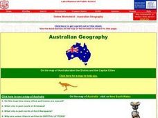
Australian Geography
In this map reading instructional activity, students label a map of Australia by adding the names of states and cities. They answer eight questions about the map.
World Maps Online
Introduction to the World Map
Students identify the differences between maps and globes. In this map skills instructional activity, students are shown a globe and a map and recognize the differences. Students use post-it notes to locate several locations on the world...
Curated OER
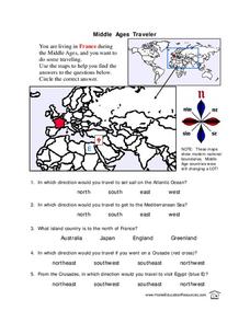
Middle Ages Traveler
In these Middle Ages worksheets, students use the maps to help them find the answers to the questions that help them understand the directions of north, south, east and west. Students also color another map of France according the...
Curated OER
Australia
First graders are introduced to the country of Australia through books, Internet research, maps and music. They listen to stories, watch videos, decorate cookies and participate in an Australian-themed day of activities.


