Institute for Geophysics
Understanding Maps of Earth
Here is your go-to student resource on primary geography concepts, including facts about the surface of the earth and its hemispheres, latitude and longitude, globes, types of maps, and identifying continents and oceans.
Curated OER
Orienteering: Map Skills
Students use a map to locate six specific landmarks on a course using a map. They identify how maps can help us and write a paragraph describing how to get from one landmark to another on the map.
Curated OER
Australia
Young scholars research Australia using the Internet. They draw a flag, identify and label Australia's major cities. They discover facts about Australia's tourists attractions and culture. They design a travel brochure using the facts.
Curated OER
Australia
Students discover information about the Aboriginal people of Australia. In this global studies lesson plan, students listen to mini-lectures regarding the history of Australia and the Aboriginal people. Students compare American Indians...
Curated OER
Dual place names in Australia
Students discuss landmarks commonly found on maps. They are divided into two groups, and asked to draw a map for a friend who hasn't been to the area. Group A may use street and place names, group B may not. Students discuss the role of...
Curated OER
Australian Aboriginal Art And Storytelling
Students explore Aboriginal storytelling traditions through the spoken word and through visual culture. They listen to stories of the Dreamtime told by the Aboriginal people and investigate Aboriginal storytelling in contemporary dot...
Curated OER
Australia: the Land Down Under
Young scholars give a solid history and geographic explanation of the country of Australia and explain why it is important. They use some creativity in designing their own island, by using the physical features of this particular country.
Curated OER
Labeling a Map of Australia
Third graders label a map of Australia. Using the internet, they research the history and maps of the continent and print a blank map. They review on how to use a compass rose and legend. In groups, they create a brochure to share...
Curated OER
Cultural Mapping
Young scholars are introduced to the cultural diversity in Australia. Using new vocabulary, they define multiculturalism and explore their own cultural backgrounds. In groups, they complete a series of worksheets to develop a better...
Curated OER
Australia
Students participate in activities in which they discover facts about Australia. They examine its climate and history. They complete a worksheet to end the lesson.
Curated OER
Orienteering: Map Skills
Students discover orienteering. In this orienteering lesson, students search for six specific landmarks. Students brainstorm how maps and landmarks are helpful.
Curated OER
The Seven Continents Scavenger Hunt
Who doesn't enjoy an engaging scavenger hunt? Here, scholars listen to, and discuss, the informative text, Where is my Continent? by Robin Nelson. They then explore the seven continents and four major oceans using...
World Maps Online
Introduction to the World Map
Students identify the differences between maps and globes. In this map skills instructional activity, students are shown a globe and a map and recognize the differences. Students use post-it notes to locate several locations on the world...
Curated OER
Middle Ages Traveler
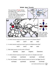
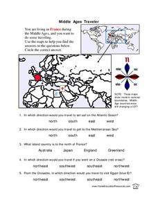
In these Middle Ages worksheets, students use the maps to help them find the answers to the questions that help them understand the directions of north, south, east and west. Students also color another map of France according the...
Curated OER
Australia
First graders are introduced to the country of Australia through books, Internet research, maps and music. They listen to stories, watch videos, decorate cookies and participate in an Australian-themed day of activities.
Curated OER
Australia
Sixth graders study the continent of Australia. In this Geography lesson plan, 6th graders create an Australian city using their knowledge of Australian cities. Students participate in a game about the continent.
Curated OER
Antarctica
Students explore the Antarctic continent, Australia's role in Antarctic exploration and development, the issues concerning Antarctica's future and the needs of the Antarctic community.
Curated OER
Lesson Plan on Map Skills for South Asia
Seventh graders observe and discuss an overhead transparency map of South Asia. In small groups, they label a blank map of South Asia, and listen to a lecture on the realm.
Curated OER
Land Use in Australian Agriculture
Seventh graders research and map agricultural practices of Australia. They complete a worksheet about their research.
Curated OER
Racism No Way
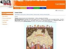
Students explore different cultural influences and their contribution to Australian identities. They reflect on their own backgrounds and making links with their peers, reflect on our heritage. Students view My family- My Australia,...
Curated OER
A New Federation
Young scholars describe the relationships between state and federal parliaments in Australia. They identify responsibilities shared between federal and state and territory governments. Students explore an alternative federal structure...
Curated OER
History/Geography
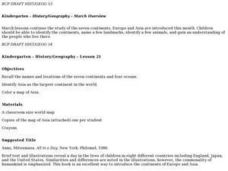
Students review North America, Africa, Europe and Asia. They identify Australia as the smallest continent. They identify Australia as an island continent nicknamed "the land down under." They color a map of Australia.
Curated OER
Middle Ages Traveler
In this map worksheet, young scholars are given three maps of France to use to answer multiple choice questions. Students complete an activity from the perspective of a Middle Ages traveler.


