Annenberg Foundation
Reading Maps
Can you read a map? Scholars use an interactive technology tool to analyze maps of various kinds to gather evidence and data to better understand their meanings and usefulness. Using newly obtained knowledge, they form an interpretation...
DocsTeach
Analyzing a Map of the Louisiana Purchase
With the stroke of a pen, Thomas Jefferson roughly doubled the size of the United States. The Louisiana Purchase not only grew the new country, but also it gave rise to the legends surrounding westward expansion and accelerated the...
University of Richmond
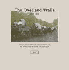
The Overland Trails 1840-1860
What led Americans to head west in the 1800s? Using an interactive map and journals from those who traveled, pupils explore the stories of those who migrated. In addition, they see how the numbers fluctuated in response to the push-pull...
University of Richmond
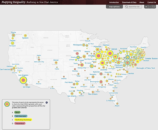
Mapping Inequality: Redlining in New Deal America 1935-1940
Redlining—or the practice of racial discrimination in housing loans—directly led to today's segregated living patterns in America. Using data from the federal Home Owners' Loan Corporation, classmates visualize the impact of policy on...
DocsTeach
Lewis and Clark's Expedition to the Complex West
Lewis and Clark's famous expedition is a prime example of the United States' westward expansion. Aspiring historians examine maps from Lewis and Clark's journey, as well as discuss their interactions with Native American tribes. The...
The Guardian
A Timeline of Women's Right to Vote
Which countries implemented women's suffrage before the 19th amendment went into effect in the United States? Which countries still do not allow women to vote? Watch the global spread of women's rights in an interactive timeline...
American Battle Monuments Commission
The Normandy Campaign: The Advance Inland
Over the summer of 1944, the Allied powers of World War II came together to take back the beaches of France. See the ways each division operated to turn the tide of war with an interactive timeline and map.
American Battle Monuments Commission
The Strategic Bombing Campaign
An extensive look at World War II details the strategic bombing campaign of the Allied forces. Beginning in September 1939 and ending in May 1945, the interactive map follows British and American forces throughout the bombing campaigns...
Ashbrook Center at Ashland University
Federalist - Antifederalist Debates
Who should have the power—individual states or the federal government? Scholars research the arguments of the Federalists and Anti-Federalists during the formation of the United States Constitution. Online resources, including a vast...
University of Richmond
Renewing Inequality: Family Displacements through Urban Renewal 1950-1966
What is progress? Who bears its cost? High schoolers consider the questions as they review data on families displaced by urban renewal projects in the 1950s and 1960s. An interactive, curated data project asks historians to consider the...
University of Richmond
Canals 1820-1860
While canals are not a common mode of transportation today, they were part of the fuel for America's industrialization. However, most of them were located in the North, also feeding regional differences and sectionalism. Using an...
American Battlefield Trust
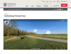
Gettysburg Virtual Tour
Step into one of the most iconic battlefields of the American Civil War with an educational interactive resource. Young historians learn about key moments, locations, soldiers, and turning points in the battle with a clickable map and...
DocsTeach
The Settlement of the American West
What do Abraham Lincoln and the Transcontinental Railroad have in common? Using a set of primary source documents, including pictures, maps, and treaties, class members link together the common themes of expansion into the American West....
DocsTeach
The Civil War: Celebrate or Commemorate? Debate Definitions
Match game for the win! Build learners' historical vocabulary using an interactive matching game. Class members match each term to its definition with a tap. A writing prompt rounds out the lesson, leading to further discussion on how...
Curated OER
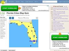
Florida Cities Map Quiz
In this online interactive geography instructional activity, students examine a map of Florida and identify the 12 noted cities on the map using a pull down menu within 3 minutes.
Curated OER
Texas Cities Map Quiz
In this online interactive geography worksheet, students examine a map of Texas and identify the 15 noted cities on the map using a pull down menu within 3 minutes.
Curated OER
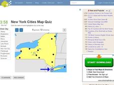
New York Cities Map Quiz
In this online interactive geography worksheet, students examine a map of New York and identify the 11 noted cities on the map using a pull down menu within 3 minutes.
Curated OER
South America Map Quiz
In this online interactive geography quiz worksheet, students examine the map that includes all of South America's countries. Students identify the 13 countries in 2 minutes.
Curated OER
Middle East Map Quiz
In this online interactive geography quiz worksheet, students examine the map that includes 26 Middle Eastern countries. Students identify the names of the countries in 4 minutes.
Curated OER
Central America Map Quiz
In this online interactive geography quiz worksheet, students examine the map that includes 22 Central American countries. Students identify the names of the countries in 3 minutes.
Curated OER
California Cities Map Quiz
In this online interactive geography quiz activity, students examine the map that includes 12 California cities. Students identify the names of the cities in 3 minutes.
Curated OER
Michigan Cities Map Quiz
In this online interactive geography worksheet, students examine a map of Michigan and identify the 14 noted cities on the map using a pull down menu within 3 minutes.
Curated OER
Canada Map Quiz
In this online interactive geography quiz activity, students examine the map that includes 13 Canadian provinces and territories. Students identify the names of the provinces and territories in 2...
Curated OER
Africa Map Quiz
For this online interactive geography quiz worksheet, learners examine the map that includes all of Africa's countries. Students match each of the country names to the appropriate locations on the map.


