Lonely Planet
Lonely Planet: Map of Argentina
A basic color map of Argentina is offered at this site, with major cities identified.
Other
Ecuador Pictures
A pictorial photo gallery of Ecuador that demonstrates the beauty of this small South American country. View animals, landscapes, towns, monuments, parks, the Rainforest, waterfalls, and so much more.
Houghton Mifflin Harcourt
Holt, Rinehart and Winston: World Atlas: Suriname
View an excellent map of Suriname accompanied by current, detailed information about this interesting country.
Houghton Mifflin Harcourt
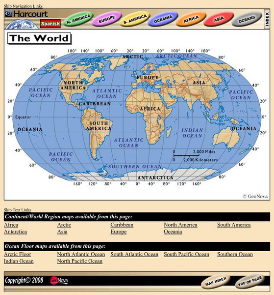
Harcourt: School Publishers: World Atlas: The World
Provides continent, country, and ocean floor maps from all over the world. Click on a continent's name to access the detailed maps which also include statistical facts on each available country.
Curated OER
Map of Uruguay
The BBC furnishes a country profile on Uruguay featuring an overview, facts, and leadership of this South American country. Links to a timeline of key events and an audio of the national anthem.
Curated OER
Map of Bolivia
Provided is a basic profile of the South American country of Bolivia with emphasis on history, culture, its leaders, and its news media. Links to a timeline of key events in history.
University of Texas at Austin
Ut Library Online: Historical Map Collection
This extensive collection from the University of Texas Library Online of detailed maps of many regions of the Earth.
Curated OER
Ecuador map.jpg (42166 Bytes)
Comprehensive reference tool with an abundance of country specific information about the South American country of Ecuador. Content covered includes photos, symbols, provinces, history, economy, geography, climate, population, culture,...
Curated OER
Ecuador Map .Gif (35419 Bytes)
Comprehensive reference tool with an abundance of country specific information about the South American country of Ecuador. Content covered includes photos, symbols, provinces, history, economy, geography, climate, population, culture,...
Curated OER
Map of Argentina
Provides an overview and some basic facts about the South American country of Argentina. Also discussed is the current leader and its media market.
Curated OER
Map of Brazil
The BBC provides many great facts about the South American country of Brazil. You can listen to the national anthem, learn about its leader, view a timeline of key events, and link to national media agencies.
Curated OER
Map of Ecuador
The BBC gives information about the Latin American country of Ecuador with details on geography, culture, its leaders, and its news media. Updated in April, 2005. Check out the link to the timeline.
Curated OER
Map of Colombia
Good reference tool for finding travel information, quick facts, and statistics for the South American country of Colombia. Includes a map and image of the flag.
Curated OER
Educational Technology Clearinghouse: Maps Etc: South America, 1898
A map of South America in 1898. The map shows capitals and major cities, railroads, terrain, rivers, and coastal features, and includes an insert map of the Isthmus of Panama. "The chief industries in South America are herding,...
Curated OER
Etc: Maps Etc: Mexico, Central America, and the West Indies, 1898
A map from 1898 of Mexico, Central America and the West Indies. The map includes an inset map of Cuba and the Isthmus of Nicaragua. "The surface of the Rocky Mountain highland in Mexico is quite similar to that of the great plateau...
Curated OER
Ecuador Nature map.gif (10759 Bytes)
Comprehensive reference tool with an abundance of country specific information about the South American country of Ecuador. Content covered includes photos, symbols, provinces, history, economy, geography, climate, population, culture,...
Curated OER
Galapagos Map mc.gif (24108 Bytes)
Comprehensive reference tool with an abundance of country specific information about the South American country of Ecuador. Content covered includes photos, symbols, provinces, history, economy, geography, climate, population, culture,...
Curated OER
American Museum of Natural History: Images: Venezuela
Labeled map of the countries of South America, in which Venezuela is highlighted.
Curated OER
M Colombia politico.jpg (271104 Bytes)
Comprehensive reference tool with an abundance of country specific information about the South American country of Colombia. Content covered includes photos, symbols, history, economy, geography, climate, population, culture, maps, and...
Curated OER
Adventure Learning Foundation: Bolivia
Comprehensive reference tool with an abundance of country specific information about the South American country of Bolivia. Content covered includes photos, symbols, provinces, history, economy, geography, climate, population, culture,...
Curated OER
Bolivia departments.png (10876 Bytes)
Comprehensive reference tool with an abundance of country specific information about the South American country of Bolivia. Content covered includes photos, symbols, provinces, history, economy, geography, climate, population, culture,...
Curated OER
Educational Technology Clearinghouse: Maps Etc: Oregon Controversy, 1792 1846
A map of the Oregon Territory between the time of exploration by George Vancouver (1792) and the Oregon Treaty of 1846. The map is color-coded to show the disputed claims of the British and United States, the Russian American line of...
Curated OER
Adventure Learning Foundation: Colombia
Comprehensive reference tool with an abundance of country specific information about the South American country of Colombia. Content covered includes photos, symbols, history, economy, geography, climate, population, culture, maps, and...


