Library of Congress
Loc: Teaching With Primary Sources: Hispanic Exploration in America [Pdf]
This is a great lesson plan from the Library of Congress that shows how to use primary sources in the examination of the Spanish Conquistadors in America. The lesson offers many possible activities for students to use with the primary...
Texas Education Agency
Texas Gateway: Exploration and Colonization of America
Given short summaries about the reasons for European exploration and colonization of North America, students will compare English and Spanish settlements in the New World.
Khan Academy
Khan Academy: Introduction to the Spanish Viceroyalties in the Americas
When the Spanish Crown (the monarchy) learned of the promise of wealth offered by vast continents that had been previously unknown to Europeans, they sent forces to colonize the land, convert the indigenous populations, and extract...
Other
Spain's Empire in the Americas [Ppt]
A brief slideshow that presents key ideas about the Spanish Empire in the Americas. Students must then answer four questions in an assessment.
Other
The Spanish Wars: Spanish American Wars of Independence
A descriptive history of the independence movements in Europe and South America which contributed to the Spanish American Wars from the fifteenth century onward.
Colonial Williamsburg Foundation
Colonial Williamsburg: Numismatics: Coins and Currency in Colonial America
Valuable lessons in the history of Europeans' early exploration and settlement of America can be gained by following the money used in trade. Coins and Currency exhibition lets you examine evidence of Spanish, British, Dutch, French, and...
Other
Universidad De Chile: La America Espanola Colonial
Description of the colonial period in South America during the 16th, 17th, and 18th centuries. Provides information about the governmental structure during the colonial period, the economy, and the problems of the times. Gives some...
Annenberg Foundation
Annenberg Learner: America's History in the Making: Colonial Designs [Pdf]
Scroll down through this unit for teacher facilitators to Appendix E and F to find maps of colonial settlement in eastern North America in 1600 and 1660. From Oregon Public Broadcasting.
Library of Congress
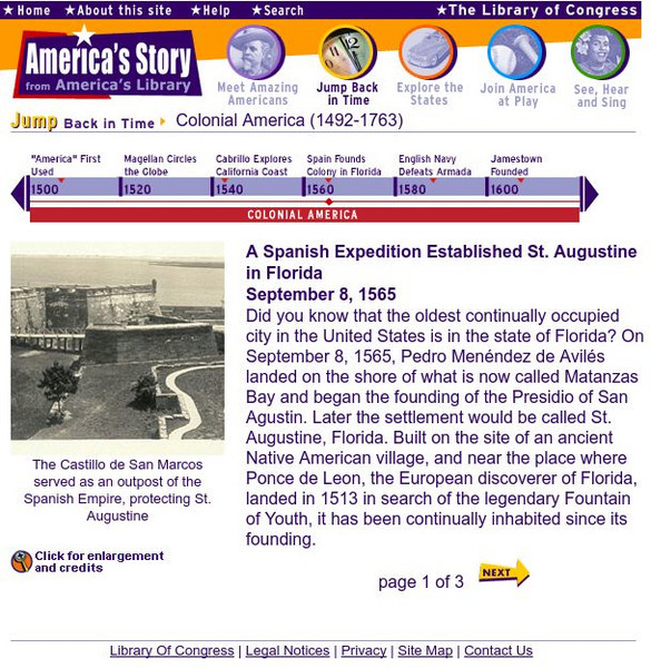
Loc: America's Story: A Spanish Expedition Established St. Augustine in Florida
Website that gives information about the founding of the oldest permanent settlement in America, St. Augustine.
University of Notre Dame
Department of Special Collections: The Coins of Colonial and Early America
This site provides links to a variety of coins used in the colonies and in the confederation. Extremely detailed.
Curated OER
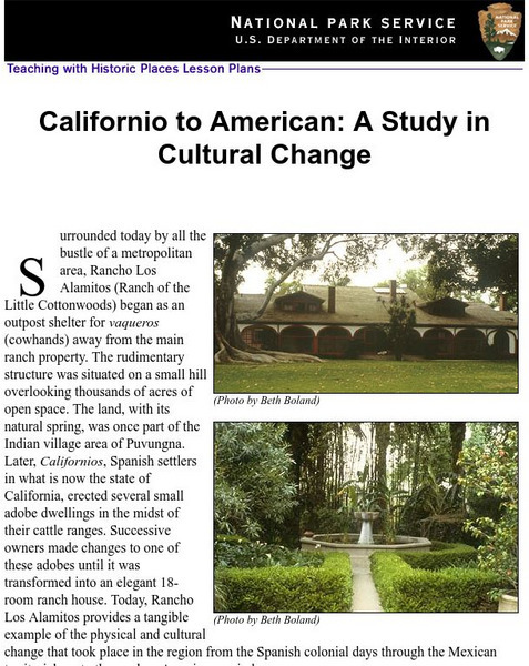
National Park Service: Californio to American: A Study in Cultural Change
This site has a instructional activity about the ranching industry, creation of California towns and the changes over time. Contains information, inquiry question, historical context, maps, readings, and images.
Other
A Timeline History of Cuba
Presents a very nice timeline history of Cuba from 1000 B.C.E. to 2003 C.E. Highlights all the major events in Cuban history.
Annenberg Foundation
Annenberg Learner: United States History Map: Colonists
Use these interactive maps to see and read about the colonization of the New World by several European nations. When you are finished looking at the maps, test your skills with the European Colonies Challenge.
Khan Academy
Khan Academy: The Convento of San Nicolas De Tolentino, Actopan, Hidalgo
After the Conquest, Spanish colonizers' first task was to convert the indigenous peoples to Christianity and eliminate their religious beliefs. Painted murals within their missions demonstrate the great fear and urgency of the...
University of Groningen
American History: Outlines: Jamestown
The first of the British colonies to take hold in North America was Jamestown. On the basis of a charter which King James I granted to the Virginia (or London) company, a group of about 100 men set out for the Chesapeake Bay in 1607....
University of Calgary
University of Calgary: The Caribbean: First Contact
This site details the initial contact of the European colonizers with the Caribbean islands. The site explains how the Caribbean became colonized and also has maps, quotes, and artwork.
Curated OER
Educational Technology Clearinghouse: Maps Etc: Eastern North America, 1812
A map of eastern North America in 1812 subtitled 'The War of Independence and the War of 1812-1814.’ The map is color-coded to show the territories of the original thirteen colonies, the territory to the west that was ceded to the...
Curated OER
Etc: Maps Etc: British Colonies After the French and Indian War, 1764
A map of the eastern portion of North America showing the British, Spanish, and Indian territories after the French and Indian War (1754-1763), with the proclamation line as established by the Treaty of Paris (1763). "The newly acquired...
Curated OER
Etc: Maps Etc: French Posts and Forts in Louisiana and New France, 1754
A map of North America showing the French posts and forts at the beginning of the French and Indian War (1754) between the French and the British. The map is color-coded to show the territorial claims of the British, French, and Spanish...
Curated OER
Etc: N America Illustrating the Conquest of Canada and War of Indep, 1757 1783
A map of eastern North America illustrating the Conquest of Canada and the War of Independence (1757-1783). The map shows major cities of the time, major river ways, topography and political boundaries. The map is color-coded to show the...
Curated OER
Educational Technology Clearinghouse: Maps Etc: Central North America, 1755
A map of central North America showing territorial claims at the beginning of the French and Indian War in 1755. The map shows the Oregon Country, the Spanish claims to New Spain and Florida, the French claims to Louisiana and Canada,...
Curated OER
Etc: Maps Etc: British Possessions in North America, 1765
A map showing the British possessions in North America in 1765 after the French and Indian War, as defined by the Treaty of 1763, Proclamation of 1763, and the Royal Orders of 1764-1767. The map shows the British Colonies on the...
Curated OER
Etc: Maps Etc: British Possessions in North America, 1775
A map showing the British possessions in North America in 1775, before the outbreak of hostilities during the American Revolutionary War. The map shows the boundaries of the British Colonies along the Atlantic, the Proclamation Line of...
Curated OER
Etc: Attempts at Huguenot Settlements in Florida, 1562 1565
A map of the southern Atlantic coastline showing the early attempts by the French Huguenots under Jean Ribault to establish settlements in the Spanish territory of Florida. The map shows the sites of Charles Fort (Charlesfort) South...
![Loc: Teaching With Primary Sources: Hispanic Exploration in America [Pdf] Lesson Plan Loc: Teaching With Primary Sources: Hispanic Exploration in America [Pdf] Lesson Plan](http://content.lessonplanet.com/resources/thumbnails/409967/large/bwluav9tywdpy2symdiwmduymc05njc1lthrc3l1zc5qcgc.jpg?1589982759)


![Spain's Empire in the Americas [Ppt] Unknown Type Spain's Empire in the Americas [Ppt] Unknown Type](https://d15y2dacu3jp90.cloudfront.net/images/attachment_defaults/resource/large/FPO-knovation.png)


