Curated OER
North America: Three Countries Map
In this North American political map learning exercise, students examine the boundaries of the three countries of North America.
Curated OER
States: United States Map
In this United States political map worksheet, students examine state boundaries. The map is labeled with the names of each of the 50 states.
Curated OER
World: Continents Map
In this outline map worksheet, students note the political boundaries of the continents of the world. The map is labeled with the names of the 7 continents.
Curated OER
United States Regions
In this United States political map worksheet, students examine regional census boundaries of the US. State boundaries are also included.
Curated OER
World Landforms
In this blank outline map worksheet, students note the major landforms of the 7 continents of the world on a Robinson projection map.
Curated OER
United States Map
In this United States political map worksheet, students examine national and state boundaries. The map also highlights the location of each of the state capitals and the national capital.
Curated OER
Two-Column Chart
In this two-column chart worksheet, students use the blank graphic organizer template as instructed by their teacher. This t-chart may be used for a variety of classroom activities.
Curated OER
California: Landform Regions Map
In this California landforms map activity, students examine the landform regions located within the state of California.
Curated OER
Eurasia Physical Map
In this Eurasia physical map worksheet, students make note of the major landforms and bodies of water located in this world region.
Curated OER
Australia and Oceania: Physical Map
In this Australia and Oceania physical map worksheet, students make note of the major landforms and bodies of water located within this region.
Curated OER
South America: Physical Map
In this South American physical map worksheet, students make note of the major landforms and bodies of water located on the continent.
Curated OER
Europe Physical Map
In this Europe physical map worksheet, students make note of the major landforms and bodies of water located on the continent.
Curated OER
Asia Physical Map
In this Asia physical map instructional activity, students make note of the major landforms and bodies of water located on the continent.
Curated OER
Washington, D.C. Map
Here is an outline map of Washington, DC. Some of the points of interest in the city are labeled, as are Maryland, Virginia and Arlington. There are plenty of important monuments and locations not identified, making for a good...
Curated OER
USA: Physical Map
In this United States physical map worksheet, students investigate the major landforms and bodies of water located throughout the country.
Curated OER
USA: Average Precipitation and Temperature Map
In this United States map worksheet, students make note of the average precipitation and temperature in regions of the country.
Curated OER
USA Capitals Map
In this United States political map worksheet, students examine state boundaries and locations of each of the state capitals.
Curated OER
USA Postal Abbreviations Map
In this United States political map worksheet, students examine the postal abbreviations of each of the states.
Curated OER
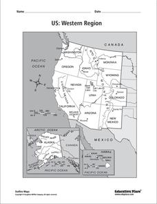
US: Western Region Map
In this United States Western Region activity, students examine the state boundaries and landforms found in this region. The map also highlights each of the state capitals.
Curated OER
Lewis & Clark Map
In this Lewis and Clark expedition map worksheet, students examine the route of the expedition and the separate return routes of both Lewis and Clark.
Curated OER
Lewis & Clark Map
In this Lewis and Clark expedition map worksheet, students examine the route of the expedition and the separate return routes of both Lewis and Clark.
Curated OER
Colonial America 1776 Map
In this United States historical map worksheet, students examine the colonial boundaries in 1776 as well as the Proclamation Line of 1763.
Curated OER
The 13 British Colonies Map
In this United States historical map worksheet, students examine the 13 colonial boundaries and noted major cities.
Curated OER
South America Map
In this South American political map worksheet, students examine both national boundaries and national capitals.
Other popular searches
- Letter Ss
- Ss Central America
- Printing Practice Ss
- Printing Letter Ss
- Manuscript Ss
- Sas Ss Aas
- Ss St Louis
- Sas, Ss, Aas
- Alphabet Letters Ss
- Sase Ss Asa
- Nazi Ss
- Handwriting Letter Ss


