Curated OER
These Maps are for the Birds
Students identify and study New York State Breeding Bird Atlas maps to learn where different bird species nest and how their distributions have changed over time. They also identify how maps serve as representations of a geographic...
Curated OER
The Westward Movement
Students study the westward movement through examining stamps. In this westward movement lesson plan, students draw conclusions, determine cause and effect relationships and examine the westward movement of the United States by...
Curated OER
More Than One Grain of Rice
Students explore mathematics, geography and agriculture by studying world rice production. In this production of rice lesson plan, students read One Grain of Rice and use a worksheet grid to calculate how much rice was received. Students...
Curated OER
Agricultural Hard Times And The Great Depression 1920 - 1930, Screen 5 and 6
Students study the interaction between the inhabitants of the state of Utah and its geographic features. In this Utah geography instructional activity, students determine how the geographic feature of Utah affected it settlement, land...
Curated OER
Pack Your Bags: Explore South Carolina
Third graders investigate different counties in South Carolina. In this geography lesson, 3rd graders are assigned a county in South Carolina to research and identify important facts about the county. Students create a PowerPoint...
Curated OER
Watersheds: The San Francisco Bay Watershed
Sixth graders make a model of a watershed. In this geography lesson, 6th graders view a shaded relief map of California and locate landmarks. Students examine the San Francisco Bay Watershed by following the journey of water through...
Curated OER
Tactics in the Persian Gulf: From Diplomacy to Force
Students trace the United States' involvement in Iraq from 1991 to today. They interpret a map of Iraq, evaluate possible causes and effects of events. They participate in, collect and analyze a poll regarding the next steps the US...
Curated OER
The Other Americans
Students explain the concept of culture and identify the components of a culture. They describe the characteristics of selected immigrant groups and the conditions they faced upon arrival in the United States. Students analyze the...
Curated OER
Mapping Landforms of South Carolina
Third graders analyze South Carolina maps. In this geography lesson, 3rd graders locate the five land regions in the state are and discuss how the regions are different. Students identify the major bodies of water and analyze how...
Curated OER
Where In the World is the Dominican Republic?
Students begin the instructional activity by discussing how where they live affects how they live. As a class, they add examples to each category such as home types, clothing, jobs and food. Using those categories, they write about...
Curated OER
The Crash, the Dust, and the New Deal
Students explore the Great Depression. In this American history lesson, students examine primary sources in order to research the Stock Market Crash of 1929, the Dust Bowl, and the Neal Deal. Students study the impact on these events on...
Curated OER
The Power of the Plug: How Electricity Will Change Our Lives... Again
Students study electricity. For this physics lesson, students review electrical energy by discussing three ways of generating it. Students explore various energy sources used for creating electricity and examine how different states...
Curated OER
King Cotton
Fifth graders explore the cotton plant. In this cotton lesson, 5th graders research the process of growing cotton. Students explore the economic and cultural differences in the states that grew cotton for trade and industry.
Curated OER
Jackie Steals Home
Learners read articles relating to Jackie Robinson's breaking of the racial barrier in professional baseball. This leads to a deeper exploration of racism in the United States. They use a variety of worksheets imbedded in this plan to...
Curated OER
Map of Town
Third graders draw a map of the town given different sites to locate on the map by the teacher. They explain that latitude and longitude are used to locate places on maps and globes, identify the distinctive physical and cultural...
Curated OER
Physical Features
Students draw physical land features using ClarisWorks or Kid Pix, write their definitions, create slideshow, and create class geography book.
Curated OER
Exploring Alternative Energy Sources
Students research the amount and kinds of energy that are produced and consumed in the United States, including the limitations of this kind of consumption. They research and create a display to teach classmates about a specific...
Curated OER
Border to Border
Students use the Internet to gather information on the country of Mexico. They also discover the culture of their people and compare them with the United States population. They take a virtual tour of some of Mexico's most historical ruins.
Curated OER
Countries of South America
Students focus on the geography of the countries of South America. Using a map, they identify the European countries who claimed the South American countries and research the influences they had on South America. To end the lesson,...
Curated OER
The Olympics
Students will research the geography and designa route form Columbia SC to an olympic competition, then follow local news and current events to track team perfomance.
Curated OER
Check My Writing: Diversity of Learners Adaptation
Students explore different spellings of the same words within the English language, as well as different words for the same thing with the international pen pal classroom. They become familiar with units of measure and time. Students...
Curated OER
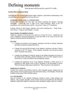
Defining moments from the past with lessons for a post-9/11 world...
Students examine extension ideas concerning 9/11, Defining Moments. They analyze a variety of Supreme Court cases, the U.S. Constitution, Mass Media Interpretations, Racism, Immigrant groups and U.S. geography. Many questions are asked...
Curated OER
Mapping the Transcontinental Journey
Students develop their geography skills. For this Lewis and Clark lesson, students collaborate to calculate the time and distance of different segments of the expedition. Students compare their estimate to Lewis and Clark's.
Curated OER
4th Grade Social Studies
In this social studies worksheet, 4th graders answer multiple choice questions about colonies, the Revolutionary War, geography, and more. Students complete 25 questions.
Other popular searches
- State Political Maps
- State of Georgia Maps
- State Outline Maps
- State and Local Maps
- State Outlines Maps


