Curated OER
Using Social Studies in Five Shared Reading Lessons: Geography
After several short 15-minute mini-lessons, your learners will gain an understanding of the characteristics of a non-fiction text. Using the book Map It by Elspeth Leacock, your class will become acquainted with non-fiction terms...
Curated OER
California Regions Map
In this California regions outline map worksheet, students examine the coastal, mountain, central, and desert regions of the state.
Curated OER
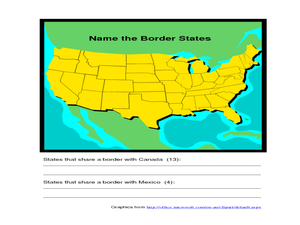
Identifying Border States of the U.S.
In this identifying border states of the U.S. worksheet, 3rd graders visually identify then write the names of the states that border Canada and Mexico; page 1 is a lesson, page 2 is the worksheet.
Curated OER
Rockin' Round New York State
Students discuss their favorite rock groups and bands. They create rock groups that will be touring New York State. Students research cities in New York, determine dates of concerts, create touring itineraries, and develop Inspiration...
Curated OER
How To Write a Social Studies Outline
One of the keys to success in school is organization. This resource leads learners through the process of creating an outline for a chapter from a social studies text. In addition, they review facts they have learned in their class...
Curated OER
MAKING CONNECTIONS WITH MAPS
Students define choropleth map. They construct a choropleth map. They interpret a choropleth map. They present geographic information.
Curated OER
United States Map - Lesson 11
Students explore lakes of the United States. In this geography activity, students identify noteworthy lakes on a map of the United States.
Curated OER
Introduction to the United States Map
Learners identify a map of the United States. In this United States map lesson, students study a map of the United States and find various locations on the map. Learners then locate and list the state that touches their state.
Curated OER
Map Memory
Fifth graders, working in a whole class setting, label a United States map with the names of all the states that they know. They transfer the names of the states to an individual map and color it. Next, they receive directions on how to...
Curated OER
Blank Map: The United States of America
In this map worksheet, students use the blank outline map of the United States to label the 50 states or for any other study purpose. Each state boundary is shown with no name labels.
Education World
Mystery State #1
In this United States mystery learning exercise, learners determine which state is described by the 5 clues listed on the sheet and then mark it on the outline map of the United States.
Louisiana Department of Education
Comprehensive Curriculum Social Studies (Grade 7)
US history from 1776 through 1877 is the focus of a comprehensive curriculum guide designed for seventh graders. Each of the seven units in the 102-page packet includes a list of guiding questions, grade-level expectations, links to...
Curated OER
Edible State Map
Fourth graders, using a map of a state for reference, make an edible map that shows the major cities in that state. Once the map is shaped, have students place the M&M's where each major city would be. Now this is a lesson plan I...
Curated OER
Mapping School Grounds
Students map and analyze the natural and cultural environment of the school grounds. In small groups, they sketch the natural and cultural features of each side of the school building, create a map, participate in a class discussion,...
Curated OER
Mapping Landforms of South Carolina
Third graders analyze South Carolina maps. In this geography lesson, 3rd graders locate the five land regions in the state are and discuss how the regions are different. Students identify the major bodies of water and analyze how...
Curated OER
U.S. Puzzle Map Bulletin Board
Learners create cutouts of each state. They research different states noting their similarities and differences. They describe each state's location in relation to the state's surrounding them.
Curated OER
United States Map- Continent, Country, State
Students identify their continent, country, and state on a globe. For this geography lesson, students use a globe to identify the seven continents, the United States, and the state which they live in. Students define key terms.
Curated OER
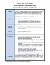
States and Capitals of the United States
Students label states and capitals on a United States map and complete research on one of the states. In this states lesson plan, students fill in the states on blank maps.
Curated OER
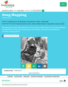
Our Land Lesson 2: Song Mapping
Students study the meaning of philanthropy as giving of time. talent, and treasures. They sing This Land Is Your Land while locating five of the places on a map of the United States showing that relief office are everywhere. They decide...
Curated OER
Rivers, Maps, and Math
Students use maps to locate and label the major rivers of North and South America. Using the internet, they identify forests, grasslands, mountain ranges and other landforms on the continents as well. They compare and contrast the...
Curated OER
Working With Electronic Topography Maps
Junior geologists examine topographic maps online and learn how to read them. they answer seven associated follow-up questions. This lesson plan is only a general outline and does not provide the details or the websites that you...
Curated OER
Introduction to the United States Map
Young scholars explore the United States using a map. In this map lesson, students discover how to use a United States map and a globe to locate places.
Curated OER
Weather Maps
Students interpret information on a weather map in order to construct a graph, and discuss how the weather impacts their lives.
Curated OER
Boundaries and People
Students map watersheds to find their boundaries. In this watershed activity students map and then give their "watershed address." Students show the trail from stream, larger stream to oceans. Students describe the...


