Curated OER
Using Primary Sources to Discover Reconstruction
Fifth graders discover how reconstruction had an impact on racial issues in the United States. In this Reconstruction lesson, 5th graders are introduced to primary vs. secondary resources and then rotate through stations to view...
Curated OER
A New Federation
Students describe the relationships between state and federal parliaments in Australia. They identify responsibilities shared between federal and state and territory governments. Students explore an alternative federal structure by...
Curated OER
Government Lesson Plan: Lesson Plan 12
Students investigate various political systems around the world. They complete a chart that compares the U.S. political system with other nations' governments, conduct research on a selected nation, and present an oral report.
Curated OER
Paul Conrad's Perspective on Civil Rights
Students review a political cartoon and discuss desegregation. In this cartoon analysis lesson, 11th graders discuss the impact of a political cartoon and its relation to a Supreme Court case. Students read additional...
Curated OER
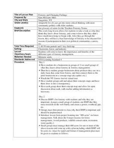
Forestry and Changing Feelings
Students investigate how the forest affects their daily lives by creating a concept map. In this ecological lesson, students create a concept map linking the forest to the many things they use each day. Students take a field...
Curated OER
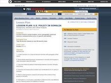
US Policy In Somalia
High schoolers investigate the US policy for the country of Somalia. They conduct research using a variety of resources. They locate the country and then discuss major geographical features of the areas. Students discuss the present US...
Curated OER
Armenian Genocide
As your historians examine the beginnings of WWI, ensure they are familiar with the Armenian Genocide. This basic introductory lesson plan utilizes teacher-led discussion, map analysis, and a Socratic seminar. Not much detail is offered...
Curated OER
NATO Geography & Language
The class receives background information on NATO, an atlas, and a blank world map. They color the original 1949 countries in red, the 1952 additions in green, and the 1990 additions in blue. This exercise would be a good starting point...
Curated OER
Food Detectives
Students investigate the regions in which particular grains are grown. Using the packaging from a variety of foods, grains are identified and the general locations where they are grown are plotted on a map.
Curated OER
To Be Or Not To Be a State? That Is the Question
Eighth graders research Puerto Rico's culture, religion, language, government, etc. and identify differences and similarities with the United States. They participate in a debate about whether or not Puerto Rico should become a state.
Curated OER
Early Presidents and Politics
Students investigate early presidents of the United States. Students complete a series of lessons in which they research the contributions and political climate during the terms of U.S. presidents from George Washington to Andrew Jackson.
Curated OER
Overland Trails To The West
After observing a map of trails that settlers took in the 1800s, your class will write a journal with the perspective of a settler. In their journals, they must describe the trail they traveled, geographical features they saw, states and...
Theodore Roosevelt Association
Roosevelt's Legacy: Conservation
The legacy of Theodore Roosevelt carries through modern American politics, economics, foreign policy, and society. But his proudest and most profound efforts were in the world of conservation, and in preserving the natural beauty of...
iCivics
Mini-Lesson: Gerrymandering
Who determines the structure of voting districts? The concept of gerrymandering brings to light the ongoing issue of how those running for office gain votes. Hands-on activities enable scholars to analyze the re-drawing of voting...
Curated OER
Mapping the Middle East
Students examine how the countries of the Middle East were created. They explore the influence of various political and geographic factors in their creation. They list the things they should consider in deciding how to draw new borders...
Curated OER
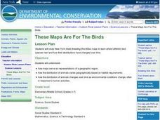
These Maps are for the Birds
Students identify and study New York State Breeding Bird Atlas maps to learn where different bird species nest and how their distributions have changed over time. They also identify how maps serve as representations of a geographic...
Curated OER
Data Comparison And Interpretation: North Korea, South Korea, And the United States
Ninth graders brainstorm "what they know about North Korea and South Korea." They determine the approximate distance from the United States to North and South Korea and create a graph comparing the birth rates, death rates, infant...
Curated OER
Migration and Immigration in the United States: Three Case Studies
Students examine the early migration of Native Americans, African Americans, and the British Colonists. They conduct Internet research, complete a timeline, label maps, compare/contrast the three groups' experiences, and write an essay.
Curated OER
Establishing Borders: The Expansion of the United States 1846-48
Students investigate how the United States acquired land after the Revolutionary War ended. In this establishing borders instructional activity, students use maps to identify territories acquired by the US and the states that later...
Curated OER
The Lincoln-Douglas Debates of 1858: Interactive Map Activity
Students utilize an interactive map to explore the 1858 Senate campaign in Illinois. They examine how factors such as population, transportation, and party strongholds can affect campaign strategies. Students write an essay discussing...
Curated OER
Our State Road Trip
Students take a virtual tour of the country of China instead of a state. Using the Internet, they examine the differences between a political and physical map and use latitude and longitude to locate specific places. They also research...
Curated OER
Mapping Change
Students compare a political map of North America today with one from 1845. They identify items of continuity in the political map of the United States today and that of 1845 and describe the influence of Indian and Hispanic cultures on...
Curated OER
United States Map
Students compare the United States on a globe and on a map. In this map lesson, students relate the sizes of the continents and locate the United States. Students identify the location of the continental US as well as Alaska and Hawaii.
Curated OER
The Oregon Trail
In this Oregon Trail worksheet, learners practice their map skills while they explore the states of Oregon, Missouri, Idaho, Nebraska, and Wyoming. Students us a map of the US to plot six points on the map that show the Oregon Trail.


