PBS
Around the Block
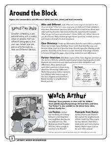
Arthur and his friends help children explore the concepts of family, community, and diversity in a fun series of activities. From performing peer interviews to mapping out the different places students have lived or visited, this...
Curated OER
MAP Practice
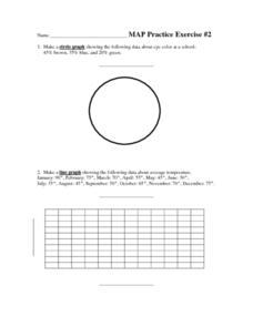
In this geometry worksheet, students create circle, line and bar graphs using different comparisons of events. There are 24 questions with an answer key.
Curated OER
Map It!
Fourth graders demonstrate map making skills by using the computer to create maps of the geographic features, regions, and economy for their state.
Curated OER
Creating Mind maps
Students discuss their impressions of Africa. They work in groups to create a mind map. Students are explained what a mind map is. They discuss what they think are the defining features of the continent of Africa. Students create a giant...
Curated OER
The Map Cartouche
Young scholars discuss the history and purpose of cartouches. They examine examples of cartouches and design an original example with symbols of their choosing.
Curated OER
Landscape Picture Map: Making a Map Grid
Learners create a map grid system. In this map instructional activity, students discuss how mapmakers use a grid system to make giving directions easier. Learners learn how the grid system works and create a grid system on their...
Kate Stickley
Reading the World: Latitude and Longitude Lesson latitude and longitude, maps, coordinates on a map, prime meridian, reading maps, equator, globes
Find five activities all about longitude and latitude! Use oranges to show the equator and prime meridian, plot birthdays on a map using coordinates, and plan a dream vacation.
World Globes & Maps
United States Map- Intermediate Directions
Students identify the four intermediate directions. For this map skills lesson, students use post-it notes to label the four intermediate directions on a map. Students locate various states using intermediate directions.
Curated OER
Countries Involved in World War II
Learners create their own floor map of Europe, Northern Africa, and the Pacific. They locate, identify, and speak for one of the countries involved. In addition, they classify the country they represent as an Axis Power or as an Allied...
Curated OER
Exploring our National Parks
Students utilize maps/Atlases to find key spatial information, locate U.S. National Parks, characterize the geography of a specific region, and create a National Park brochure.
American Library Association
Explorers Project
Delve into the Age of Exploration with a multiple-intelligences research project. Learners generate a rubric and worksheet to guide their studies and research one explorer. There is emphasis on research skills, citing sources,...
PBS
Arthur Compass Rose
Keep your class headed in the right direction with this printable compass rose. Large and easy to read with a smiling picture of Arthur in the middle, this resource would make a fun addition to the desk of any primary grade student.
Curated OER
A Place of My Own: A Study of Maps
Students investigate maps. They demonstrate their knowledge about maps and place landforms in the proper place as they create salt dough maps. They create a geography folder as well.
Curated OER
2nd Grade - Act. 21: Me On the Map
Second graders read book, Me On the Map, and create map of their bedroom and of their house.
Curated OER
Map Skills
Students create two types of maps. In this map skills lesson, students discuss map vocabulary and view maps of Florida. Students draw a free hand map of Florida and include major cities, bodies of water and land forms. Students work...
Curated OER
From Maps to Models
Students explore watersheds through the use of a topographic map. They observe topographical maps and discuss their characteristics. In groups, students create a model clay island and make a topographical map of it. Afterward, groups...
Curated OER
Play Doh Map of Your State
Students create a state map using Playdoh. In this hands-on state geography lesson, students work in groups to form a three-dimensional map of their state using Playdoh made at home following a (given) recipe. Students use four colors...
Curated OER
North Carolina Salt Dough Map Social Studies Project
In this lesson plan, North Carolina Salt Dough Map, 4th graders create a salt dough map of North Carolina, Students use dough to form the shape of the state of North Carolina. Students label the three regions of North Carolina and all...
Curated OER
Map of Ship Trap Island
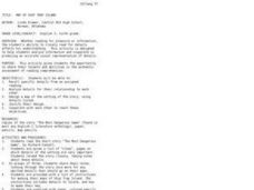
Students read the short story "The Most Dangerous Game," and create maps of Ship Trap Island and justify why items are placed on their map in certain locations.
Curated OER
Weather Map Challenge
For this weather worksheet students use a weather map to answer given questions. Students answer questions using map symbols and make predictions based on map. Students create additional questions with answers using the same map.
Curated OER
Classifying Matter: A Concept Map
In this classifying matter worksheet, students create a concept map to show the relationships between given terms such as elements, matter, substances and solutions.
Curated OER
Readers Who Struggle Can Learn From Wonderful Teacher/Student Created On-Level Reading Projects
Students create their own books. In this book making lesson, students pick a subject and take photographs of it. They use these photographs to write their own story using their sight words.
Curated OER
Story Mapping A Favorite Book
First graders create a diagram of a story by using the computer program Kidspiration. In this diagramming lesson plan, 1st graders will pick a book to write about. They then will plug in story elements of the book into the computer...
Curated OER
Magical Maps
Second graders discuss the importance of using maps and how they are used. After they listen to a folktale, they develop their own story line maps and write their own folktale to accompany a map. They also identify and locate the seven...


