Curated OER
WEEDS ON THE WINDOWSILL
Discuss the suffix "cide." Have students name words having this suffix (homicide, suicide, genocide). Ask students what all these words have in common. Then ask students to define the word "pesticide." (Pesticides control organisms that...
Curated OER
Relative Ages of Rocks
In this rocks worksheet, high schoolers review how sediments are layered over time and how the relative ages of rocks are determined. This worksheet has 1 matching and 11 multiple choice questions.
Alabama Learning Exchange
Alex: Surface Water Testing
In this environmental science lab you will chemically test a nearby creek or pond for dissolved oxygen, pH, alkalinity, hardness and turbidity. This is a field test and will determine the water quality of standing body of water. The lab...
Science Education Resource Center at Carleton College
Serc: Investigating Sedimentary Rock Deposition and Weathering
Middle schoolers will hike to the Mawikwe Bay Sea Caves along the frozen shoreline of Lake Superior in order to investigate the sedimentary rock deposition and weathering of the sandstone cliffs. Students will measure take measurements,...
Texas Education Agency
Texas Gateway: Human Impact
This tutorial provides some insight to the study of human impacts on water supplies.
TeachEngineering
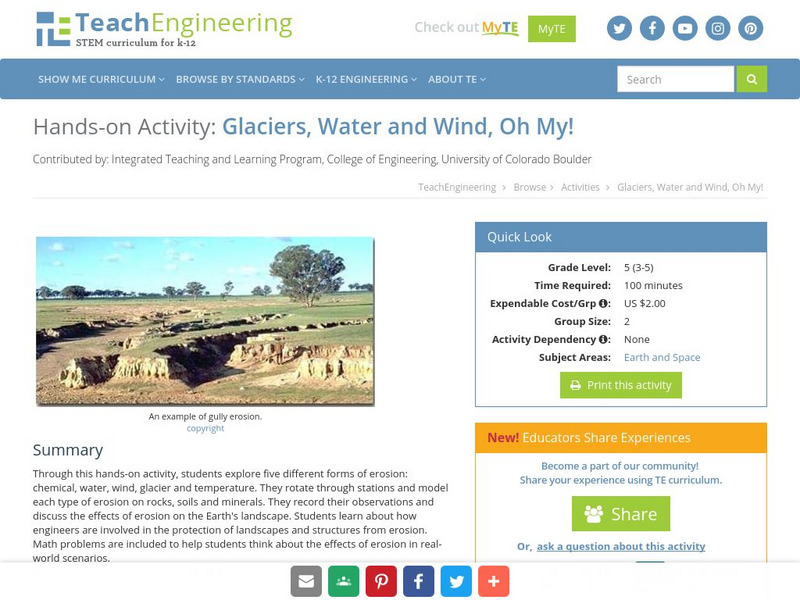
Teach Engineering: Glaciers, Water and Wind, Oh My!
This hands-on activity explores five different forms of erosion (chemical, water, wind, glacier and temperature). Students rotate through stations and model each type of erosion on rocks, soils and minerals. The students record their...
US Geological Survey
Usgs: Effects of Human Activities
This site reviews the effects of agricultural development, urban and industrial development, drainage of the land surface, modifications to river valleys, and modifications to the atmosphere have on ground water and surface water.
Science Struck
Science Struck: Understanding Deposition in Geology
Explains what is meant by the deposition of sediments by wind and water and provides examples of the resulting landforms.
CK-12 Foundation
Ck 12: Fourth Grade: Earth Science: Erosion and Deposition by Flowing Water
[Free Registration/Login may be required to access all resource tools.] Discusses how flowing water causes erosion; describes how runoff, streams, and rivers change Earth's surface; and identifies features caused by groundwater erosion.
Science Education Resource Center at Carleton College
Serc: A Study of the Process of Sediment Deposition and Particle Sorting
Students will investigate the way particles are sorted during deposition using gravel. sand, clay, potting soil, a 2L bottle, and water then form hypotheses as to why sorting occurs in this way.
Australian Museum
Australian Museum: Sedimentary Environments
This resource gives short descriptions of how sedimentary deposition occurs in rivers, lakes, river mouths, coral reefs, glaciers, arid environments, and tropical environments.
Science Education Resource Center at Carleton College
Serc: Erosion in Our World
Learners collect evidence to investigate erosion and deposition around the schoolyard.
Science Education Resource Center at Carleton College
Serc: Investigating Processes of Sedimentation in Gravel Pits
In this field investigation, students will investigate processes of deposition that have contributed to the current Minnesota sediments and landscape. After learning about weathering and erosion and having a short introduction to...
TeachEngineering
Teach Engineering: The Earth Is a Changin'
This lesson introduces and describes the main types of erosion (i.e., chemical, water, wind, glacier and temperature). Students learn examples of each type of erosion and discuss how erosion changes the surface of the Earth. Students...
Other
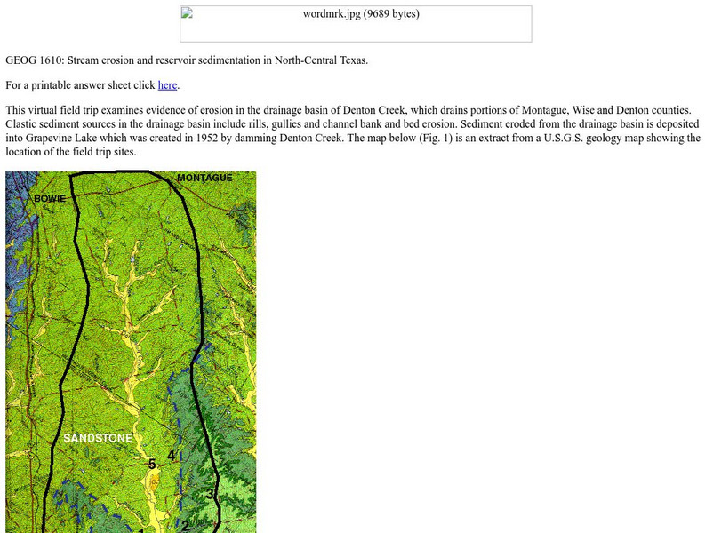
University of North Texas: Stream Erosion
An introduction to the basic concepts of stream erosion, with illustrated examples from a creek called Denton Creek. Contains review questions at the bottom of the page.
NASA
Nasa: Ganges River Delta
View a satellite image of the Ganges river delta. Click on the image to see a more detailed picture.
NASA
Nasa: Colorado River Delta
A satellite image from NASA of the Colorado River Delta, located in Northern Mexico. Follow the links for more detailed images.
American Geosciences Institute
American Geosciences Institute: Earth Science Week: What's Down There?
Students build a model to learn about the cycle of erosion and deposition by water and wind which deposits layer upon layer of rock, soil, and organic material to the surface.
Science Education Resource Center at Carleton College
Serc: Investigating Stream Char and Discharge: Interdisciplinary Approach
In this Interdisciplinary Field Investigation students will combine science, math, geography, creative writing and art. The setting will be a local stream (site yet to be determined, Minnehaha or Vermillion) where 150 students will...
Science Education Resource Center at Carleton College
Serc: Investigating River Flow: Calculating the Discharge of a Stream
Before going to the stream middle schoolers will need to understand depth, velocity and discharge. Students will at first be given minimal instruction and no materials. Middle schoolers will be asked to try and decide the velocity and...
Science Education Resource Center at Carleton College
Serc: Investigating Local Stream Discharge
This activity's purpose is to introduce hydrology to eighth grade students by investigating stream discharge of a local stream. The students will make observations about the stream, determine the velocity and discharge of the stream, and...


