Other
Mayan Monuments and Rubbings
A series of photos and rubbings from Mayan stone calendars and standing stones (stelae) that could be used as primary sources for a unit on Mayan history.
Science Museum of Minnesota
Science Museum of Mn: The Puuc Hills: Uxmal
Numerous photographs of the ancient Mayan city of Uxmal.
Science Museum of Minnesota
The Temples of Tikal
This site provides various pictures of the numerous temples in the Mayan city of Tikal.
Other
Mayan Math
A basic, illustrated description of the math system developed by the Mayans. Includes a paragraph comparing the Mayan system favorably with the Roman numeral system of the same time.
Other
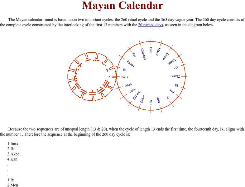
Mayan Calendar
While brief, this simple explanation of the Mayan calendar may clarify for some how its two cycles work together.
Other
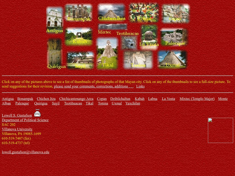
Villanova University: Chichen Itza
This site from Villanova University contains many pictures of the Mayan City of Chichen Itza. Click on each thumbnail to enlarge.
Curated OER
Mayan Human Sacrifice
Extremely brief examination of the belief of the Mayans in bloodletting and human sacrifice.
Curated OER
Clip Art by Phillip Martin: Mayan Man
Cartoon drawing of a traditionally attired Mayan man.
Curated OER
Photograph:mayan Ruins at Xunantunich, Belize, C. 650
photograph of Mayan ruins at Xunantunich, Belize
Curated OER
Clip Art by Phillip Martin: Mayan Headdress
A clipart illustration by Phillip Martin titled "Mayan Headdress."
Foundation for the Advancement of Mesoamerican Studies
Famsi: Chichen Itza:the Palace of the Sculptured Columns (1996)
Color images of the Palace of Sculptured Columns at Chichen Itza and the Osario (High Priest's Grave).
Foundation for the Advancement of Mesoamerican Studies
Famsi: Map of Maya Area
Map shows the locations of Mayan sites in Belize, El Salvador, Guatemala, Honduras and Mexico.
Fundación Cientec
Modelos Matematicos Del Cosmos De Los Indigenas Mayas Precolombinos
This site explains the Mathematical models used by the Mayan. You can see the traditional designs that Indians were using in their paintings and ceramic in the search for their calendars, their models of the cosmos and their mathematical...
Curated OER
Mayan Monuments and Rubbings
A series of photos and rubbings from Mayan stone calendars and standing stones (stelae) that could be used as primary sources for a unit on Mayan history.
Curated OER
University of St Andrews: Mayan Mathematics
This site from the University of St. Andrews provides indepth information about the mathematics of the Mayan civilization, and shows just how advanced they were.
Curated OER
Vessel 8, Tomb 2, Chan Chich, Belize
Excavation of tomb indicates the occupant was elite as indicated by wooden snake. Several Mayan artifacts are pictured.
Curated OER
Figure 3. Palenque's Subterranean Palace Aqueduct.
Study indicates that Palenque aquaducts were part of city planning and suggests reasons that Mayans would choose the existing plan. Many photographs of the aquaduct are included.
Curated OER
Wikipedia: Maya Architecture
This article covers Mayan urban design, types of structures and building processes.
Other
Villanova University: Ancient Maya Architecture
View photographs of pre-Columbian Maya architecture in the regions from central Mexico to Honduras and Nicaragua.
Other
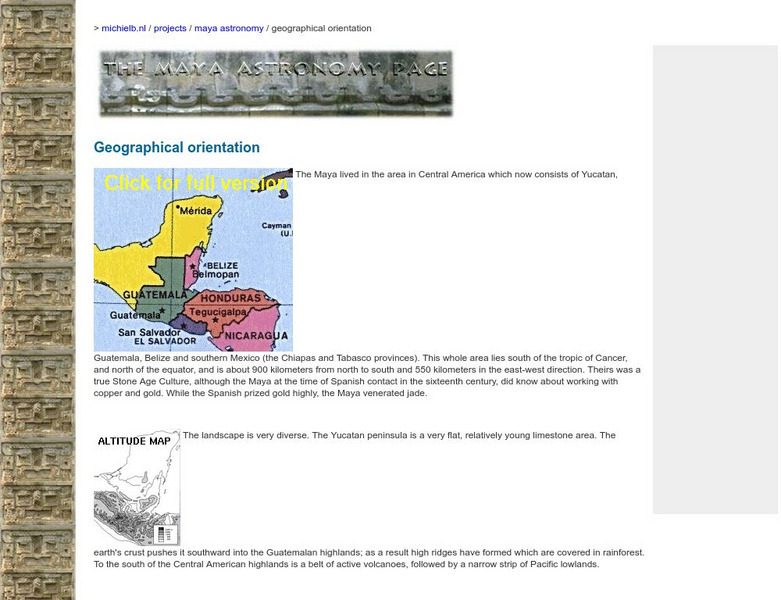
Virtual Sun: Maya Environment
This site from the Virtual Sun gives a detailed account of the geographical region once inhabited by the Maya People. It describes the landscape, climate, and altitude.
Other
Mesoweb: Mesoamerican Time Line
Mesoweb provides a timeline that shows which cultures existed when in Mesoamerica and where.
Curated OER
Unesco: Mexico: Pre Hispanic City of Chichen Itza
This sacred site was one of the greatest Mayan centres of the Yucatan peninsula. Throughout its nearly 1,000-year history, different peoples have left their mark on the city. The Maya and Toltec vision of the world and the universe is...
Curated OER
Educational Technology Clearinghouse: Maps Etc: The Yucatan, 1882
A map of the Yucatan Peninsula showing the explorations of Dr. Desire Charney in 1882. The map shows the Mayan sites visited, including Palenque, Uxmal, Kabah, Acanceh, Ake, Izamal, and Chichenitza, and the territories of the Lacandon...


