New York State Dept. of Health
New York State Department of Health: Rocky Mountain Spotted Fever
From the New York State Department of Health, a communicable disease fact sheet on Rocky Mountain Spotted Fever.
Other
Ranges: Rocky Mountains
Informative site offering detailed information about the Rocky Mountains. Learn about the conglomeration of ranges and the fascinating peaks. The site has links to various peaks and view photographs of these beautiful mountains.
Library of Congress
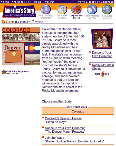
Loc: America's Story: Colorado
Discover more about the Rocky Mountains. Why is Colorado called the "Centennial State?" Look at this website for captivating facts.
Curated OER
Etc: Maps Etc: Forest Map of the United States, 1910
A map from 1910 of the United States showing the forest regions of the Pacific, Rocky Mountains, Northern Forest in the Great Lakes and New England areas, Southern Forest along the Gulf and East Coast, and the Hardwood Forest. The map...
Curated OER
Etc: Maps Etc: Relief of the United States, 1910
A relief map from 1910 of the United States showing the physical features of the New England Highlands, Adirondacks, Appalachian Plateau and Mountains, Piedmont Plateau, Coastal Plains, Lake Superior Highlands, Red River Valley Plains,...
Curated OER
Etc: Maps Etc: Relief of the United States, 1904
A relief map from 1904 of the United States showing the mountain systems and highlands, plateaus, plains, lakes, rivers, and coastal features. This map divides the area into the main groups of the St. Lawrence Basin, Allegheny Region,...
Curated OER
Etc: Mountain Passes & Overland Routes in the West, 1841 1850
A map of the Pacific region of the United States west of the Rocky Mountains in 1841-1850. The map shows the Old Spanish Trail from Los Angeles to Santa Fe, the Pioneer Route from the Platte River to San Francisco, the routes of Fremont...
Curated OER
Etc: Maps Etc: United States Forest Regions, 1901
A map from 1901 of the United States showing the forest regions, coded to show heavily forested and moderately forested areas. Areas of typical forest types are shown, including pine and hardwoods, spruce, birch, and maple in the...
Curated OER
Educational Technology Clearinghouse: Maps Etc: The United States, 1910
A map from 1910 of the United States showing general elevations, water depths, watershed boundaries, and terrain features, including the Pacific Slope, Great Basin, Colorado Plateau, Cordilleran Highlands, Rocky Mountains, Great Central...
Curated OER
Etc: Maps Etc: Physical Features of the United States, 1898
A map from 1898 of the United States showing general elevations, water depths, and terrain features, including the Pacific Slope, Great Basin, Rocky Mountain Plateau, Great Plains, Mississippi Valley, Gulf Plain, Appalachian Highlands,...
PBS
Nh Pbs: Nature Works: Red Headed Woodpecker
The red-headed woodpecker can be found in woodlands throughout the United States east of the Rocky Mountains. The content of this site includes information on the characteristics, habitat, life cycle, range, behavior and diet of this...
Curated OER
Etc: Maps Etc: Mexico, Central America, and the West Indies, 1898
A map from 1898 of Mexico, Central America and the West Indies. The map includes an inset map of Cuba and the Isthmus of Nicaragua. "The surface of the Rocky Mountain highland in Mexico is quite similar to that of the great plateau...
Curated OER
Educational Technology Clearinghouse: Maps Etc: Colorado, 1906
A map from 1906 of Colorado showing the State capital of Denver, major cities and towns, railroads, the Rockies and other mountain systems, lakes, and rivers.
Curated OER
Educational Technology Clearinghouse: Maps Etc: Colorado, 1909
A map from 1909 of Colorado showing the State capital of Denver, major cities and towns, railroads, the Rockies and other mountain systems, lakes, and rivers.
Curated OER
Educational Technology Clearinghouse: Maps Etc: Colorado, 1919
A map from 1919 of Colorado showing the State capital of Denver, major cities and towns, railroads, the Rockies and other mountain systems, lakes, and rivers.
Curated OER
Educational Technology Clearinghouse: Maps Etc: Colorado, 1902
A map from 1902 of Colorado showing the State capital of Denver, counties, major cities and towns, railroads, the Rockies and other mountain systems, lakes, and rivers.
Curated OER
Educational Technology Clearinghouse: Maps Etc: Colorado, 1920
A map from 1920 of Colorado showing the State capital of Denver, counties and county seats, major cities and towns, railroads, the Rockies and other mountain systems, lakes, and rivers.
Curated OER
Educational Technology Clearinghouse: Maps Etc: Colorado, 1920
A map from 1920 of Colorado showing the State capital of Denver, counties and county seats, major cities and towns, railroads, the Rockies and other mountain systems, lakes, and rivers.
Curated OER
Educational Technology Clearinghouse: Maps Etc: Colorado, 1911
A map from 1911 of Colorado showing the State capital of Denver, counties and county seats, major cities and towns, railroads, the Rockies and other mountain systems, lakes, and rivers. A grid reference in the margins of the map lists...
Curated OER
Educational Technology Clearinghouse: Maps Etc: Colorado, 1920
A map from 1920 of Colorado showing the State capital of Denver, counties and county seats, major cities and towns, railroads, the Rockies and other mountain systems, lakes, and rivers. A grid reference in the margins of the map lists...
Curated OER
Educational Technology Clearinghouse: Maps Etc: Colorado, 1914
A map from 1914 of Colorado showing the State capital of Denver, counties and county seats, major cities and towns, railroads, the Rockies and other mountain systems, lakes, and rivers. A grid reference in the left margin of the map...


