Curated OER
Educational Technology Clearinghouse: Maps Etc: Kansas, 1919
A map from 1919 of Kansas showing the State capital of Topeka, major cities and towns, railroads, and rivers.
Curated OER
Educational Technology Clearinghouse: Maps Etc: Kansas, 1922
A map from 1922 of Kansas showing the State capital of Topeka, major cities and towns, railroads, and rivers.
Curated OER
Educational Technology Clearinghouse: Maps Etc: Kansas, 1892
A map from 1892 of Kansas showing the State capital of Topeka, counties and county seats, major cities and towns, railroads, and rivers.
Curated OER
Educational Technology Clearinghouse: Maps Etc: Kansas, 1920
A map from 1920 of Kansas showing the State capital of Topeka, counties and county seats, major cities and towns, railroads, and rivers.
Curated OER
Educational Technology Clearinghouse: Maps Etc: Kansas, 1920
A map from 1920 of Kansas showing the State capital of Topeka, counties and county seats, major cities and towns, railroads, and rivers.
Curated OER
Wikipedia: National Historic Landmarks in Kansas: Fort Leavenworth
This fort has been in continuous occupation by the United States Army since it was first established in 1827 to protect caravans on the Santa Fe Trail. It played a pivotal roles in the Mexican and Civil Wars, and it became the temporary...
Curated OER
Wikipedia: National Historic Landmarks in Kansas: El Cuartelejo
This archeological district consists of more than 20 sites, mostly associated with the Dismal River/Plains Apache culture, dating from c CE 1650 to 1750. The principal site is a pueblo ruin thought to have been built by Taos Indians who...
Curated OER
Etc: Maps Etc: United States Expansion and the Railroads, 1880
A map of the United States and territories showing the expansion from the formation of the original states to 1880, and the railroad network in 1880. The map is color-coded to show the original states, the states admitted between 1791...
Other
Midwestern Higher Education Compact
The MHEC serves students from several states. The program provides reduced out-of-state tuition rates at designated colleges.
Library of Congress
Loc: America's Story: Missouri
Why is Missouri called the "Show Me State?" Where was the "Birth of the Ice Cream Cone?" How much did it cost to send a letter through the Pony Express? These are just a few questions that will be answered on this website.
University of Missouri
Famous Trials: The Red Scare
In-depth information about the Red Scare that started in the United States at the end of World War I, and ended in the early 1920s. Discusses its history, including strikes in Seattle and Boston, causes, and results of the anti-communist...
Kansas Historical Society
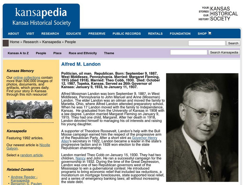
Kansapedia: Alfred M. Landon
One of the few progressive Republicans to hold state office during the presidency of Franklin Roosevelt, Landon was tapped to run against him in 1936. Read about the life of this interesting Kansan both before and after his run for the...
Kansas State
Kansas State University and Usda: Wind Erosion Control
This website provides numerous pictures and brief descriptions that illustrate a variety of ways to control wind erosion. Clicking on a picture will enlarge it to provide a better view.
University of Missouri
Famous Trials: Brown v Topeka Board of Ed. (1951)
Brown v. Board of Education of Topeka is widely known as the Supreme Court decision that declared segregated schools to be "inherently unequal." The story behind the case, including that of the 1951 trial in a Kansas courtroom, is much...
University of Groningen
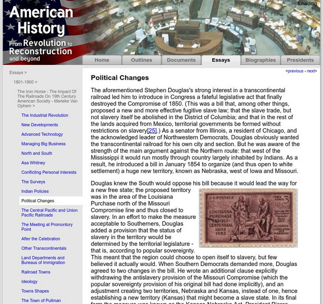
American History: Essays: The Iron Horse: Political Changes
From a lengthy essay on the history of the railroad in the United States. This section describes the dramatic political changes that took place with the passage of the Kansas-Nebraska Act in 1854. This led to the formation of the...
Lesson Tutor
Lesson Tutor: History: Go Eat Your Homework!
Learn a little about a few major cities in the United States while munching on the food that the city is known for. For example, Boston's history goes better while eating Boston Baked Beans and Brown Bread. Recipes are included.
Curated OER
Federal Reserve Districts in United States
This page from the Federal Reserve Board provides a map of the 12 Federal Reserve Districts with addresses, phone numbers, and links to the following Federal Reserve Banks: Boston, New York, Philadelphia, Cleveland, Richmond, Atlanta,...
Kansas State
The Laser Adventure
Kansas State University site explaining all aspects of LASERS. The site is set up as an online book with clickable chapters.
Kansas State
Negro Leagues Baseball E Museum: Jackie Robinson
Designed for educators and students, the Negro Leagues Baseball eMuseum presents this brief history of famed baseball player Jackie Robinson. An introductory video provides a snapshot of information about Jackie Robinson.
Curated OER
Educational Technology Clearinghouse: Maps Etc: Presidential Election, 1860
A map of the United States showing the results of the presidential election of 1860. The map is color-coded to show the states carried by Lincoln (Republican), Breckinridge (Southern Democrat), Bell (Constitutional Union), and Douglas...
Curated OER
Educational Technology Clearinghouse: Maps Etc: Presidential Election , 1860
A map of the United States showing the results of the presidential election of 1860. The map is color-coded to show the states carried by Lincoln (Republican), Breckinridge (Southern Democrat), Bell (Constitutional Union), and Douglas...
Curated OER
Etc: The Us at the Outbreak of the Civil War, 1860 1861
A map of the United States at the outbreak of the Civil War (1860-1861) showing the States that seceded to form the Confederate States of America. The map also shows the territorial boundaries of the Washington Territory, Dakota...
Other
Supreme Court: Brown v. Board of Education, 347 u.s. 483
Contains the text to the appeal from the United States District Court for the District of Kansas.
Stanford University
Influenza Pandemic of 1918: Statistics From the Influenza Epidemic
Find a graph showing the mortality caused by the influenza epidemic in Kansas in 1918. Included is a map showing the spread of the flu across the United States in the autumn of 1918.


