Science Matters
A Model of Plate Faults
The San Andreas fault is one of the longest fault zones in the world. In a series of 20 lessons, the fourth lesson has pupils use a paper model to recreate various types of plate faults. Each is held in position then drawn...
Curated OER
Natural History of Costa Rica
Students use outline maps to become acquainted with Costa Rica. They see how it was formed and how its origin has created very diverse environments. Students then use atlases and compare their physical maps with maps of climate and the...
Curated OER
Images of Katrina
High schoolers use maps and online data to find specific geographic areas. In hurricane Katrina lesson students use aerial photographic imagery to see some impacts of hurricane Katrina.
Curated OER
Pacific Atolls and Island Groups
Learners construct, interpret and translate maps and geographic data. Given a worksheet, students identify an island, an atoll, a scale, and a compass rose. Learners grid systems, legends, and symbols. They use the map to find answers to...
Curated OER
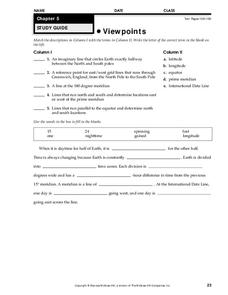
Viewpoints
In this map worksheet, students review latitude, longitude, equator, and prime meridian. This worksheet has 5 matching and 8 fill in the blank questions.
Curated OER
Weather, Migrations, and Plants
Students research the effects of day-to-day weather on animal migrations, plant growth and other seasonal events. They consult maps, observe and record local conditions, keep journals and use their collected data check hypotheses.
Curated OER
Native Americans and Topography at Rose Bay
Students visit a wetland ecosystem. While they are there, students explore how to read topography maps of Rose Bay.
Curated OER
What's Down There?
Pupils analyze data on coral reefs and use this to help characterize reefs. In this mapping coral reefs lesson plan students identify and explain the major threats to coral reefs.
Curated OER
Abundant Lakes
Students define lake life zones. They define stormwater runoff and its effects on lakes. They identify the relationship between decaying substances and water pollution. They construct a freshwater food web.
Curated OER
Exploring For Copper Deposits
Pupils examine ore deposits and identify factors in their origin. They analyze geologic maps, and locate porphyry copper deposits on a sediment geochemistry map.
Curated OER
Seed Selection for Genetic Variation
Learners will research the origin of corn, analyze factors that contribute to shorter and longer growing seasons, and use the scientific method to answer the question: Did seed selection contribute to the successful movement of corn from...
Curated OER
ESRI Live Earthquake Site
Students examine a World map and find earthquakes near plate boundaries. They locate and describe earthquakes in the United States and California.
Curated OER
Creating Community - A Function Of Design
Learners discuss the physical and human impacts of community design. They identify traditional neighborhood design elements and evaluate them with features of conventional suburban development.
Curated OER
Brochures
Middle schoolers discuss how the climate in their area affects they way they live their life. In groups, they identify the climate zones throughout the world and research one country of interest to them. To end the lesson, they make a...


