Hi, what do you want to do?
US Geological Survey
Usgs: Mount St. Helens Elevation
See a three-sixty view of the post-eruption elevation of Mount Saint Helens.
Indiana University
Indiana Univ. Bloomington: Geo Notes: Indiana's Region of Karst Topography [Pdf]
Describes the geological features of the karst topography found in Indiana.
PBS
Pbs Learning Media: Earth's Systems: Map It
Explore different types of maps and how different things are represented on maps in this media gallery from WGBH. Maps are used to help locate different places and different things. Map symbols are representations of larger things in the...
NOAA
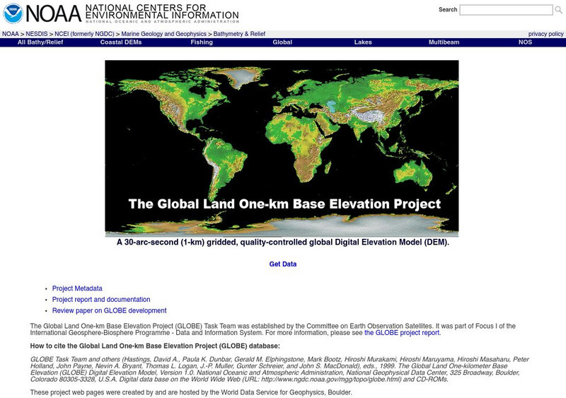
Noaa: Ngdc: Globe Project
Explore some topographic data at the Globe site. What environmental measurements are taken in the study? How are these measurements presented?
Math Graphs
Houghton Mifflin: Math Graphs: Orthogonal Trajectories 1 [Pdf]
Students draw orthogonal trajectories on a map. The exercise consists of an enlarged printable version of a topographic map available in PDF format.
Math Graphs
Houghton Mifflin: Math Graphs: Orthogonal Trajectories 2 [Pdf]
The exercise has students draw orthogonal trajectories on a map. The handout includes an enlarged printable version of a topographic map available in PDF format.
ClassFlow
Class Flow: Georgia
[Free Registration/Login Required] The student will locate major topographical features of Georgia and will describe how these features define Georgias surface. Locate all the geographic regions of Georgia: Blue Ridge Mountains,...
University of Groningen
American History: Essays: The Iron Horse: The Surveys
From a lengthy essay on the history of the railroad in the United States. This section describes the surveys that were done to determine where to route the transcontinental railroad, and where it was finally built. These surveys provide...
Other
Virtual Gallery of Historic Saint John
Features early paintings of Saint John from a variety of artists that were created between the years 1750-1910. A brief description of each is given.
Other
Everest News: K2 History: Captain Henry Haversham Godwin Austen
Details about Godwin-Austen's geographic explorations, especially in the Himalayas where he was considered one of the greatest mountaineers of his time.
Mocomi & Anibrain Digital Technologies
Mocomi: Types of Maps
Details on the different types of maps, scale, and symbols.
Curated OER
Educational Technology Clearinghouse: Maps Etc: South China, 1971
"South China comprises the drainage basins of the middle and lower Yangtze River, the basin of the His Chiang (West River) in Kwangtung and Kwangsi; and the mountainous coastal provinces of Fukien and Chekiang. The division between the...
Curated OER
Educational Technology Clearinghouse: Maps Etc: Southern Rockies, 1911
A map from 1911 of the southern Rockies showing the main topographic features of the region, including; the eastern foothills (hogback topography); the Colorado or Front Range and Wet Mountains; the Park, Sawatch (or Saguache), and...
Curated OER
Educational Technology Clearinghouse: Maps Etc: Roc Drumlins, 1911
A map from 1911 from the Baldwinsville quadrangle showing the topographic feature of roc drumlins or drumloids. The drumlin-shaped forms in the upper part are developed on shale. Roc drumlins are distinct from the more common type of...
Curated OER
Educational Technology Clearinghouse: Maps Etc: Cumberland Plateau, 1911
A topographic map from 1911 of the Cumberland Plateau showing elevations given in feet and indicating river systems and valleys in the region. On the right is the summit of the plateau; on the left is the surface of the Highland River;...
Curated OER
Educational Technology Clearinghouse: Clip Art Etc: General Gouverneur K. Warren
General Warren, born in Cold Spring, N. Y., January 8th, 1830, died in Newport, R. I., August 8th, 1882, was graduated from the United States Military Academy in 1850, and assigned to the Topographical Engineers as brevet second...
Curated OER
Educational Technology Clearinghouse: Clip Art Etc: General Joseph G. Totten
General Totten, born in New Haven, Conn., August 23rd, 1788, died in Washington, D. C., April 23rd, 1864. Was graduated from the United States Military Academy in 1805, and promoted second lieutenant in the corps of engineers. After the...
Curated OER
Educational Technology Clearinghouse: Clip Art Etc: James Harrison Wilson
James Harrison Wilson (September 2, 1837 - February 23, 1925) was a United States Army topographic engineer, a Union Army General in the American Civil War and later wars, a railroad executive, and author.
PBS
Pbs Teachers: Water Use: Tragedy in the Owens River Valley
Map the geographical area of a watershed, evaluate watershed use and describe land use practices of the people within one. Investigate the events surrounding the war over the Owens River in California at the turn of the 20th century.
Other popular searches
- Topographic Maps
- Reading Topographic Maps
- Topographic Map Reading
- Topographic Maps Profile
- Topographic Map Symbols
- Topographical Maps
- Science Topographic Maps
- Making Topographic Maps
- Geography, Topographic Maps
- Topographic Maps Labs
- Topographic Maps Computer
- Topographic Maps Isolines


![Indiana Univ. Bloomington: Geo Notes: Indiana's Region of Karst Topography [Pdf] Handout Indiana Univ. Bloomington: Geo Notes: Indiana's Region of Karst Topography [Pdf] Handout](https://static.lp.lexp.cloud/images/attachment_defaults/resource/large/FPO-knovation.png)


