Curated OER
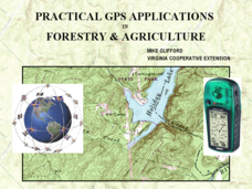
Practical GPS Applications in Forestry & Agriculture
An explanation of the Global Positioning System (GPS) and the Geographic Information System (GIS) is given in this presentation. Uses and applications are considered. How it works and sources of error are also touched upon. A large...
NOAA
A Quest for Anomalies
Sometimes scientists learn more from unexpected findings than from routine analysis! Junior oceanographers dive deep to explore hydrothermal vent communities in the fourth lesson in a series of five. Scholars examine data and look for...
Curated OER
Ping!
Seventh graders study side-scan sonar and discover how it can be used to locate objects underwater. They complete a sonar simulation activity in which they create and map mystery landscapes inside shoeboxes.
Curated OER
You Can Die Here
Students examine Death Valley including the amount of precipitation and winds that it gets. In this climate based instructional activity students explain the reasons for the amount of precipitation and windward patterns in Death Valley.
Curated OER
Louisiana Purchase
Students use maps to locate and describe the area purchased by the Louisiana Purchase. In groups, they write a letter to Thomas Jefferson in which they evaluate the topography, climate and geography of the land. They determine the land's...
Curated OER
SUBMARINE MOUNTAINS
Students create a two-dimensional contour map of a submerged area from a simulated survey using sounding techniques.
Curated OER
Geography, Map Skills & the Internet:
Students research various websites focusing on Italy while enhancing student utilization of computer, keyboards and the Internet. They discuss their findings on the geography, history, topography, and culture.
Curated OER
Design an Island
Students make a map of an imaginary island using the topographic symbols provided from a worksheet. Students place lakes, dwellins, reefs, etc. in areas where they would logically be located from understanding how the topography of an...
Curated OER
"Potato Mountain": Reading/Understanding Topographic Maps
Students investigate how to read topographic maps. For this map reading lesson students complete a topographic map activity.
Curated OER
It's Gettin' Hot In Here, So Transfer Energy
Students study the means by which energy is transferred from the sun through the Earth's atmosphere. They examine radiation, conduction, and convection. They complete a lab to determine how the different transfers affect the atmosphere...
Curated OER
Geography and Its Five Themes
Geography is not limited to just learning about the Earth and its physical features.
Curated OER
Landforms
Students begin their examination of landforms. Using a map, they locate and identify the major landforms on Earth. They discuss how landforms affect the lifestyle of the community and determine which goods and services the community...
Curated OER
Candy Bar Subsurface Geology
Students are introduced to drawing and interpreting topographical maps. They each cut through there Jell-o mountain at regular height intervals, and trace around the shape of the Jell-o cut off at the height, overlaying the different...
Curated OER
Maps Reinforcement
For this map worksheet, middle schoolers complete 6 multiple choice questions and 5 short answer questions about 3 different map figures.
NOAA
The Oceanographic Yo-yo
How does chemistry help deep-sea explorers? Part four of a five-part series of lessons from aboard the Okeanos Explorer introduces middle school scientists to technologies used in ocean exploration. Groups work together to analyze data...
Curated OER
Weather Olympics
Students consider the effects of topography on climate patterns. In this earth science lesson, students research weather patterns and make inferences of how the land forms may create different climates. Students compare Celsius...
Curated OER
Building A Topographic Model
Students visualize, in three dimensions, features represented by contour lines on a topographic map. They see that the different elevations shown on a two dimensional topographic map can be used to build a 3-D model.
Curated OER
Topographic Map Unit Plan
Students examine topographic maps and discover how to decipher contour intervals, use contour lines and apply information to complete a topographic map lab. Working in groups, they identify the scale of the map, latitude and longitude,...
Curated OER
Generate an Accurate Landscape Profile from a Topographic Map
Learners enerate an accurate landscape profile from a topographic map. They determine the correct interval needed to accurately graph the change in elevation on a single piece of graph paper.
Curated OER
Welcome to My World!
Second graders increase their usage of maps and understand how maps are important in their lives. Students define what an atlas is, and to enforce the students' definition of what an atlas is, they also make their own atlas.
Curated OER
Making Topographic Maps and Mountain Profiles
Students study how to mark inclines and construct a mountain profile. In this topographic map instructional activity students mark contour intervals and draw mountain profiles.
Curated OER
Introduction to Topographic Maps
Tenth graders create a topographic map and see how it represents different elevations. In this topographic maps lesson students read and interpret topographic maps.
Curated OER
Take a Hike
In this geography skills worksheet, students respond to 9 questions that require them to read topographic maps and interpret them. The topographic maps are not included.
Curated OER
Geographic Landscapes and Interstate Freeway Development
Students investigate the topography of the United States through a discovery lesson. They create a hypothetical route for a highway across the United States. Students also conduct research major landforms and define geographic terms.


