Curated OER
Antebellum North Carolina
Eighth graders examine pictures & documents relating to the Hayes Plantation (Edenton, NC). They also use various maps of North Carolina to help them analyze how James Cathcart Johnston used, modified and adapted to the physical...
Curated OER
Life During the Civil War for Women and Civilians
Young scholars follow an overview of the American Civil War from a film, the text and/or teacher direct instruction. They create a timeline with a large map of the U.S. in the 1860's available for student reference as they do the spider...
Curated OER
TURNING POINT IN HISTORY:The War of 1812
Students act as investigative reporters and research battles or events of the War of 1812. They write an original article, which may include a map, drawing, or illustration.
Curated OER
Enhancing Students' Problem-Solving Abilities
Students analyze the results of a hypothetical cloning experiment using a restriction endonuclease map obtained from an on-line data source. They answer the question, "How can I tell if the DNA I have obtained from this hypothetical...
Curated OER
Little Pig, Little Pig
First graders compare versions of the Three Little Pigs. In this comparison lesson, 1st graders read several version of the Three Little Pigs and compare the situations, characters, settings, solutions, emotions and costumes. ...
Curated OER
Lines of Symmetry
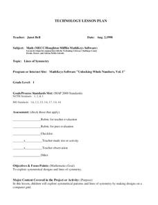
First graders create symmetrical designs using a computer program. In this lines of symmetry lesson, 1st graders review their symmetrical designs and discuss other ways symmetrical designs can be made. Students work in pairs...
Curated OER
Stories of Hope: Dragonfly and Mosquito
Students identify and interpret the value of the dragonfly as a predator of the mosquito. They create their own folktales using the dragonfly or a creature of their choice to solve the malaria problem or another issue. Students also...
Curated OER
Forecast the Weather
Students analyze different weather conditions before creating their very own first-person report from the eye of a storm. They use maps to analyze different weather conditions, record an online weather script
and write a first-person...
Curated OER
Separate But Equal? A Lesson on the Briggs v. Elliott Case in Claredon County, SC
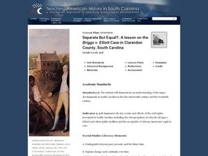
Third graders discussschool integration. In this racial inequality lesson, 3rd graders read Remember: The Journey to School Integrationand discuss the school facilities and how people must have felt. Students watch a...
Curated OER
Reasons to Settle in America
Students complete a research project. In this American History lesson plan, students work in groups to research reasons that people wanted to settle in America. Students record the information, share what they found and write...
Curated OER
Eating Up Energy
Students examine the amount of energy that is consumed in different countries and see the global effects. In this energy lesson students calculate the amount of CO2 released as a by product and map the impact of its emissions.
Curated OER
Charlotte's Web
Fourth graders focus on fluency by reading the book Charlotte's Web. In this reading strategies lesson, 4th graders partner read, do guided reading, and independent reading to increase fluency. Students use Venn Diagrams, discuss...
Curated OER
The Open Ocean, What is it and How Does it Change?
Students investigate the ocean environment. In this ocean lesson plan, students discover the physical properties of the ocean. Over two days, students work in small groups investigating ocean maps and creating water currents.
Curated OER
The Brooklyn Museum of Art Newspaper
By working cooperatively, writers will create a newspaper about the Brooklyn Museum of Art. Each member will take on a different role representing various types of newspaper writers. They will discover the history, exhibits, special...
Curated OER
Genetics and Heredity: The Next Generation
Tenth graders work in teams to order events of DNA transcription and translation protein synthesis. In the second lesson, they put the steps of mitosis and meiosis in order using a concept map poster. They use modeling clay to create...
Curated OER
Meet the Weather Scientist
Fourth graders collect, record and analyze data using simple weather instruments or use weather resources to comprehend weather. They comprehend that scientists are very important people in today's world. Pupils look at cloud types to...
Curated OER
Money
Third graders review the values of quarters, dimes, nickels, and pennies. They discuss how the different types of coins can equal the same amount. Students give examples of ways to make a given amount under $1.00. They explain what the...
Curated OER
Where In the World is the Dominican Republic?
Students begin the lesson by discussing how where they live affects how they live. As a class, they add examples to each category such as home types, clothing, jobs and food. Using those categories, they write about their life in the...
Curated OER
Blow It Up
Students observe an experiment. In this science instructional activity, students watch an experiment where baking soda and vinegar are used to blow up a balloon. Students answer comprehension questions about the experiment.
Curated OER
Dream Houses
Learners imagine and create their dream house. In this comprehension and interpretation lesson, students read The Big Orange Splot, answer comprehension questions about the story and complete a character traits web. ...
Curated OER
Modeling an Oil Reserve
Students conduct an experiment. In this oil and natural gas lesson, students learn how geoscientists identify and explore reserves of petroleum. Students make a model of an oil reserve, record how much it would cost to drill...
Curated OER
Following a Bearing
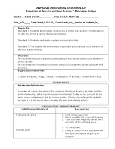
Students practice finding a bearing. In this orienteering lesson, students review how to use a compass and set a bearing. Students complete a worksheet where they practice finding a bearing and complete a group activity to...
Curated OER
Importance of Water
Students complete a KWL chart on what they comprehend about water. They complete a water activity determining how much usable water is available, and they determine the water usage in their households. Students take notes on water and...
Curated OER
Romans in Britain, or Classical Colonialism
Students identify the extent of the Roman Empire on a map of Europe and North Africa. They discuss the reasons behind Roman expansion and occupation. They read Cymbeline and write about the attitudes of 3 characters. Groups stage the scene.
Other popular searches
- Different Types of Maps
- Reviewing Types of Maps
- Types of Maps Grids
- Types of Maps Worksheets
- 10 Types of Maps
- Three Types of Maps
- 2 Types of Maps
- Types of Maps Australia
- Types of Maps "Australia
- Types of Maps "Australia"
- Maps Types Key Symbols


