Curated OER
What's Down There?
Students analyze data on coral reefs and use this to help characterize reefs. In this mapping coral reefs lesson students identify and explain the major threats to coral reefs.
Alabama Learning Exchange
Diverse Life Forms of the Ocean
Pupils recognize marine organisms and differentiate between plankton and nekton. In this investigative instructional activity students create a concept map using their list of terms and study marine life forms.
Curated OER
Shipwreck Mystery
Students study web pages on a shipwreck then locate where this took place on a map. In this marine archaeologist lesson students examine what clues archaeologists use to find the location of a shipwreck and what they might find.
Curated OER
Spherical Geometry: A Global Perspective
Students investigate spherical geometry using a globe and an apple. In this spherical geometry lesson plan, students translate Euclidean geometry terms to spherical geometry terms using a globe. They answer 3 questions about spherical...
Curated OER
GPS Treasure Hunt
Learners explore geography by participating in a treasure hunt activity. In this Global Positioning System lesson, students define the terms latitude and longitude while utilizing an electronic GPS device. Learners view a PowerPoint...
Curated OER
Desert Cinquains
Learners use the cinquain structure and correct parts of speech to write a poem with a desert theme.
NASA
Cloudy vs. Clear - Graphs
Explore the link between solar energy and cloud cover using real data from NASA from China! Future climatologists analyze and interpret graphs of solar energy on clear and cloudy days using a literacy cube. Investigators draw conclusions...
Curated OER
Places and Production
Students investigate the economy and the market value of goods. In this algebra instructional activity, students differentiate between domestic goods value and international good value. The define and identify the importance of GDP or...
Curated OER
Monument Museum
Students design monuments, taking into account what is known about geometric shapes and measuring. Students create a museum complete with monuments and descritions of the monuments. Students provide guides at each monument in order to...
Curated OER
Where in the World is Tacky the Penguin?
First graders complete activities related to they story they are reading in class. Through art and measurement activities, 1st graders relate a story from the "Tacky the Penguin Series" to everyday objects and ideas they encounter.
Curated OER
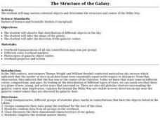
The Structure of the Galaxy
Students infer the galaxy shape. In this structure of the galaxy lesson plan students observe the distribution of objects in the sky and answer questions.
Curated OER
The Geography of Renaissance
Students use the internet to research the geography of the Renaissance. Using maps of Europe, they identify at least three key cities during the time period and discuss the main types of transportation. They research the various customs...
Curated OER
Erosion: On the Move...Defending the Coast Against Wave Attack
Students study how people have tried to save beaches from wave erosion. They examine what has occurred to Cape Hatteras as a result of beach erosion and the efforts to reduce the erosion.
Curated OER
Making Rocks
Young scholars use their imaginations in order to journey to the center of the earth to find different types of minerals. They create minerals using playdough and create scientific drawings of them. Finally, students create a map to...
Curated OER
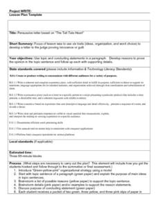
Persuasive Letters and The Tell Tale Heart
Students write persuasive letters based on "The Tell Tale Heart." They brainstorm topic sentences, main ideas, and details. They analyze the character and determine if he is innocent or guilty. They create a map listing their reasons to...
Curated OER
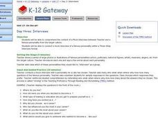
On the air! Interviews
In this mock interview lesson, young scholars view pictures of famous personalities and determine which of these personalities they would like to interview. Students follow the three step interview process and conduct a mock...
Curated OER
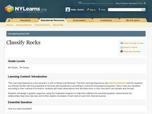
Classify Rocks
Students classify different types of rocks. In this earth science lesson plan, students test different rock samples and construct a chart to record observations. They create a concept map that answers essential questions.
Curated OER
Roller Coaster Mania
Fifth graders extend their knowledge of developing maps. They work in cooperative groups to develop an amusement park display and a brochure.
Curated OER
Social Studies For Elementary School
Fourth graders become familar with maps and work in groups to get an overview of what Europe is like. The real assignment is in the form of students creating their own trip if it could really be taken.
Curated OER
What is an Explorer
Students become explorers. They examine a picture of an explorer and create props to explore within the classroom. Students are studying the Louisiana Purchase of 1803. They explore how to read a map and create a map of the classroom...
Curated OER
Our State Road Trip
Students take a virtual tour of the country of China instead of a state. Using the Internet, they examine the differences between a political and physical map and use latitude and longitude to locate specific places. They also research...
Curated OER
"Where in the World is my School?"
Students learn new vocabulary and discuss what GPS is and does. They locate their school using the equipment.
Curated OER
Snow Cover By Latitude
Students create graphs comparing the amount of snow cover along selected latitudes using data sets from a NASA website. They create a spreadsheet and a bar graph on the computer, and analyze the data.
Other popular searches
- Different Types of Maps
- Reviewing Types of Maps
- Types of Maps Grids
- Types of Maps Worksheets
- 10 Types of Maps
- Three Types of Maps
- 2 Types of Maps
- Types of Maps Australia
- Types of Maps "Australia
- Types of Maps "Australia"
- Maps Types Key Symbols
