Curated OER
Weather Predictions
Fourth graders explore meteorologists. They explore symbols on a weather map and make five day forecasts.
Curated OER
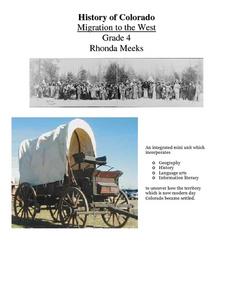
History of Colorado-Migration to the West
Fourth graders identify reasons for people moving to the Colorado Territory and examine how moving in the 1800's is different than moving today. They also practice reading maps and gathering information from maps, as well as, describe...
Curated OER
Immigrants & Community
Learners examine how different groups of immigrants contributed to the growth of specific communities. After reading a novel, they keep a journal on the important elements found and create a map of the community portrayed. Using the...
Curated OER
Wisconsin
Fourth graders brainstorm a list of places they have visited in Wisconsin. They watch a video "Cultural Horizons." Students use the CD and find on a map several locations in Wisconsin. Students bring in photos, pictures, and artifacts...
Curated OER
Our Monster Travels...
Students write emails to their parents and locate specific places on a map. In this email lesson, students email their parents from the teacher's account and map locations of their parents.
Curated OER
Geography of the Wasatch Front
Students examine and discuss urban geography and land-cover types along the Wasatch Front. They analyze thermal images, create collages, and predict surface and air temperatures from aerial photos in the Salt Lake City Valley.
Curated OER
Peru's Earthquake
Students identify the patterns of earthquakes by mapping USGS data and comparing it to mapped tectonic plates. They discover the relationship between earthquakes and the moving plates of the Earth's crust.
Curated OER
The Russian View of Territorial Encroachment
Twelfth graders produce a map illustrating the current NATO members, future nations, and nations that have applied for membership. They research current information regarding NATO, and the Russian viewpoint about the expansion of NATO....
Curated OER
BEWARE OF POISONS
Students research and explore all the safety conditions to being exposed to poisons in real-world situations. They review/discuss/investigate about types, sources, effects and responses of poisons by creating general questions to pose to...
Curated OER
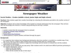
Newspaper Weather
Students use their knowledge of the weather to evaluate information from the newspaper. They also take this knowledge and construct a weather map predicting the next day's weather.
Curated OER
Oregon Trail Landforms
Fourth graders explore landforms located along the Oregon Trail. They discuss the significance of the Oregon Trail, identify visual landforms, and explain the definition of each one. Students complete worksheets, color, and label maps.
Curated OER
Planting A Garden On Campus
Students investigate the school campus area in order to plan the best spot for a class garden. They create a map of the school and research the different types of soil that exist in order to find the best spot. The class takes the...
Curated OER
GIS and Agriculture
Students are introduced GIS systems and how they operate. Using a GIS system, they locate and map the various types of agricultural products grown in Oregon. They rank each county based on the amount of agricultural products produced and...
Curated OER
Snacks in a Bag
Learners brainstorm a list of their favorite snacks. Using clues, they identify the type of snack being described. On a map, they identify and locate the origin of the ingredients used to make it. They write their own clues for...
Curated OER
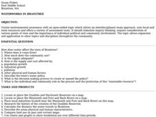
Waterworks In Braintree
Students examine how water affects the community of Braintree. Using a map, they locate main resevoirs and rivers in the area and research the history of one of the resevoirs. They use charts and graphs to show how land use has changed...
Curated OER
Somewhere in Indiana
Second graders locate the United States, Indiana, their community, and their neighborhood community on a map, and a world globe 4 out of 5 times correctly. They then discuss what they have learned in the lesson.
Curated OER
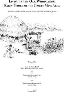
Living in the Oak Woodlands: Early People of the Jewett Mine Area
Students examine the archeology and native peoples of the Jewett Mine area of Texas. Using a map, they explain the economic patterns of the native groups and how the geography of the area affected activities. They compare and contrast...
Curated OER
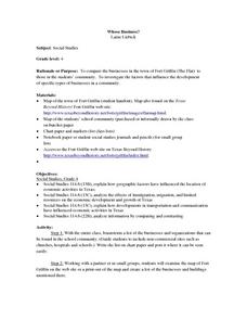
Whose Business?
Fourth graders compare and contrast the businesses in Fort Griffin with those in their own community. Using the internet, they discover the factors that have influenced the development of businesses in a town. They also create a map of...
Curated OER
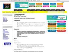
Traveling Apples
Young scholars locate countries in which different apples are grown. They discuss and illustrate different types of transportation that would be best for traveling between the United States and New Zealand. They share their stories and...
Curated OER
What Do Plants Need to Grow?
Fourth graders control variables to determine the effect on plant growth. They collect information by observing and measuring and construct simple graphs, tables, maps and charts to organize, examine and evaluate information.
Curated OER
Tacoma Narrows Bridge
Students, in groups, create a profile of different Pacific Northwest explorers. They develop PowerPoint presentations and maps to showcase their findings.
Curated OER
Watershed Investigations
Students find maps of the region to show rock formations and soil types and use GIS to compare radon levels. They describe three types of radioactive decay, interpret graphs, and follow steps to develop a nuclear bomb or energy.
Curated OER
Ancient Highways-Native Byways of Salmon Lake State Park
Eighth graders investigate the concept of the trail system used by the Native Americans. They compare and contrast the trails to modern transportation roadways of today. Students also define the types of information archaeologists use to...
Curated OER
Choosing a Family Dog
Fourth graders research types of dogs and recommend one that would make the best family pet. They work in cooperative groups of three using Kidspiration to map out the essential question before beginning their research, write reports,...
Other popular searches
- Different Types of Maps
- Reviewing Types of Maps
- Types of Maps Grids
- Types of Maps Worksheets
- 10 Types of Maps
- Three Types of Maps
- 2 Types of Maps
- Types of Maps Australia
- Types of Maps "Australia
- Types of Maps "Australia"
- Maps Types Key Symbols

