Curated OER
The Reservations
Third graders investigate the concept of a reservation and how it effects the lives of Native American indian tribes. They conduct research with the help of guiding questions to find the correct type of information. Students take notes...
Curated OER
African Rattles
Students locate Africa on the map or globe and tell one important fact about the continent. They follow directions and demonstrate the proper process of making an African Rattle.
Curated OER
The Hot Spot Hypothesis
Students use a digital atlas, geologic maps, and topography maps to explore geologic regions of Yellow Stone National Park. They locate evidence that support the theory of hot spots. Students research and explore the movements of Hot...
Curated OER
Dividing the Philanthropic Shares
Students define who volunteers are the and the types of jobs that they do. They identify various groups who volunteer in their community, and locate them on a city map.
Curated OER
The Guest Investigator Puzzle
Students conduct a brief astrophysics lab matching the EUVE spectra of various kinds of "mystery" stars with the spectra of known stars taken at Extreme Ultraviolet and optical wavelengths to determine their type.
Curated OER
The Accuracy of Climate Data
Students use maps to determine how accurate climate data really is. They also answer questions using a table of data.
Curated OER
Nebraska's Geology, Soils, Groundwater Regions, and Topographic Regions
Students examine the distribution of geology, soils, groundwater, topography, and geography in Nebraska. They identify various regions and characteristics on a map, and develop a plan to manage the soil and groundwater resources of the...
Curated OER
Careers in Science
Stuents explore the current job market for scientists. They explore types of jobs, salary range and job requirements. Students write a letter of application for a particular job.
Curated OER
Water: The Liquid of Life
Sixth graders complete a lesson plan on the properties, types and amounts of water on Earth. In groups, they travel between stations to identify water resources in Illinois and pollution sources. They complete the lesson plan with a...
Curated OER
Dinosaur History (Part 4)
Young scholars read the scripture that cooresponds with this lesson on dinosaurs. Using the text, they determine the types of animals on the ark with Noah. They identify the factors necessary for fossil formation and discuss how the...
Curated OER
Earthquake Introduction
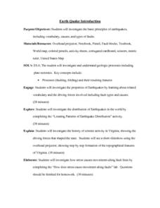
Students investigate basic principles and properties of earthquakes, including vocabulary, causes, and types of faults. They examine history of seismic activity in their home state, and complete "Locating Patterns of Distribution" lab.
Curated OER
Life on the Border
Students discuss different types of boundaries. They research the United States/Mexico border and answer questions about their findings. They create collages, posters, or multimedia presentations showcasing various areas of concern...
Curated OER
Weather Wise
Students investigate weather and how to forecast it. They discuss the three types of clouds and the kind of weather they bring. After setting up a database, they reearch weather-related websites to check cloud conditions and weather...
Curated OER
Water Walk
Students conduct a visual survey to discover information about local land use and water quality; document their findings by mapping and profiling the water body; and use this initial investigation to raise questions about local land use.
Curated OER
Shore is Windy!
Students consider what a hurricane is and how it impacts both land and people, explore the speculations surrounding Hurricane Isabel, research potential target sites and create maps illustrating how Isabel may affect them.
Curated OER
Wolf Pack in a Bottle
Students participate in an activity of a mock electrophoresis using paper chromatography to study DNA and genetic restriction mapping.
Curated OER
Anolis Lizards of the Greater Antilles
Students "take a trip" to the Greater Antilles to observethe Anolis lizards. They study the body structures and habitat of different species, then plot this data on a map to look for patterns in their distribution. From the patterns they...
Curated OER
Meteorology
Seventh graders examine the job of meteorologists. They decide which characteristics of the atmosphere that meteorologists focus on. They use local weather maps from newspapers to predict weather in their area.
Curated OER
Hoosier Artists
Young scholars examine the paintings of various Indiana artists. Using the internet, they relate the landscapes shown to the history of the state and how it affected Native Americans. Using the information they gathered, they write story...
Curated OER
ADULT ESOL LESSON PLAN--Level 5--Telephone Communication
Students, after reviewing/defining an extensive list of vocabulary terms on the board, examine/identify a variety of resources found in telephone directories (maps, government agencies, coupons, customer guide section, emergency numbers,...
Curated OER
Eating Your Words!
First graders study how to complete activities in sequential steps. They participate in various activities describing each step needed to complete the tasks. They work in pairs to type the list of steps necessary in making a sandwich. ...
Curated OER
Community Bus Tour
Second graders take a bus tour to discover different businesses, schools, and other buildings located in the community. They then learn about the different types of technology that is used in the community.
Curated OER
Earth's Surfaces
Students identify and define geology and earth surface vocaulary and their meanings to classify rocks and explore caves and their properties. Students find rocks and test them according to Moh's scale. They create a color coded earth...
Curated OER
Choose Your Own Soil Adventure
Ninth graders will use a soil survey to make management decisions and by interpreting geologic maps. The importance of different soil types is discussed and the implications of how soil can be useful for our communities.
Other popular searches
- Different Types of Maps
- Reviewing Types of Maps
- Types of Maps Grids
- Types of Maps Worksheets
- 10 Types of Maps
- Three Types of Maps
- 2 Types of Maps
- Types of Maps Australia
- Types of Maps "Australia
- Types of Maps "Australia"
- Maps Types Key Symbols

