Workforce Solutions
Workforce Solutions 2-3 Lessons
Four lessons and an at-home connection examine 12 jobs. Beginning with an interactive map, scholars view and discuss each one within their small group. Groups focus on the products provided and on their scarcity. Finally, pupils look...
Smithsonian Institution
Borders and Community: Early 20th Century Chicago Neighborhoods and Ethnic Enclaves
Chicago is one city, four neighborhoods, and countless nationalities. The lesson explores the ethnic division of Chicago in the early twentieth century. Academics read primary sources, analyze maps, and tour an online exhibit to...
Curated OER
The Earth is an Orange
Students examine and identify the various types of maps. Using two types of maps, they compare the data that can be gathered from each one. They also identify and locate the continents and the oceans. They review the purposes of each...
Curated OER
Are We There Yet?
Students discover how to use maps and why they are important when using a map. They calculate distance using a map scale and time using travel speed and a map scale.
Curated OER
Shizuko's Daughter: Concept of Definition Word Map
Help your class use critical thinking when it comes to unfamiliar words. With vocabulary from Kyoko Mori's Shizuko's Daughter, kids write the word in the center of a graphic organizer, and find its category, comparisons,...
Curated OER
Regents High School Examination: Physical Setting Earth Science 2006
Test your class on earth science with this extensive resource. This test, created by The University of the State of New York Regents, is made up of 50 multiple choice questions and 32 short answer questions that cover the branches of...
EngageNY
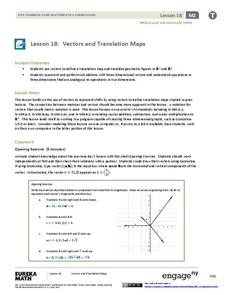
Vectors and Translation Maps
Discover the connection between vectors and translations. Through the lesson, learners see the strong relationship between vectors, matrices, and translations. Their inquiries begin in the two-dimensional plane and then progress to the...
EngageNY
A Rainforest Folktale: Determining the Message of “The Wings of the Butterfly,” a Tukuna People Tale
Did you the message? Scholars listen to a read aloud of The Wings of the Butterfly to summarize and determine the message of the text. They discuss the folktale and vocabulary in groups, then use a double bubble map to compare the story...
EngageNY
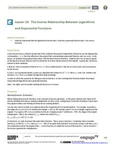
The Inverse Relationship Between Logarithmic and Exponential Functions
Introducing inverse functions! The 20th installment of a 35-part lesson encourages scholars to learn the definition of inverse functions and how to find them. The lesson considers all types of functions, not just exponential and...
EngageNY
Getting a Handle on New Transformations 2
Use 2x2 matrices to move along a line. The second day of a two-day lesson is the 28th installment in a 32-part unit. Pupils work together to create and solve systems of equations that will map a transformation to a given...
National Wildlife Federation
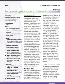
Bats: Maligned or Malicious?
Most people couldn't name the positive qualities of bats. Learners discover how bats benefit the environment and then create a concept map to summarize the information. After their reading, they identify misconceptions people have about...
Curated OER
Types of Transportation
Students study different types of transportation including specialized trucks. In this transportation lesson, students look at a landscape picture map (not included) and identify all of the modes of transportation they see. They see...
Curated OER
A Place Called Fairfax
Students are introduced to the various types of maps of Fairfax County, Virginia. Using the maps, they explain the relative and absolute locations of the county and discuss the importance of both. They also discover how the county is...
Curated OER
When You're Hot, You're Not!!
Students investigate volcanoes. In this landforms lesson plan, students locate two volcanoes on a world map. Students compare and contrast the types of volcanoes by using various Internet sites.
Curated OER
Create a Story May
First graders review the terms characters, setting and events in stories. They are shown how to access the Kidspiration Map, and how to add pictures in the correct spaces on the map. Students insert pictures in the map of the story...
Curated OER
Study Skills Assignment
Students utilize six different types of study skills as they review material for a final exam. They are graded on the exam and on the study process for the exam.
Curated OER
Using Graphic Organizers for Sensemaking
Students create concept maps in order to assess the information that they have gathered during research. They study the concept map to determine if the research is complete.
Curated OER
Weather Forecasting Unit
Students study weather concepts, mapping, characteristics in this series of lessons.
Curated OER
Europe Before and after WWI
Eighth graders compare and contrast maps of Europe before and after World War I. In this World War I lesson, 8th graders color and label maps of Europe prior to the war and after it. The historical maps can be accessed online.
Curated OER
Ancient Egypt: Connecting Literature and Geography
Students brainstorm prior knowledge of Ancient Egypt, locate Egypt on map of Africa and on world map, watch King Tut film, discuss term biography, and map geographical information mentioned in stories and documentaries about Ancient Egypt.
Curated OER
Creating A Life Map
Students investigate the concept of a life plan and how to write one with the help of a graphic organizer that encourages one to create a timeline for planning. They write journal prompts that are based upon personal knowledge of life...
Curated OER
Compass Rose Directions
Second graders use cardinal and intermediate directions to locate places on maps and places in the classroom, school, and community. They draw a setting map of "Little Red Riding Hood." Students give five steps of cardinal or...
Curated OER
Climb a Mountain, Raft a River on Your Own Land
Pupils are introduced to the characteristics of a map. As a class, they discuss the uses of public lands in their community and develop symbols for each feature. They use the symbols to create a map showing the recreational uses of the...
Curated OER
World Map and Globe-Equator, North Pole, and South Pole
Students identify the Equator, North Pole, and South Pole on a map. In this geography lesson, students use a world map and circle the North and South Pole. Students locate the Equator on a globe and use a map marker to highlight it.
Other popular searches
- Different Types of Maps
- Reviewing Types of Maps
- Types of Maps Grids
- Types of Maps Worksheets
- 10 Types of Maps
- Three Types of Maps
- 2 Types of Maps
- Types of Maps Australia
- Types of Maps "Australia
- Types of Maps "Australia"
- Maps Types Key Symbols


