Curated OER
Washington, D.C. Map
Here is an outline map of Washington, DC. Some of the points of interest in the city are labeled, as are Maryland, Virginia and Arlington. There are plenty of important monuments and locations not identified, making for a good...
PBS
Pbs Learning Media: Earth's Systems: Map It
Explore different types of maps and how different things are represented on maps in this media gallery from WGBH. Maps are used to help locate different places and different things. Map symbols are representations of larger things in the...
University of Texas at Austin
Perry Castaneda Library Map Collection: u.s. Maps
At this site find any type of map on the U.S. and any of its states here. Great site for teachers to print out maps to use in the classroom.
University of Chicago
University of Chicago Press: What Is a Map? A Collection of Unusual Maps
Showcases a collection of unusual maps from the book "Maps: Finding Our Place in the World." Types of maps included are journey maps, city maps, slave maps, imaginary maps, and handy maps.
University of Texas at Austin
Perry Castaneda Library Map Collection: African Maps
At this site find any type of map on Africa. Just click on what you want and you will get an accurate, colorful map.
Other
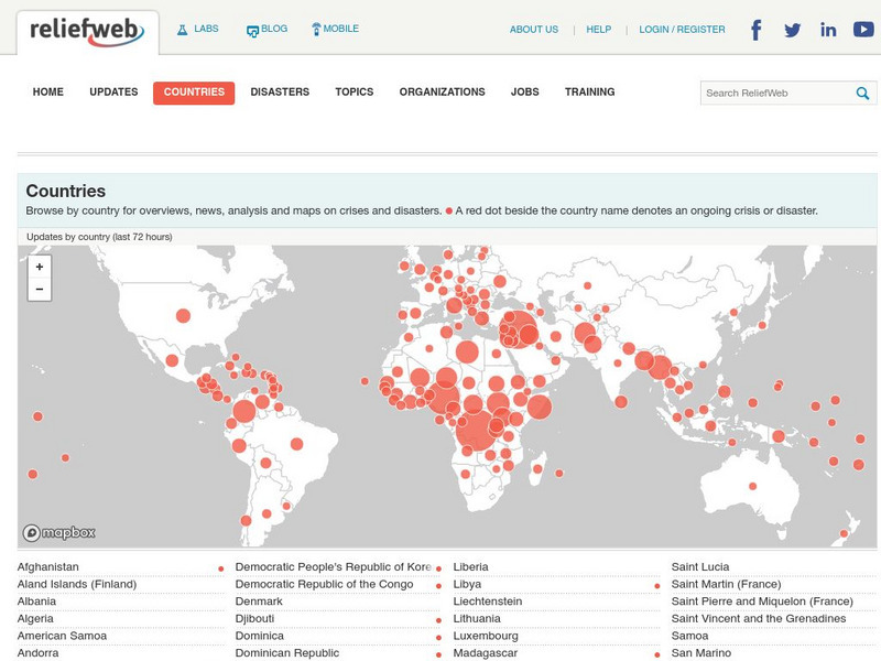
Relief Web: Countries
This resource provides information on countries throughout the world, current news, and different types of maps.
Princeton University
Princeton University: Qed: Mapping Globalization: Map Category Queries
A large database of historical maps that can be searched by map type, time period (prehistory to 21st century), theme, and world location. Themes cover economics, war, disease, trade, migration, and much more.
Sophia Learning
Sophia: Note Taking: Concept Maps and Flow Charts
This slideshow lesson focuses on note taking using concept maps and flow charts; it provides background information, 6 types of concept maps or flow charts with best uses, uses in the classroom, uses while reading or researching, and how...
Latimer Clarke Corporation
Atlapedia Online: Map Index
This website has a political and a physical map index.
Other
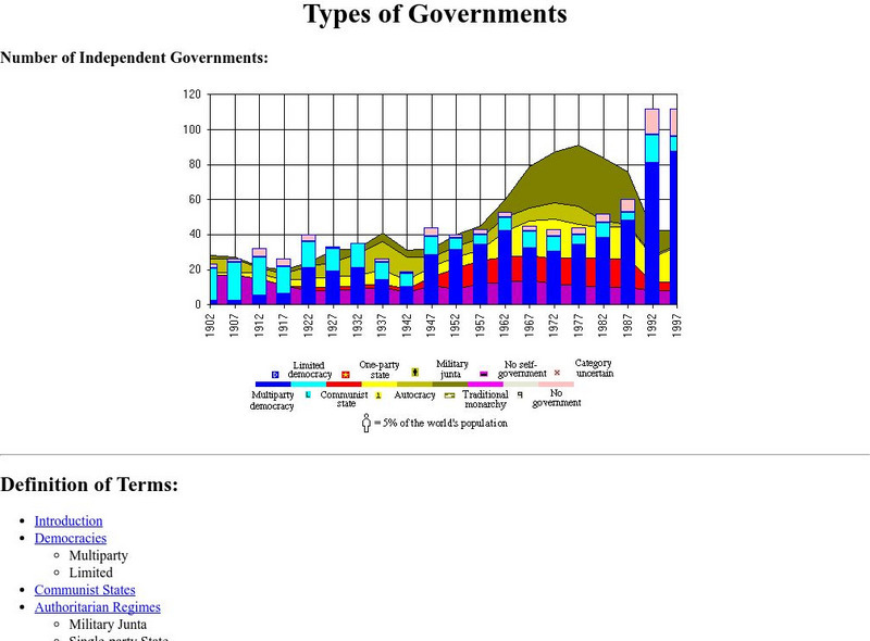
Historical Atlas of the 20th Century: Types of Governments
This site takes a look at a wide range of government types. Investigates democracies, communist states, authoritarian regimes, absolute monarchies, and more. Detailed, time-stamped charts and maps are also included.
Other
Stadtplandienst Map Service
A helpful tool in finding locations in Germany. Just type in an address or town/city, or click on the interactive map, and receive a map of your destination. This site is only in German.
ReadWriteThink
Read Write Think: Persuasion Map
A printable graphic organizer for students to use when writing on opinion or persuasive essay. Directions on how to use this type of graphic organizer as well as lists of teaching ideas, lesson plans, and other resources are also...
Other
Map: Imperialism and the Balance of Power
World maps of the Colonial Empires of 1914 as well as their revenues during that time period. There are also maps depicting urban growth, type of government, wars and atrocities, and living conditions of the world in 1900.
ReadWriteThink
Read Write Think: Essay Map
A fillable essay map in PDF format with boxes for an introduction, main ideas, supporting details, and a conclusion. Directions on how to use this type of graphic organizer as well as lists of teaching ideas and related resources are...
University of California
Us Geological Survey: Cartogram Central
The USGS offers detailed information on Types of Cartograms, Congressional Districts, Software for Cartograms, Publications, and a Carto-Gallery.
Other
Freeology: Free Graphic Organizers
Blank templates of all types of graphic organizers from Venn Diagrams to Vocabulary Sketches are available for free at this resource.
California Digital Library
Calisphere: Maps
A broad selection of images featuring maps can be found on this site by Calisphere. By clicking on individual images you'll find high quality photographs and image information.
Curated OER
Etc: Maps Etc: Vegetation Distribution of South America, 1911
A map from 1911 of South America showing the distribution of vegetation types. The map is color-coded to show regions of forests, regions of woodlands, grass, and cultivation, regions of steppes and prairies, desert regions, and regions...
Other
Reading Quest: Strategies for Reading Comprehension: Concept of Definition Map
Sometimes teaching students about creating definitions is difficult because they do not understand about multiple meanings or depth in meaning. This is a chance to teach students, using the concept map included, how to create definitions...
Other
Five Main Types of Graphic Organizers
This site provides information on how to use each graphic organizer. There are also 21 different graphic organizers for you to see.
Other
Didactalia: Mapas Interactivos: Physical Relief of Mexico
Explore the map of Mexico and try to identify the types of landforms. Available in multiple languages.
Other
Bucks County Community College: Visual Organizers
This site walks you through the benefits of visual organizers, and focuses on a variety of types: tables, charts, graphs, timelines, flowcharts, diagrams, and webs.
Curated OER
Etc: Types of Colonial Governments, 1682 1730
A series of three maps of the British colonies in North America showing the types of colonial governments between 1682, 1692, and 1730, and the shift from charter colonies electing their own governors to the colonies with councilors...
Curated OER
Educational Technology Clearinghouse: Maps Etc: Fisheries of Europe, 1915
A map from 1915 showing the principal fishing grounds of Europe. The map shows the chief types of fish produced in the areas. The map shows principal cities and ports, railroads, rivers, and coastal features.
Other popular searches
- Different Types of Maps
- Reviewing Types of Maps
- Types of Maps Grids
- Types of Maps Worksheets
- 10 Types of Maps
- Three Types of Maps
- 2 Types of Maps
- Types of Maps Australia
- Types of Maps "Australia
- Types of Maps "Australia"
- Maps Types Key Symbols


