Curated OER
Clouds
Students read the "Cloud Book" by Tomie de Paola and create a map of clouds identifying atmospheric conditions, color and type, and what type of weather each cloud indicates. Emphasis is placed on the use of Kidspiration.
Curated OER
Why Do You Live Where You Do?
Eighth graders identify reasons why settlers bought land from the railroad and not a Homestead grant. Using that information, they compare and contrast the types of land given in each situation. They discuss the reasons why given...
Curated OER
Virginia In the World: The Geography of Commerce
Students examine how Virginia connects with the world through export trade. Using a map, they use symbols to depict the value of trade and the direction of the flow of goods. They complete a scavenger hunt using electronic almanacs and...
Curated OER
Borah Peak Earthquake
students use the internet, an atlas map, and other sources to explore a map of Idaho. They locate the Lost River Range and Mt. Borah. Students read the atlas map to locate earthquake faults, find the magnitude, fault, and epicenter of...
Curated OER
Geology and it’s Influence
Students compare current geological map and the one from 1800's. In this earth science lesson, students discuss differences between the two and explain the factors that caused the change. They write an essay about how these changes...
Curated OER
Elements of Biology: Biomes
Students describe the different types of biomes. In this biology lesson, students create a map of assigned biome with descriptive paragraphs. They share their findings to class.
Curated OER
Counties of Michigan
Fourth graders complete an atlas worksheet to become familiar with the types of information found in an atlas.
Curated OER
Math: Road Trip
Twelfth graders use road maps to calculate the distance between two locations. They estimate the cost for fuel and the miles per gallon. They consider other factors such as geography, road conditions, and traffic that may impact the cost.
Curated OER
How Far Will You Go And How Much Will It Cost?
Students examine how places of various size function as centers of economic activity. They develop a list of things that families shop for, analyze a local map, create a chart demonstrating how far they travel for the items they listed,...
Curated OER
Geometry: Lesson 1: Points, Lines, Segments, Angles
Fourth graders examine the concepts of, draw, and label points, lines, segments, and angles, They draw, label, and identify horizontal, vertical, intersecting, parallel, and perpendicular lines. They complete an associated worksheet that...
Curated OER
The Mathematics of Space and Place
Young scholars investigate the measurements and geometry of the school grounds. They conduct inquiry while measuring the campus and some of the city blocks. Then students draw a map to scale and categorize property types using a pie graph.
Curated OER
Getting Down to Business
Students develop a business plan to serve as a road map that ultimately help them achieve business goals. They create a description of the business and their work.
Curated OER
Investigation 1 - Wetlands, Forests & Deserts
Fourth graders examine surface terrain and how plants and animals are affected by the temperatures and precipitation that elevation and terrain creates. Then students predict what type of environment plants and animals live in.
Curated OER
Sailing Through History
Students research examples of different types of sailing ships, investigating the vessels as well as the politics, economy, and people at the historical time and place the boat was launched. They create displays for a museum exhibit...
Curated OER
Exploring For Copper Deposits
Students examine ore deposits and identify factors in their origin. They analyze geologic maps, and locate porphyry copper deposits on a sediment geochemistry map.
Curated OER
Weather Predictions
Fourth graders explore meteorologists. They explore symbols on a weather map and make five day forecasts.
Curated OER
History of Colorado-Migration to the West
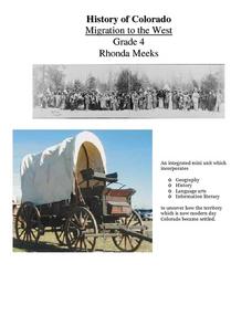
Fourth graders identify reasons for people moving to the Colorado Territory and examine how moving in the 1800's is different than moving today. They also practice reading maps and gathering information from maps, as well as, describe...
Curated OER
Immigrants & Community
Learners examine how different groups of immigrants contributed to the growth of specific communities. After reading a novel, they keep a journal on the important elements found and create a map of the community portrayed. Using the...
Curated OER
Wisconsin
Fourth graders brainstorm a list of places they have visited in Wisconsin. They watch a video "Cultural Horizons." Students use the CD and find on a map several locations in Wisconsin. Students bring in photos, pictures, and artifacts...
Curated OER
Our Monster Travels...
Students write emails to their parents and locate specific places on a map. In this email lesson, students email their parents from the teacher's account and map locations of their parents.
Curated OER
Geography of the Wasatch Front
Learners examine and discuss urban geography and land-cover types along the Wasatch Front. They analyze thermal images, create collages, and predict surface and air temperatures from aerial photos in the Salt Lake City Valley.
Curated OER
Peru's Earthquake
Students identify the patterns of earthquakes by mapping USGS data and comparing it to mapped tectonic plates. They discover the relationship between earthquakes and the moving plates of the Earth's crust.
Curated OER
The Russian View of Territorial Encroachment
Twelfth graders produce a map illustrating the current NATO members, future nations, and nations that have applied for membership. They research current information regarding NATO, and the Russian viewpoint about the expansion of NATO....
Curated OER
BEWARE OF POISONS
Middle schoolers research and explore all the safety conditions to being exposed to poisons in real-world situations. They review/discuss/investigate about types, sources, effects and responses of poisons by creating general questions to...
Other popular searches
- Different Types of Maps
- Reviewing Types of Maps
- Types of Maps Grids
- Types of Maps Worksheets
- 10 Types of Maps
- Three Types of Maps
- 2 Types of Maps
- Types of Maps Australia
- Types of Maps "Australia
- Types of Maps "Australia"
- Maps Types Key Symbols


