Curated OER
Newspaper Weather
Students use their knowledge of the weather to evaluate information from the newspaper. They also take this knowledge and construct a weather map predicting the next day's weather.
Curated OER
Oregon Trail Landforms
Fourth graders explore landforms located along the Oregon Trail. They discuss the significance of the Oregon Trail, identify visual landforms, and explain the definition of each one. Students complete worksheets, color, and label maps.
Curated OER
Planting A Garden On Campus
Young scholars investigate the school campus area in order to plan the best spot for a class garden. They create a map of the school and research the different types of soil that exist in order to find the best spot. The class takes the...
Curated OER
GIS and Agriculture
Students are introduced GIS systems and how they operate. Using a GIS system, they locate and map the various types of agricultural products grown in Oregon. They rank each county based on the amount of agricultural products produced and...
Curated OER
Snacks in a Bag
Learners brainstorm a list of their favorite snacks. Using clues, they identify the type of snack being described. On a map, they identify and locate the origin of the ingredients used to make it. They write their own clues for...
Curated OER
Waterworks In Braintree
Students examine how water affects the community of Braintree. Using a map, they locate main resevoirs and rivers in the area and research the history of one of the resevoirs. They use charts and graphs to show how land use has changed...
Curated OER
Somewhere in Indiana
Second graders locate the United States, Indiana, their community, and their neighborhood community on a map, and a world globe 4 out of 5 times correctly. They then discuss what they have learned in the lesson.
Curated OER
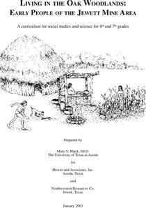
Living in the Oak Woodlands: Early People of the Jewett Mine Area
Students examine the archeology and native peoples of the Jewett Mine area of Texas. Using a map, they explain the economic patterns of the native groups and how the geography of the area affected activities. They compare and contrast...
Curated OER
Whose Business?
Fourth graders compare and contrast the businesses in Fort Griffin with those in their own community. Using the internet, they discover the factors that have influenced the development of businesses in a town. They also create a map of...
Curated OER
Traveling Apples
Students locate countries in which different apples are grown. They discuss and illustrate different types of transportation that would be best for traveling between the United States and New Zealand. They share their stories and...
Curated OER
What Do Plants Need to Grow?
Fourth graders control variables to determine the effect on plant growth. They collect information by observing and measuring and construct simple graphs, tables, maps and charts to organize, examine and evaluate information.
Curated OER
Tacoma Narrows Bridge
Students, in groups, create a profile of different Pacific Northwest explorers. They develop PowerPoint presentations and maps to showcase their findings.
Curated OER
Watershed Investigations
Students find maps of the region to show rock formations and soil types and use GIS to compare radon levels. They describe three types of radioactive decay, interpret graphs, and follow steps to develop a nuclear bomb or energy.
Curated OER
Ancient Highways-Native Byways of Salmon Lake State Park
Eighth graders investigate the concept of the trail system used by the Native Americans. They compare and contrast the trails to modern transportation roadways of today. Students also define the types of information archaeologists use to...
Curated OER
Choosing a Family Dog
Fourth graders research types of dogs and recommend one that would make the best family pet. They work in cooperative groups of three using Kidspiration to map out the essential question before beginning their research, write reports,...
Curated OER
SHOW 303: The Channel Island Fox
Students explore how archaeologists and other scientists use different clues to piece together a picture of the past. Students perform activities that allow them to conduct three types of scientific research. They discuss their...
Curated OER
Plot and Conflict
Students review the literary elements of plot and conflict. In this plot and conflict instructional activity, students read a story and answer questions about the plot and conflict within. Students create a concept map for the novel to...
Curated OER
Alternative Energy
Students identify the five major alternative energy sources. In this physical science lesson, students assess the advantages and disadvantages for each type of energy. They complete a concept map using information they researched.
Curated OER
Can You Dig It?
Students investigate a fossil site and diagram a site map. They role play as paleontologists.
Curated OER
Latin America: Places and Regions
Seventh graders create a Latin American portfolio in the form of a country presentation using PowerPoint software. They use their knowledge of geographic concepts to interpret maps, globes, charts, diagrams, and timelines.
Curated OER
All Messed Up
Students begin the experiment by mapping and calculating their school parking lot. They calculate the volume of water falling on the lot and map the route the water runoff takes. They discuss the roles that humans play in affecting water...
Curated OER
Hazard Alert
Students examine data regarding the occurrence of natural hazards as they occur in the United States. They record data on a classroom chart, map the areas affected by the hazards, and analyze and discuss conclusions drawn from the...
Curated OER
Testing the Waters
Students explore water in depth through discussion, research, and experiment. Students apply map skills to locating particular regions of the world as they relate to water. Students predict water quality based on information researched...
Curated OER
Our Little Town
Students draw a map of their local community using a drawing program. Using the internet, they locate various landmarks and identify famous people living or coming from their town. They participate in interviews with the community...
Other popular searches
- Different Types of Maps
- Reviewing Types of Maps
- Types of Maps Grids
- Types of Maps Worksheets
- 10 Types of Maps
- Three Types of Maps
- 2 Types of Maps
- Types of Maps Australia
- Types of Maps "Australia
- Types of Maps "Australia"
- Maps Types Key Symbols
