Curated OER
States and Capitals - Lesson 4 - U.S. Political Map
In this U.S. state capitals activity, learners identify the capital cities of the 50 states using the latitude and longitude coordinates provided.
Curated OER
Using Primary Sources to Discover Reconstruction
Fifth graders discover how reconstruction had an impact on racial issues in the United States. In this Reconstruction lesson, 5th graders are introduced to primary vs. secondary resources and then rotate through stations to view...
Curated OER
The Battle Over Reconstruction: The Aftermath of Reconstruction
High schoolers examine the Reconstruction Era. In this American history lesson, students explore the condition of the United States following the Civil War as they read statistical data. High schoolers analyze the Reconstruction policies...
Curated OER
Presidential Places
Students investigate American presidential landmarks throughout the continental United States. They research and analyze American presidential landmarks to determine their value to American history and how they have been preserved over...
Curated OER
Geography and Topography, History and Architecture
For this social studies lesson plan, students answer short answer questions about the geography, topography, history, and architecture of the east part of the United States. Students complete 24 questions.
Curated OER
Holocaust Map Studies
Students analyze maps and answer discussion questions related to WWI. In this geography lesson plan, students analyze historic maps to determine causes and effects of WWI in Europe. Students read testimonies of Holocaust survivors and...
Echoes & Reflections
Contemporary Antisemitism
Despite the recognized atrocities of the Holocaust, anti-semitism continues. The 11th and final installment of the Teaching the Holocaust series explores the long-term effects of the Holocaust on modern anti-semitism, asking pupils to...
Teach Engineering
Where Are the Plastics Near Me? (Mapping the Data)
The last activity in a nine-part series has teams create a Google Earth map using the data they collected during a field trip. Using the map, groups analyze the results and make adjustments to the map to reflect their analysis. A short...
K20 LEARN
Of Mice and Men in the Great Depression: Background and Setting
What were living conditions like in the United States during The Great Depression, and how do those conditions compare with today? That's the question young scholars consider as they prepare to read John Steinbeck's Of Mice and Men....
American Battlefield Trust
Civil War Battle Strategy
But for a fluke, 1862 could have gone differently during the Civil War. When Union troops found Robert E. Lee's battle plans for critical engagements in Maryland wrapped around cigars and tossed aside, history changed forever. Class...
Curated OER
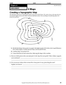
Creating a Topographic Map
In this topographic map instructional activity, students add contour lines to a topographic map using instructions provided. Once topographic map is finished, students complete 2 follow-up short answer questions.
Curated OER
Teaching Six Big Ideas in the Constitution
Students debate the constitutional principles of the United States. For this U.S. government lesson, students examine the meaning of the text of the U.S. Constitution and analyze other primary documents of the era. Students prepare for...
Curated OER
Mapping Landforms of South Carolina
Third graders analyze South Carolina maps. In this geography lesson, 3rd graders locate the five land regions in the state are and discuss how the regions are different. Students identify the major bodies of water and analyze how...
Curated OER
Weather, Data, Graphs and Maps
Students collect data on the weather, graph and analyze it. In this algebra instructional activity, students interpret maps and are able to better plan their days based on the weather reading. They make predictions based on the type of...
Curated OER
Weather in Your City
Students observe weather conditions of a particular city. Multiple intelligences are explored within this lesson. They locate their particular city on a United States map. Each student writes about their discoveries in his/her journal...
Curated OER
Describe That State
Young scholars broaden knowledge about all the 50 states. They combine their knowledge about states with their knowledge about parts of speech to create grammatically correct sentences that describe the characteristics of the states.
Curated OER
Map Skills
Students examine the nations, battlefields, troop movement of the Germans through Belgium and the location of both fronts during World War I by creating a map. They visualize the strength of the Germans early in the war.
Curated OER
FUN WITH MAPS
Second graders receive a general overview about how maps are made and used, how specific information can be derived from them, and how a student can gain personal information about their surroundings from examining them.
Curated OER
Turning the Tide in the Pacific, 1941-1943
Students analyze the Japanese strategy for the Pacific and compare it to the Allied strategy. They identify on a map the sites that were important the early war in the Pacific, and identify key military engagements.
Curated OER
National Expansion
Students investigate the Manifest Denstiny. They explore how the idea was evident in 19th century American maps. Students brainstorm the relationships between maps and national expansion. They review a map from 1816 that called for...
Curated OER
Rivers Run Through It
Using a relief map of New York State, learners answer questions about the distance between different cities, identify bodies of water, and more. First, they discuss vocabulary related to the Hudson River area. Then, they complete a...
Curated OER
River Run Through It
With vocabulary lists, worksheets, and more, this lesson sets learners on an exploration of the Hudson River area. They read an essay about the area, analyze a relief map of New York State, and complete a worksheet.
Curated OER
Hawaii: A Stolen Star
Explore the islands of Hawaii. Investigate Hawaiian culture and compare their personal traditions to Hawaiian traditions. They locate Hawaii on a map and research the history of Hawaii.
Bismarck Public Schools
Chapter 9 Review WKST
Here is a traditional multiple-choice, true/false, and fill-in-the-blank assessment on the presidency of James Monroe in the United States. It was designed to supplement a particular textbook chapter, but could be used to assess learning...


