Hi, what do you want to do?
Curated OER
Etc: Territorial Development of the United States, 1783 1889
A map from 1889 of North America showing the expansion in the region of the United States from the original Thirteen Colonies at the end of the Revolutionary War in 1783 to the time the map was made, around 1889, before the territories...
Curated OER
Etc: Maps Etc: Forest Map of the United States, 1910
A map from 1910 of the United States showing the forest regions of the Pacific, Rocky Mountains, Northern Forest in the Great Lakes and New England areas, Southern Forest along the Gulf and East Coast, and the Hardwood Forest. The map...
Curated OER
Etc: Maps Etc: United States and Neighboring Lands, 1920
A map from 1920 of southern Canada, the United States, and northern Mexico showing terrain features, lakes and river systems, and general vegetation types of the region. The map is keyed to show the submerged portion of the continental...
Curated OER
Etc: Maps Etc: United States Industrial Sections, 1901
A map from 1901 of the United States showing the product regions by separating the country into "(1) the Northeastern, or cloth-manufacturing section; (2) the Northern, or food-, iron-, and coal-producing, and manufacturing section; (4)...
Curated OER
Etc: Maps Etc: The United States Coal Fields, 1897
A map from 1897 of the United States showing the region of coal deposits and coal production.
New York Times
New York Times: International
[Free Registration/Login Required] The New York Times is an internationally recognized daily newspaper published in New York City, New York. Content of the international section includes top news and issues from around the world, special...
ClassFlow
Class Flow: North American Regions
[Free Registration/Login Required] This flipchart contains a labeling activity and Activote questions pertaining to the North American regions.
Other
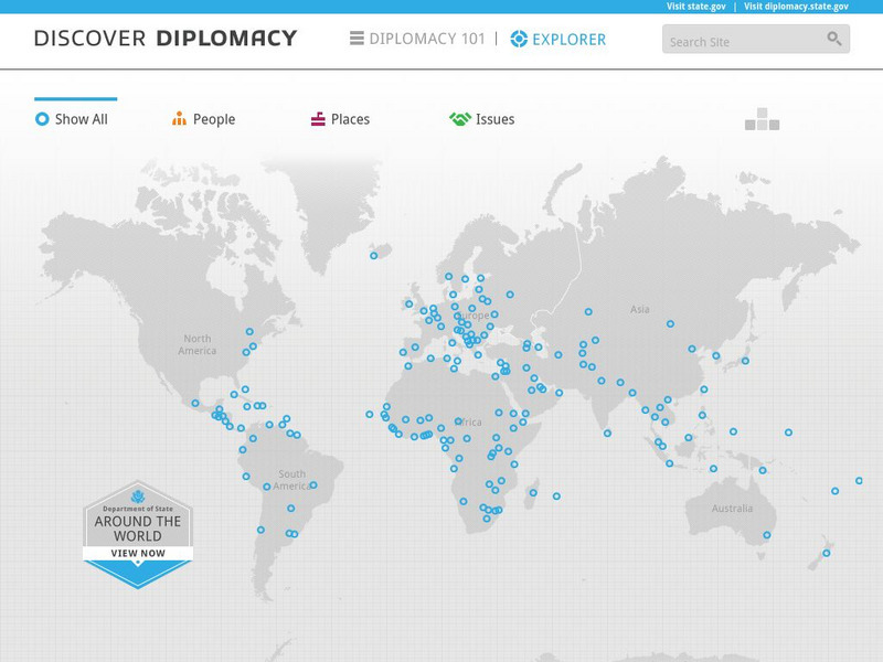
Discover Diplomacy: Around the World
The following map is a visual representation of the presence of the United States around the world. This interactive map shows our diplomats and their roles in their respective countries, places in the world where we practice diplomacy,...
Cengage Learning
Investigating Social Change: Midwest
Explore the evolution of the Midwest region of the United States. Learners and teachers will gain a different perspective about the Midwest when they check out this site.
Curated OER
Educational Technology Clearinghouse: Maps Etc: United States, 1917
A map of the United States and territories showing the expansion from the formation of the original states to the purchase of the Danish West Indies (Virgin Islands) in 1917. The map is color-coded to show the original states, the states...
Curated OER
Etc: Maps Etc: Gold and Silver Mining Regions of the United States, 1904
Gold and silver mining regions of the United States.
Curated OER
Etc: Maps Etc: Gold and Silver Mining Regions of the United States, 1906
Gold and silver mining regions of the United States.
Curated OER
Etc: Maps Etc: Natural Regions of the United States, 1906
A relief map from 1906 of the United States showing terrain features of mountain systems and highlands, basins, plains, prairies, lakes, rivers, and coastal features.
Curated OER
Etc: Theatre of War in the United States, 1861 1865
A map showing the extent of the Confederate territories east of the Mississippi River during the American Civil War (1861-1865). The map shows state lines and capitals, major cities, forts, battle sites, and rivers in the region. The map...
National Weather Service
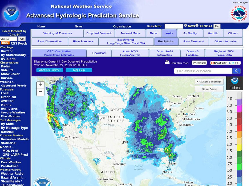
National Weather Service:climate Prediction Center: Daily Precipitation Analysis
Find real-time daily precipitation analysis for the United States, Mexico, and South America as well as accumulated precipitation maps for the past 30 or 90 days.
Cornell University
Cornell University: The Regional Climate Centers
Site provides information on the National Climatic Data Center's Regional Climate Centers Program. Click a region on the map of the United States and find information about that region's climate!
Curated OER
Educational Technology Clearinghouse: Maps Etc: Iron Regions, 1899
The United States' Iron Regions.
University of Richmond
American Panorama: The Executive Abroad 1905 2016
The Executive Abroad maps the international trips of presidents and secretaries of state. Interactive allows the user to select a President or Secretary of State to map their travels and see the frequency of visits to each geopolitical...
Curated OER
Educational Technology Clearinghouse: Maps Etc: Forest Regions, 1898
A map from 1898 of the United States showing the forest regions in the contiguous 48 states. "Fully one third of the timber cut in the world each year comes from the forests of the United States. Indeed, lumbering is carried on so...
Curated OER
Etc: Maps Etc: Blue Book for Every Section of the Country, 1920
A map of the United States identifying the regions covered by each volume of the 1920 Blue Book, available from the Automobile Blue Book Publishing Company.
Curated OER
Etc: Maps Etc: Mexico, Central America, and the West Indies, 1898
A map from 1898 of Mexico, Central America and the West Indies. The map includes an inset map of Cuba and the Isthmus of Nicaragua. "The surface of the Rocky Mountain highland in Mexico is quite similar to that of the great plateau...
Curated OER
Educational Technology Clearinghouse: Maps Etc: Summer Monsoon in India, 1910
A map from 1910 of the Indian subcontinent and the Central Asia region showing the typical rainfall distribution patterns during the summer monsoons, keyed to show areas of rainfall ranging from very light to, according to this text, the...
Curated OER
Educational Technology Clearinghouse: Maps Etc: Industrial Sections, 1898
A map from 1898 of the United States showing the Industrial Sections of the contiguous 48 states at the time. "Owing largely to differences in surface structure, climate, and soil, the great productions of our country are confined more...
Curated OER
Etc: Maps Etc: Mexico, Central America, and the West Indies, 1906
A map from 1906 of Mexico, Central America, and the West Indies showing the political boundaries at the time, capitals and major cities, mountain systems, coastal features, and islands of the region. An inset map shows the entire North...


