Curated OER
Puerto Rico: The 51st State?
Students examine the political status of Puerto Rico. In this global studies lesson, students explore Puerto Rico and consider the feelings of Puerto Ricans regarding their unique political status.
Curated OER
Searching the Net
Students create a Native American Nation flip book. In this Native American lesson, students choose one of four Native American Nations: The Iroquois, Hopi, Seminoles, Sioux. They research them on the Internet using teacher given...
Curated OER
Mapping Landforms of South Carolina
Third graders analyze South Carolina maps. In this geography lesson, 3rd graders locate the five land regions in the state are and discuss how the regions are different. Students identify the major bodies of water and analyze how...
Curated OER
US Policy In Somalia
Students investigate the US policy for the country of Somalia. They conduct research using a variety of resources. They locate the country and then discuss major geographical features of the areas. Students discuss the present US...
Curated OER
The New Madrid Earthquakes of 1811-1812: Shaking Our Misconceptions about Earthquakes in United States History
Students Examine how earthquakes work and what plate tectonics and fault lines are. For this earthquake lesson students complete an earthquake scavenger hunt.
Curated OER
The Southeast Region
Students write a song about the southeast region. In this southeast region lesson plan, students view pictures of landforms, hear music, look at maps of states, and more.
Curated OER
FUN WITH MAPS
Second graders receive a general overview about how maps are made and used, how specific information can be derived from them, and how a student can gain personal information about their surroundings from examining them.
Curated OER
River Run Through It
With vocabulary lists, worksheets, and more, this lesson sets learners on an exploration of the Hudson River area. They read an essay about the area, analyze a relief map of New York State, and complete a worksheet.
Curated OER
Rivers Run Through It
Using a relief map of New York State, learners answer questions about the distance between different cities, identify bodies of water, and more. First, they discuss vocabulary related to the Hudson River area. Then, they complete a...
Curated OER
What's Your Temperature?
Learners take a look at the local newspaper and focus on the weather section. They get into small groups, and each one looks at the same map, but of a different part of the country. They must prepare a presentation that shows how...
Curated OER
Learning the 50 States
Young scholars become familiar with all 50 states over the course of ten days.
Curated OER
Electronic Survey Activity
Fifth graders conduct a class survey and share the results with a class in another state via an electronic bulletin board. This technology-rich lesson is an ideal way to have learners practice communicating with others through the use of...
Curated OER
Finding Your Way Using Maps and Globes
Students identify the similarities and differences between different maps and globes. Individually, they create a map of their classroom along with a compass rose. They also practice reading maps as a class and finding specific locations.
Curated OER
Mapping the United States
Fifth graders research assigned states. They identify the capital, the climate, industries,rivers, and native animals.
Curated OER
This Land is Your Land - Travel Posters
Eleventh graders compile a list of places in the United States where they have either traveled or where their relatives or friends live. They collect travel posters, brochures, postcards, and maps from their region of the United States.
Curated OER
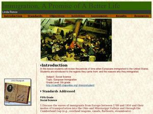
Immigration - A Promise of Better Life
What a great way to discuss European immigration in the 1700's to 1800's in America. Learners identify regions where immigration occurred, list the reasons people moved to the United States, and interview an immigrant about their...
Curated OER
Barrels and Buckets: Access to Water - What Would It Be Like to Live in Africa?
Students compare water access in the United States with that of Africa. In this water access lesson plan, students located Ghana and Kenya on a globe before reading Peace Corps Volunteer accounts of the difficulty of accessing clean...
Curated OER
The Water Around Us
Pupils discuss importance of reading maps and knowing about the geography of the United States, and locate bodies of water on different types of maps and examine how they are used in the state or local community.
Curated OER
U.S. Geography: The Northeast
Students investigate U.S. Geography by creating a map in class. In this natural resource instructional activity, students create a map of the United States and research the Northeast based on their resources and recyclable...
Curated OER
Natural Features as a Resource
Students identify resources provided by nature for basic human needs. In this natural features lesson, students discuss the various regions of the United States. They explore one region in depth and complete activities that identify...
Curated OER
Welcome to New York State
Young scholars choose one region of New York state, and create a travel brochure that includes information such as geographical features, tourist attractions, accesibility, economic features, and historical events that occured in that...
Curated OER
Tropical Regions/Mapping Biodiversity
Students use a world map to locate the country of Puerto Rico. In groups, they identify the various types of vegetation found on the island. They compare and contrast the biodiversity of the country to the United States. To end the...
Curated OER
Quarters from the Coast
Learners discuss Fifty State Quarters Program, compare and contrast location of land and water on map of United States, while also becoming aware of physical shape of nation and home state, and explore coastal areas in United States.
Curated OER
Planting Time
High schoolers research crops grown in the United States. In this agriculture lesson, students identify various crops cultivated across the United States as they create charts and maps that note the information.


