Curated OER
Tolerance: Gender Issues
Learners explore why some professions have been gender-dominant in the past. In this lesson, students identify some professions that have typically had one specific gender employed in the past, then research that job to see when it...
Curated OER
Tooling Around Arizona: Reading Arizona Maps
Students study geography. In this Arizona maps lesson, students develop their map reading skills. They have class discussions and work independently with various copies of Arizona maps to practice those skills. This lesson mentions...
Curated OER
What Countries Say/What Countries Do Regarding Children's Rights
Students investigate the adoption of the Convention on the Rights of The Child. Students describe the extent of the problem as the international community sees it. They evaluate the analysis of both the countries and the NGO's to comment...
Curated OER
Save the Planet!
Third graders explore the Recycle City Web site. They examine ways to save the environment. They write a short interview between a news reporter and an environmental expert. They practice acting out their news report.
Curated OER
Battle of the Bulge
Students identify the date and location of the Battle of the Bulge and the sides battling in it and who the military leaders were. They identify what each side did in the battle, who the victor was, and the condition each side was in...
Curated OER
Black History Stamps
Young scholars explore the lives and contributions of the many black Americans who are honored on U.S. commemorative postage stamps, make a presentation that synthesizes information about a historical figure and time, and write a...
Curated OER
The Lincoln-Douglas Debates of 1858: Interactive Map Activity
Eleventh graders utilize an interactive map to explore the 1858 Senate campaign in Illinois and how factors such as population, transportation, and party strongholds can affect campaign strategies.
Curated OER
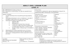
The Right and Responsibility To Bear Arms
Students write a paragraph summarizing the rights and responsibilities of owning a gun, including penalties for owners of guns which injure or kill. This less is designed for students acquiring English.
Curated OER
The Lincoln-Douglas Debates of 1858: Interactive Map Activity
Students utilize an interactive map to explore the 1858 Senate campaign in Illinois. They examine how factors such as population, transportation, and party strongholds can affect campaign strategies. Students write an essay discussing...
Curated OER
Musical Plates
Sixth graders engage in a study of the plates and how they are part of the formation of the ever changing landscape of planet earth. They access web sites that have applications for observation and conducting different activities. The...
Curated OER
Social Programs and Government Responsibility
Students compare and contrast two Presidents and how viewed the government in times of difficulty. They examine what role each President handled the role of philanthropy during their years in office. They identify acts of philanthropy...
Curated OER
Sioux Treaty of 1868
Students explore and research the history of Native Americans in North America.
Curated OER
Earthquakes
Students research statistics about the last five large earthquakes. They compare data in small groups and present their information orally to the class. They also attempt to predict the next large earthquake.
Curated OER
When Grandparents Are The Only Parents
Learners examine the way American families are changing. In groups, they discuss the impact of grandparents being the only parents to their grandchildren. They identify the mixed emotions felt by all members of the family and share...
Curated OER
Around the World in 17 Days
Students examine geography while studying the 2006 Winter Olympics. Students keep track of the winners of each Olympic event by finding the results using the Internet or by reviewing the newspaper and discuss the country the medalist...
Curated OER
Reading A Weather Map
Ninth graders construct a weather map. In this meteorology lesson, 9th graders construct a weather map using contour lines and temperature.


