Curated OER
Weather Lesson Five
Learners define a weather forecast, make a forecast using a weather map, identify three prediction guidelines, and explain how computers help to make forecasts. Students make a 24-hour forecast for each of the thirteen states targeted.
SeaWorld
Animal Migrations
Here is a fabulous set of activities for your young scientists. Each lesson contains map, hands-on, and game activities that will help the class understand why and how animals migrate from one place to another. First they'll examine the...
Curated OER
The Sweet Connection
Students use maps to find what crops are dominant in areas where honey bees are raised and discuss possible correlations. They mark the top ten honey- producing states on a US map.
Curated OER
Silk Roads Big Map
Learners create an oversized map from Europe to East Asia. They include information such as Silk Roads, geographical features, major cities and cultural information on their map.
Curated OER
United States Map
Students compare the United States on a globe and on a map. In this map lesson, students relate the sizes of the continents and locate the United States. Students identify the location of the continental US as well as Alaska and Hawaii.
Common Sense Media
The Masque of the Red Death
Poe goes high tech with a lesson that asks high schoolers to use the internet and various apps as they read and analyze "The Masque of the Red Death." In addition to responding to comprehension questions in Quizlet, they use Minecraft to...
Curated OER
The Brief American Pageant: Wilsonian Progressivism at Home and Abroad
Many various pieces of information about the Wilson administration adorn these slides. For instance, a map with 1912 election results, a chart detailing the organization of holding companies, and another map outlining U.S. presence in...
Curated OER
How Much Water is in That River?
Students practice measurement using the Hudson River. They calculate the discharge measurement at a location on the Hudson River using ingenuity and a topographic map.
Curated OER
World Map Labels
In this geography skills worksheet, students identify the countries and bodies of water labelled on the maps of the world, Africa, Asia, Canada, Europe, the Caribbean, the Middle East, North America, Australia, and South America.
Curated OER
Where Has It Been? Tracking the Ivory-Billed Woodpecker
By studying the assumed extinction, and subsequent rediscovery of the Ivory-billed Woodpecker, learners use maps and come up with a scenario for the rediscovery of the bird. This incredibly thorough lesson plan is chock-full of...
Curated OER
Organizing Your Ideas Into an Effective Outline
Students explain the components of a speech outline and write an interesting speech.
Curated OER
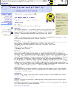
Salt Relief Map of Virginia
Fourth graders create a salt relief map of the four regions of Virginia. They indentify land forms and bodies of water, and summarize how they made their project.
Curated OER
Three Mapping Activities
Pupils label three maps of China after being introduced to background information about the country. In this geography lesson plan, students color two maps and label various points of interest in China. Finally, pupils draw...
Curated OER
Location, Location, Location!
Twelfth graders locate cities, states and countries on maps. They use the cardinal directions to locate places on maps. They describe where they were born by giving clues without naming the exact state. They trade papers and try to guess...
Louisiana Department of Education
Comprehensive Curriculum Social Studies (Grade 7)
US history from 1776 through 1877 is the focus of a comprehensive curriculum guide designed for seventh graders. Each of the seven units in the 102-page packet includes a list of guiding questions, grade-level expectations, links to...
Curated OER
Edible Resource Maps
Third graders work in groups to create an edible resource map showing locations of at least five resources in the United States. Students research on the internet different regions and the resources that are found in those areas. They...
Curated OER
Applications of GIS
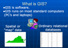
Don't be concerned that the title slide of this presentation mentions Virginia's Geospatial Extension Program; this slide show is very informative for any technology-focused curriculum when considering global information systems. It...
Curated OER
I Can Find that Where? - A Study of Landforms
First graders make landform maps of the United States. In this landform lessons, 1st graders participate in a discussion of local landforms and make a landform map of the United States. They follow the teacher's directions to add plains,...
Curated OER
Continents
Students investigate World Geography by researching the different continents. In this Asian Geography lesson, students discuss the continent of Pangaea and color a worksheet of the continents. Students locate China on the map worksheet...
Curated OER
The Writing Process
Show your young researchers how to find information, brainstorm a topic, map or outline their own stories, and create rough drafts. This instructional activity also shows learners how to peer edit, conference with the teacher, and write...
Curated OER
A Brief History of Vietnam (1858-2004) and Its Evolving Communist System
High schoolers examine the French colonization of Vietnam, the Vietnam War, and the current evolving Communist system. They develop political maps, outline the major events of the Vietnam War, write an essay, and compare/contrast...
Curated OER
Mapping A Stream
Students participate in mapping an actual waterway. They include reach lengths, transects, compass reading, and scale determinations. They include windfalls, plant cover, types of streambed composition, and landmarks such as trees and...
Curated OER
Mapping La Salle's Travels
Students use the internet to create a map showing the path of La Salle through North America and the Caribbean. They identify the main geographic features of the two areas and the main French forts. They also complete a timeline.
Curated OER
Mapping Your Neighborhood
Students define and outline their neighborhoods using GIS (geographic information systems) or a regional map and relate their neighborhoods to the principles of Smart Growth.


