Curated OER
Abbreviations
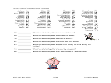
Test your middle schoolers on their knowledge of common abbreviations. Abbreviations such as PS, RSVP, PM, and AM are discussed. I suppose you could use this as a bell-ringer or a time-filler. There are 12 questions listed.
Curated OER
Name The States Worksheet 3
In this states worksheet, students analyze the shape of 5 US states. Students identify each state and write the name of the state and its postal abbreviation.
Curated OER
USA Postal Abbreviations Map
In this United States political map instructional activity, learners examine the postal abbreviations of each of the states.
Curated OER
United States Geography: Crossword Puzzle
In this geography learning exercise, students use the 14 clues in order to fill in the crossword puzzle with the appropriate United States geography answers.
Curated OER
States Quizzes
In this state postal code activity, students respond to 45 fill in the blank questions that require them to use the listed state postal codes as answers.
Curated OER
Blank US Map
In this blank outline map activity, students study the physical boundaries of the 50 states that make the United States. This outline map may be used for a variety of geographic activities.
Curated OER
Barack Obama Worksheet
In this President Barack Obama worksheet, students match 20 words pertaining to the life of our current President with the phrases and facts that go with them.
Curated OER
Latitude and Longitude
In this latitude and longitude worksheet, students complete 4 activities to demonstrate understanding. Students use a protractor to measure angles on a map of the earth. Students fill out a latitude and longitude chart after studying a...


