Curated OER
U.S. Political Map
For this political map worksheet, students use the map of the United States and the 7 cities to measure the straight-line distance between the cities. Students add the total number of miles traveled and write their answers in the spaces.
Curated OER
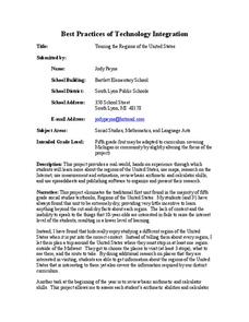
Touring the Regions of the United States
Fifth graders explore the regions of the United States. In this geography skills lesson, 5th graders examine the landforms, climates, and economies of the regions of the United States. Students conduct Internet research in order to...
Curated OER
Iowa State Quarter
In this Iowa learning exercise, students are given the state quarter of Iowa and answer questions about its symbols. Students answer 4 questions about the symbols.
Curated OER
Maine State Quarter
In this Maine worksheet, students analyze a picture of the state quarter of the state of Maine. Using the information on the coin, students answer 5 short essay questions about Maine.
Curated OER
Massachusetts State Quarter
In this Massachusetts instructional activity, students examine a picture of the state quarter of Massachusetts. Using the information on the coin, students answer 5 short essay questions.
Curated OER
Mississippi State Quarter
In this Mississippi learning exercise, students examine a picture of the state quarter for the state of Mississippi. Using the information on the coin, students answer 5 questions.
Curated OER
Pennsylvania State Quarter
In this Pennsylvania worksheet, students examine a picture of the state quarter of Pennsylvania. Using the information on the coin, students answer 5 essay questions about the state of Pennsylvania.
Curated OER
Texas State Quarter
In this Texas instructional activity, students analyze a photo of the state quarter of Texas. Students answer 7 questions about Texas using the information on the coin.
Curated OER
5th grade social studies geography
In this geography worksheet, 5th graders complete multiple choice questions about hemispheres, maps, cities, ecology, and more. Students complete 25 questions.
Curated OER
The Desert Alphabet Book
Young scholars explore world geography by researching a science book with their classmates. In this desert identification lesson, students utilize a U.S. map to locate the geographical locations of deserts. Young scholars create an oral...
Curated OER
California Geography
Fourth graders explore geography of four distinct regions of California: mountains, coast, central valley, and desert. They locate California on map, identify state's boundaries and borders, and explore agriculture, a major economic...
Curated OER
Using Google Squared to Compare and Contrast Canada and the US
Sixth graders compare and contrast Canada and the United States. In this geography skills lesson, 6th graders use Google Squared to research information so that they may compare the geography of Canada and the United States.
Curated OER
Our Country's Geography
Third graders study geography. In this United States landforms lesson, 3rd graders create a map of the U.S. made out of dough. They use various edible treats to mark the country's capital, the plains, the mountains and the rivers &...
Curated OER
Little House in the Census: Almanzo and Laura Ingalls Wilder
How would you use census data from 1880-1900? Here are a set of ways you can incorporate the book Little House on the Prairie and US census data from that time period. Learners will research the validity or the book based on factual...
Curated OER
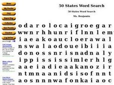
50 States Word Search
In this fifty states worksheet, students identify and locate all fifty states of the United States of America. There are 50 states located in the word search.
Curated OER
United States & Canada: How Are We The Same? How Are We Different?
Students compare and contrast similarities and differences between Canada and the US. In this geography lesson, students read various articles and identify similarities and differences in economies, cultures, geography, climate,...
Curated OER
MAISA and the REMC Association of Michigan
Students complete online research to study geography's impact on weather. In this geography and weather lesson, students research weather in their city for ten days using an online website. Students bookmark the site, enter data into a...
Curated OER
U.S. Archaeological Sites: Geography Practice
In this archaeological sites worksheet, students read about sites in the Unites States and use a map to complete a set of 7 short answer questions.
Curated OER
Agriculture Cares for the World
Students explore world geography by analyzing agriculture. In this dietary habits lesson, students discuss the role parents play in their children's diet and where the food comes from. Students write agricultural research paragraphs and...
Curated OER
Flat Stanley
Students read Flat Stanley, and make a poster board Flat Stanley which they sent out to family members in different states. They create an adventure for their Flat Stanley based on his "travels" and map out his trip.
Curated OER
Geography Journey
In this geography worksheet, students use a map of Amtrak train routes (not included) to answer 10 short answer questions. Students describe physical features and landmark cities they would see if traveling by train across the country.
Curated OER
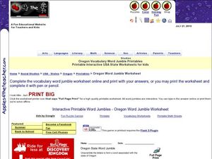
Oregon State Word Jumble
In this word jumble worksheet, students unscramble the letters to spell words associated with the state of Oregon. Students spell 20 words.
Curated OER
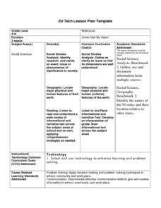
Come Visit My State!
Fourth graders conduct research on a selected state in the United States. They complete a WebQuest and conduct research on a variety of websites. Students then organize and present a visual display about their state that includes a...
Curated OER
Train Of States
Fourth graders create a class book with information about each of the United States. After students draw a state name out of a hat, they use various resources to fill in a facts chart about their state. Students draw the state flag and...

