Hi, what do you want to do?
Curated OER
Educational Technology Clearinghouse: Maps Etc: The Northwest Territory, 1787
A map of the Northwest Territory of the United States north of the Iroquois or Ohio River in 1787 showing early forts and settlements with dates of establishment given, rivers, and the general territories of the Illinois, Miami, and...
Curated OER
Etc: u.s. Territorial Acquisitions, 1783 1853
A map from 1910 of the United States showing the territorial acquisitions from the original states and territory established in 1783 to the Gadsden Purchase in northern Mexico in 1853.
Curated OER
Etc: Maps Etc: Territorial Gains of the United States, 1919
A map from 1919 of the United States showing the territorial acquisitions from the original states and territory established in 1783 to the Tripartite Convention of 1899 in which Germany and the United States divided the Samoan Archipelago.
Curated OER
Etc: Territorial Growth of the United States, 1783 1853
A map from 1914 of the United States showing its acquisition of territory from the original states and Northwest Territory after the American Revolutionary War in 1783 to the Gadsden Purchase in 1853. The dates for each acquisition are...
Curated OER
Etc: How the United States Obtained Its Territory, 1783 1853
A map of the United States showing its acquisition of territory from the original states and Northwest Territory after the American Revolutionary War in 1783 to the Gadsden Purchase in 1853.
Curated OER
Etc: Maps Etc: Territories of the United States, 1900
A map from 1909 showing territories added to the United States: Alaska (1867), Hawaii by annexation (1898), and Puerto Rico and the Philippines after the Spanish-American War (1898).
Curated OER
Etc: Maps Etc: The Territory of the United States, After April 30, 1803
A map of the United States in 1803 showing the extent of the territory after the Louisiana Purchase from France. The map is color-coded to show the possessions of the United States, Great Britain, and Spain at the time, and shows the...
Curated OER
Etc: Maps Etc: The Territory of the United States, After February 19, 1821
A map of the United States in 1821 showing the extent of the territory after taking control of Florida from Spain. The map is color-coded to show the possessions of the United States, Great Britain, and Spain at the time, and shows the...
Curated OER
Etc: The Territory of the United States, 1846 1848
A map showing the territory of the United States after the annexation of Texas in 1845, and the acquisition of the Oregon Country by treaty with Great Britain in 1846. The map is color-coded to show the possessions of the United States,...
Curated OER
Etc: Maps Etc: The Territory of the United States, After February 1, 1801
A map of the United States in 1801 showing the extent of the territory at the time of the presidency of Thomas Jefferson. The map is color-coded to show the possessions of the United States, Great Britain, Spain, and France at the time,...
Curated OER
Etc: Acquisition of Territory by the United States, 1783 1917
A map from 1922 of the United States showing the acquisition of territory from 1783 to the purchase of the Dutch West Indies (Virgin Islands) in 1917. This map is color-coded to show each of the acquisitions with map notations giving...
Curated OER
Etc: Territorial Growth of the Us 1783 to 1867, 1783 1867
The United States, showing the growth of territory from 1783 to 1867.
Independence Hall Association
U.s. History: The Missouri Compromise
A good look at the issues debated about the admission of new states, particularly those that would be made from the Louisiana Purchase. Read about why the issue of allowing slavery in the new states was such a hard decision for Congress....
Independence Hall Association
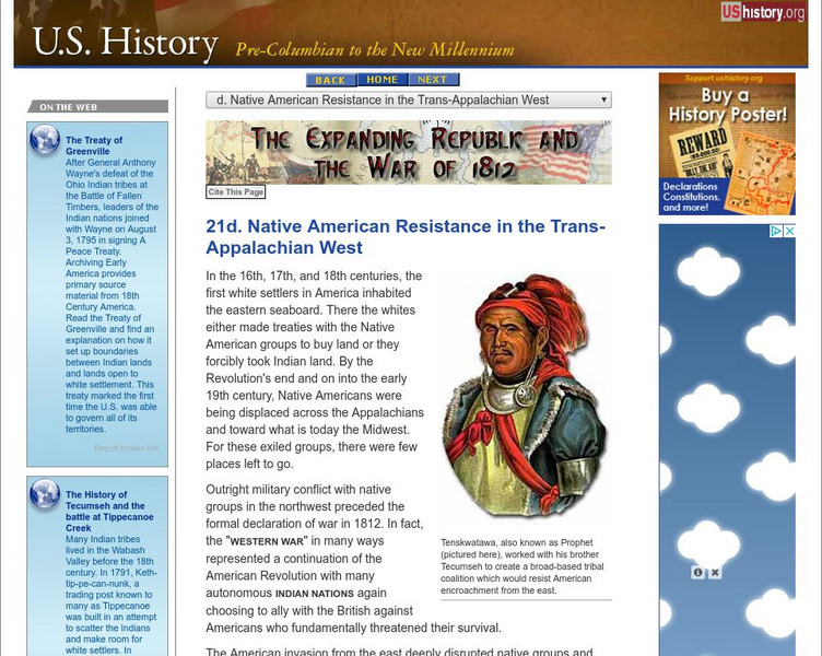
U.s. History: Native Resistance in the Trans Appalachian West
This site gives a brief look at the Indian alliance built by Tecumseh to confront the U.S. military which wanted to protect the settlers moving west into Indian territory.
US Mint
U.s. Mint: We're Going on a Bison Hunt [Pdf]
In this four-part lesson, examine the significance of the Louisiana Purchase and Lewis and Clark's Expedition. Then take the students on a simulated bison hunt to understand the importance of the bison as a food and materials source in...
US Mint
U.s. Mint: Our Goal Pole [Pdf]
In this four-part lesson, young scholars will demonstate knowledge of the sequencing of events by studying the westward journey, use terms that indicate the sequence of events and demonstrate an understanding of certain historical...
US Mint
U.s. Mint: Which Came First? [Pdf]
Introduce students to the Louisiana Purchase and Lewis and Clark's Expedition. Then, using the tails side of the Keelboat Nickel as a guide, make a timeline of the westward journey.
US Mint
U.s Mint: Which Side Is Which [Pdf]
Introduce students to the Louisiana Purchase and Lewis and Clark's Expedition. Then take a look at the Peace Medal nickel and differentiate between heads and the tails sides. Finally, do a coin-flip activity, and record and analyze the...
Curated OER
Etc: The Territory of the Us Before and After the Louisiana Purchase, 1783 1803
A map of the United States showing the extent of the country prior to, and after the Louisiana Purchase from France in 1803.
Independence Hall Association
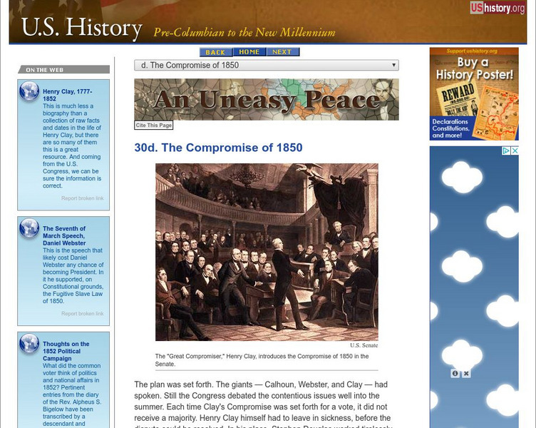
U.s. History: The Compromise of 1850
Find the various parts of the Compromise of 1850, proposed by Henry Clay, that extended slavery in some cases, prohibited in others, and added California as a free state. A clear chart shows what parts of the law were beneficial to the...
Curated OER
Educational Technology Clearinghouse: Maps Etc: Treaty With Spain, 1819
A map of the western United States and northern Mexico showing the territorial disputes settled and boundary established by the Adams-Onis Treaty between the United States and Spain in 1819. The territorial disputes involved the natural...
Curated OER
Educational Technology Clearinghouse: Maps Etc: United States, 1821
A map of the United States and territories in 1821 after the Missouri Compromise, showing the Free States and territories, the Slave States and territories, and the transitional territories at the time. The map is color-coded to show the...
Curated OER
Educational Technology Clearinghouse: Maps Etc: United States, 1917
A map of the United States and territories showing the expansion from the formation of the original states to the purchase of the Danish West Indies (Virgin Islands) in 1917. The map is color-coded to show the original states, the states...
Curated OER
Educational Technology Clearinghouse: Maps Etc: United States, 1789
A map of the United States in 1789, showing the State territorial claims, territories, and areas of territorial dispute. The map is color-coded to show States, territories, British possessions, and Spanish possessions, and shows the...


![U.s. Mint: We're Going on a Bison Hunt [Pdf] Lesson Plan U.s. Mint: We're Going on a Bison Hunt [Pdf] Lesson Plan](https://content.lessonplanet.com/knovation/original/249025-9f5e44d8a919bd8ec2d9ad8c543a3d75.jpg?1661243093)
![U.s. Mint: Our Goal Pole [Pdf] Lesson Plan U.s. Mint: Our Goal Pole [Pdf] Lesson Plan](https://content.lessonplanet.com/knovation/original/249027-a06b6e1b3a7aa5c8e4fc49293e940618.jpg?1661243094)
![U.s. Mint: Which Came First? [Pdf] Lesson Plan U.s. Mint: Which Came First? [Pdf] Lesson Plan](https://content.lessonplanet.com/knovation/original/249028-fe9fd34e9fd91c5e0f661d831bfde2a1.jpg?1661243091)
![U.s Mint: Which Side Is Which [Pdf] Lesson Plan U.s Mint: Which Side Is Which [Pdf] Lesson Plan](https://content.lessonplanet.com/knovation/original/249033-ff1ff264a293b5ffb6c4bba64baec78d.jpg?1661243090)
