CK-12 Foundation
Topographic and Geologic Maps: Topographic Maps
Maps are great for helping you get where you're going, but what does that place actually look like? Geology scholars compare and contrast the features of topographical and geologic maps using an interactive lesson. The resource describes...
Curated OER
Musical Plates-Earthquakes
In this plotting earthquake data learning exercise, learners use a large world map and given web sites showing the latitude and longitude for the epicenter of recent earthquakes around the world. Students plot 2 weeks of earthquake data...
Curated OER
Air Pollution:What's the Solution?-Weather's Role
In this air pollution and weather activity, students collect data using an online animation to determine the air quality at given times along with the wind speed and temperature in a particular city. Students make 3 bar graphs using the...
Curated OER
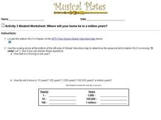
Where Will Your Home be in a Million Years?
In this house movement worksheet, students look at the gps website given and locate where their home may be and what climate change will take place in a million years. Students complete 9 questions.
Curated OER
Today's Weather
In this weather worksheet students complete an interactive activity and complete a series of short answer questions on temperature and weather fronts and predict the weather.
Curated OER
Weather Facts Internet Hunt
For this weather worksheet, learners click on the links in the questions about weather to find the answers to the questions and then come back and answer the questions. Students answer 17 questions total.
Curated OER
Country Shape Quiz #1
In this online interactive geography quiz worksheet, students respond to 16 identification questions about the shapes of countries shown . Students have 4 minutes to complete the quiz.
Curated OER
Country Shape Quiz
In this online interactive geography quiz worksheet, students respond to 16 identification questions about the shapes of countries shown . Students have 4 minutes to complete the quiz.
Curated OER
Country Shape Quiz #4
In this online interactive geography quiz activity, students respond to 16 identification questions regarding the shapes of countries of the world. Students have 4 minutes to finish the timed quiz.
University of Oregon
University of Oregon: Interactive Nolli Map of Rome: 1748 Map of Rome
Interactive Nolli Map introduces students to Rome and the structure of its urban form based on the work of eighteenth-century Italian architect Giambattista Nolli. Using the map engine, navigate through the city at a variety of scales,...
Shodor Education Foundation
Shodor Interactivate: Image Tool
Measure angles, distances, and areas in several different images (choices include maps, aerial photos, and others). A scale feature allows the user to set the scale used for measuring distances and areas.
Other popular searches
- Using a Map Scale
- Using Map Scales
- Using Map Scale Distance
- Using Maps to Scale
- Proportions Using Map Scale
- Maps Using Scale


