Curated OER
You want me to do what with this Dirt?
Eighth graders explore how to take soil samples and use GPS to determine the location of the site they have chosen to take the samples.
Curated OER
Testing Soils for Garden Planting
Sixth graders collect soil samples and record the location of the samples by using GPS.
Curated OER
Can You Find Me Now?
Students locate points using longitude and latitude coordinates. They locate their home using longitude and latitude, explore the uses of GPS, and accurately use a GPS.
Curated OER
Where's My Bot?
Students estimate geographic position based on speed and air travel. In GPS lesson students use GPS to estimate the set and drift of currents.
Curated OER
Rocks in our Backyard
Students examine igneous and sedimentary rocks. They observe and identify geological formations in their community, analyze igneous and sedimentary geological layers using a geological map, and use GPS to locate geological formations.
Curated OER
Periodic Table of Fun
Are you looking to put the fun back in the fundamentals of chemistry? Why not have groups create their own periodic tables of something (animals, food, music groups, etc.) practicing the organizational strategies used in the periodic...
University of Georgia
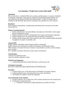
Would Your Cat Eat This Stuff?
Processed foods use inorganic compounds for flavoring and preservation. This take-home laboratory challenges scholars to find 20 different compounds identified on the labels of foods to list on their data collection sheet. The activity...
Curated OER
Mapping My Community
Ninth graders are introduced to GPS technology. They complete fieldwork as they visit a specific area of their community to identify and map types of land use in the surveyed area. They use the collected data to create a digital map.
Curated OER
Science Inquiry Lesson: Mapping Project
Students explore the methods of creating maps. They create a map of Animas River Park using a compass and measuring tape, develop a single map from the team map sections, and devise another map of the Animas River Park using a GPS unit.
Curated OER
Drift Study
Students observe, work with charts, and work with GPS in order to determine the path lobster larvae travel based on local currents. In this currents lesson plan, students work with local fishermen to observe the natural currents.
Curated OER
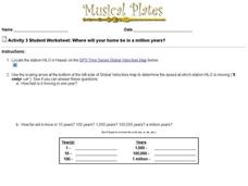
Where Will Your Home be in a Million Years?
In this house movement instructional activity, students look at the gps website given and locate where their home may be and what climate change will take place in a million years. Students complete 9 questions.
Curated OER
It's Not Your Fault
Students study the San Andreas Fault, calculate its movements, and compare the movements on both sides. In this earthquake lesson students use the Internet to track movement, and calculate movement using a spreadsheet.
Curated OER
I Know Where You Are!
Students study what a GPS is and use it to challenge themselves and find positions on a map. For this investigative lesson students find various points on a map using a GPS system and answer questions on a worksheet.
Curated OER
Find It!
Students analyze the basic concept of Global Positioning Systems using triangulation and measurement on a small scale in the classroom. They describe a satellite and how it helps in locating a person on Earth. They explain how...
Curated OER
Orienteering: Welcome to the Jungle
Students work together in groups to complete a treasure hunt. Using the school grounds, they search for pictures and stuffed animals of different species. They use a GPS to locate them and record which habitat they live. They calculate...
Curated OER
Floodplains in the field (with GIS)
Students measure a topographic and geologic cross-section across a floodplain by simple surveying and auguring techniques. They consider the spatial context of the field observations, use GPS measurements, and desktop GIS analyses.
Curated OER
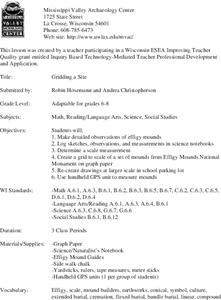
Gridding a Site
Students make observations of effigy mounds and record them in a notebook. In groups, they must determine the scale of measurement and create their own grid to scale part of the Effigy Mounds National Monument. They also practice using...
Montana State University
Who’s on Top?
What's it like to climb Mount Everest? An educational resource encourages an in-depth knowledge of Mount Everest's scientific missions through a variety of activities, including an analysis of maps, a KWL chart, videos, a simulation, and...
University of Georgia
Endothermic and Exothermic Reactions
Equip your chemistry class with the tools to properly understand endothermic and exothermic reactions. Young chemists collect, analyze, and graph data to determine how the Law of Conservation of Matter is applied to chemical composition...
Captain Planet Foundation
Worm Your Way Out of This
How can you provide healthy soil for your garden? Study worms, bacteria, and other microorganisms in a lesson about decomposition and organic compost. After discussing what you know about worms and watching a video, watch what worms do...
Curated OER
State Your Position
Middle schoolers practice using a global positioning system. They discuss the use of celestial objects as navigation points and its problems. They list the advantages and disadvantages of GPS as well.
Curated OER
Glacial Striation Investigation
Students operate a GPS unit to investigate the direction of glacier movement. They describe the motion of glacier movement by interpreting a graph. Students explain how scientists use glacier striations to determine glacier movement.
Curated OER
Black Holes....II
In this black hole worksheet, students use the equation for time dilation to solve 8 problems including determining the time it takes to receive a GPS signal from space, the time delay for the GPS-Earth system, the distance a radio...
Curated OER
Project Map: Latitude And Longitude Worksheet
In this latitude and longitude worksheet, learners find the coordinates of 14 cities around the world and use this information to complete 14 short answer questions. This worksheet includes online atlas web links.


