Curated OER
Maps and Globes: Where in the World are We?
Students explore maps and globes. In this introduction to map and globe concepts lesson, students identify features of physical maps, political maps, and globes. Students locate land and water, and recite a poem about the names of the...
Curated OER
Magical Maps
Second graders discuss the importance of using maps and how they are used. After they listen to a folktale, they develop their own story line maps and write their own folktale to accompany a map. They also identify and locate the seven...
Curated OER
Learning About Maps
Pupils investigate the many uses and features of maps and globes and locate where they live on both. In this map lesson, student play a travel game and create their own maps to explore states, continents, countries, and islands.
Curated OER
Mapping the News
Students explore cartography. In this map skills and map making lesson, Students work in groups to create wall size world maps including legends, compass roses, latitude and longitude, and physical features. Students collect current...
Curated OER
Create A Park Map
Students design ultimate park experience for Florida families as they demonstrate their knowledge of map legend skills.
Curated OER
A Walk Around the School: Mapping Places Near and Far
After reading Pat Hutchins’ Rosie’s Walk, have your young cartographers create a map of Rosie’s walk. Then lead them on a walk around the school. When you return class members sequence the walk by making a list of how the class got from...
Curated OER
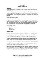
The Globe and World Map
Students explore how to use maps for travel. In this map skills lesson, students read the text, With Love from Gran and discuss the places the character traveled. Students list the names of each city and country on chart paper.
Curated OER
Places in My World
Second graders explore where they are located on the globe. In this maps and globes lesson, 2nd graders use a map to show where they live and show the cardinal directions. Students identify characteristics of mountains, flat land,...
Curated OER
Poverty Point Native Americans
Students investigate the Poverty Point Indians. In this Native Americans lesson, students research the Indians and use the information to fill out graphic organizers and to compare and contrast communities over time. Students locate...
Curated OER
A Map Mystery
First graders solve a mystery by following map clues. In this map clues lesson plan, 1st graders follow a computer program called Neighborhood Map Machine. In this program, it gives students directional and spatial clues in order to...
Curated OER
Put Me in My Place: Using Alphanumeric Grids to Locate Places
Students practice locating points on a large wall grid and create and label a neighborhood map. In this geography lesson, students spell and discuss places as the teacher places them on the map. They discuss the concept of an...
Curated OER
Kid Maps: Reading and Creating Maps with Human Characteristics
Students look at maps. In this map instructional activity, students listen to the book My Map Book by Sara Fanelli and they see the difference between human characteristics (buildings, etc.) and natural characteristics (rivers, etc.)....
Curated OER
Through the Forest and Home Again: Maps Help Us Find Our Ways
Students read Little Red Riding Hood, focusing on her path home to Grandma's house. In this language arts and geography lesson, students perform a reader's theater, re-creating the walk home and possible routes that could have been...
Prairie Public Broadcasting
Egyptian Pyramids Virtual Field Trip!
A virtual field trip takes enthusiastic travelers to the pyramids of Giza. Using Google, scholars explore the grounds of the ancient pyramids found in Egypt then complete three worksheets: a photo analysis page, a reflection sheet, and a...
Curated OER
Mapping Electricity
Students complete Internet research and use their map reading skills to learn about how the United States creates and uses electricity in different states. In this energy sources activity, students study the mini map of energy usage in...
Curated OER
You Are Here
Students map local places and learn to use scale and distance. In this mapping lesson, students map their school and a favorite place. Students recreate their maps showing distance and scale sizes. Students locate their location on a...
Shakespeare Globe Trust
Fact Sheet: Playhouses
Laborers used common materials to build London's first performance venues, including sticks, plaster, and ... hair? Using an informational handout, scholars learn about the construction of different types of playhouses where actors...
Curated OER
Lesson Ten: Direction
Students explore the concept of relative location. In this map lesson, students read I Hate English by Ellen Levine and consider how maps and globes help people to familiarize themselves with an area.
Curated OER
A Month of Mapping Literature
Explore the world through literature! With push pins to mark where each story came from, learners examine cultural differences, geographical location, and how those elements affect story content. This lesson could use deeper development,...
Curated OER
Tortoise and Hare Races
Practice basic map skills with the story of The Tortoise and the Hare. After listening to the story, class members create a map that indicates the starting line, the path the animals took, where they stopped to rest, and the finish line....
Curated OER
Geography and Culture in South Carolina
Learners explore South Carolina. In this cultural heritage activity, students investigate the topography of South Carolina using maps. Learners are engaged in identifying the different regions of the state and examine the cultural...
Curated OER
A Tale of Two Frogs
Second graders locate Russia on a map or globe and work in pairs to complete the Map worksheet. They read the book, A Tale of Two Frogs stopping after page 15. They write an ending to the story and then read more of the book stopping...
Curated OER
Map Reading
After examining a map from 1803 and 2003, they explore how to become map readers. They describe what they see on the map from 1803 and compare the information to the map from 2003. Students create their own map of the neighborhood that...
Curated OER
Great Basin Tribes- Use of Land for Sustenance
Students explore four Native American tribes from Nevada. In this Native American history lesson, students identify and generate important corresponding attributes of the Southern Paiute, Northern Paiute, Washoe, and Western Shoshone...


