Curated OER
Topographic Maps
In this topographic map worksheet, learners learn how to read a topographic map and create a topographic map of their own using clay or Play-Doh. Students include contour lines by layering the clay. Learners answer 6 questions about...
Curated OER
Maps/ Scales and Conversions
In this math worksheet, middle schoolers look for the actual values for the measurements of distance. The answers are found on page three.
Curated OER
Exploring Earth Through Maps and Technology
In this maps instructional activity, students read 3 pages of detailed information about maps, latitude, longitude, topography, satellites and global positioning. Students then answer 10 questions. There is also a research project...
Curated OER
How to Interpret a Map
In this social studies worksheet, learners find all the important facts on a map. Students find any map and fill out the chart and answer 12 questions about what they find.
EngageNY
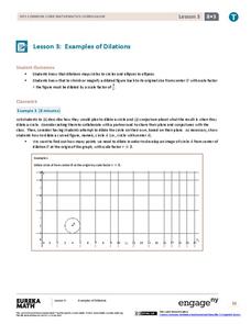
Examples of Dilations
Does it matter how many points to dilate? The resource presents problems of dilating curved figures. Class members find out that not only do they need to dilate several points but the points need to be distributed about the entire curve...
Curated OER
Scale Drawing
In this scale drawing worksheet, 10th graders solve 10 different word problems that include various types of scale drawings in each. First, they determine the length of a highway on a map. Then, students determine the dimensions of a...
Curated OER
Map Work: How Far?
For this map scale worksheet, students analyze a map of an area with several towns marked. Students use the scale (1 cm = 1 km) to answer 6 questions about the distances between towns.
Curated OER
Where Am I? Map Activity
In this map activity worksheet, learners determine which countries are shown on a set of 16 maps, then read facts about each country designed to help with a report on that country.
Curated OER
Ancient Egypt Geography
Nine questions to answer and one map to read. Seventh graders will use the map of Ancient Egypt to practice map reading skills and build a visual image of Ancient Geography.
Oregon State
World Map of Plate Boundaries
Young geologists piece together the puzzle of plate tectonics in an earth science lesson. Given a physical map of the world, they search for land formations that indicate the location of different types of plate boundaries.
Inside Mathematics
Swimming Pool
Swimming is more fun with quantities. The short assessment task encompasses finding the volume of a trapezoidal prism using an understanding of quantities. Individuals make a connection to the rate of which the pool is filled with a...
Curated OER
Maps Not Drawn to Scale
In this maps instructional activity, students redraw a map to make it more accurate and drawn to scale in the space given. Students draw 1 map and answer 2 questions.
Mathed Up!
Enlargements
Make enlargements with and without centers. Pupils work through seven problems dealing with dilations or enlargements. The first couple items are strict enlargements without centers, while the others have centers. Class members also...
Balanced Assessment
School Zone
Find the right house within walking distance from school. The short assessment has pupils determine the houses that are a given maximum distance from a school. Individuals then determine the shortest and longest walks from the homes that...
Mathematics Assessment Project
Fruit Boxes
Perfect for visual and hands-on learners, an engaging lesson prompts pupils to consider the different-sized boxes they can create from a piece of cardboard. They develop a model to determine the size of the box with the greatest...
Curated OER
Map Activities
In this geography worksheet, learners follow the directions and shade 3 different regions of a UK political map, shade European Union countries on a political map of Europe, match 4 physical feature of Africa to their descriptions, and...
Curated OER
Complex Analysis: Linear Transformations, Inversion Mappings
In this transformation worksheet, students identify a series of transformations and sketch them. They use inversion mapping to establish a one-to-one correspondence between nonzero points. This four-page worksheet contains...
Curated OER
Musical Plates-Earthquakes
In this plotting earthquake data worksheet, students use a large world map and given web sites showing the latitude and longitude for the epicenter of recent earthquakes around the world. Students plot 2 weeks of earthquake data...
Curated OER
Comparing the New Madrid and San Andreas Fault Zones
For this faults worksheet, students use an earthquake reference sheet to find the numbers for a modified Mercalli and Richter scale. They compare the San Andreas Fault zone and the New Madrid fault zone on the United States map. They...
Laboratory for Atmospheric and Space Physics
Charting the Progress of New Horizons
In 2006, New Horizons began its mission to fly to Pluto. As it continues its journey, scholars track its progress with the help of an informative website, all the while reinforcing measurement concepts with the construction of a scaled...
Curated OER
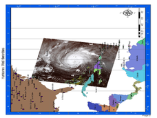
Hurricane Winds: A Spatial Hierarchy of Processes at Different Scales
For this earth science lesson, students study a satellite image of hurricane Isabel and write answers to 5 questions that follow. They match predictions to the map locations.
Curated OER
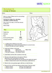
A Map of Ghana
In this Map of Ghana worksheet, students are given a blank map and key. They are told to label major features and color according to directions.
Curated OER
Is There Ice on Mercury?
In this ice on Mercury worksheet, students read about the data collected from the NASA Messenger and the Arecibo Radio Telescope indicating the possibility of ice on Mercury. Students solve 6 problems including finding the scale of the...
Curated OER
Outline Map of Japan
In this geography instructional activity, students examine a black line outline map of Japan. There is a compass rose on the page. There are no labeled cities.


