Curated OER
Using Your Senses
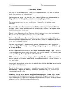
In this using your senses worksheet, students read a 1 page article on senses and then connect 6 body parts to their actual senses by drawing a line from one to the other.
Curated OER
Map of India
In this map of India activity, students label the capital city, the bodies of water and the compass points, then color the surrounding colors according to directions.
Curated OER
Measure for Measure
In this standard measurement worksheet, students solve 10 problems in which body parts and classroom objects are measured in inches. A paper ruler is provided.
Curated OER
WS 8.9 Presentation Questions
In this mixtures worksheet, students answer twenty three questions about student presentations on topics such as amalgams, homogenized milk, antifreeze and coolants, soaps and detergents and water softeners.
Curated OER
Regions of North America: The Chesapeake Bay
In this reading comprehension learning exercise, students read an article on "The Chesapeake Bay". Students read 5 sentences and fill in each blank in each sentence with a word from the article. Students answer 3 short answer...
Curated OER
Waterdrops Watershed Issue
For this environment worksheet, students take part in a variety of activities that includes an experiment, word search, and readings related to the watershed.
Curated OER
Physical vs. Chemical Changes
In this chemical reactions activity, students read about the differences between physical and chemical changes in substances. Then kids identify situations as either an example of physical or chemical change. Students learn how to...
Curated OER
Early Filtrate Functioning
In this biology worksheet, students look at the function of filtering in the nephron of the kidneys and the biochemistry is emphasized.
Curated OER
Outcomes Science 4
In this outcome science 4 worksheet, students apply scientific knowledge to answer and calculate a variety of questions. Students research the answer to several questions using the websites suggested.
Curated OER
Europe Puzzle
For this geography worksheet, students complete a crossword puzzle in reference to the geography of Europe. They identify the capital cities of various countries and the bodies of water which surround specific countries of Europe.
Curated OER
North America Puzzle Answer Sheet
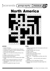
In this geography worksheet, students name the capitals of various countries found in North America. They also identify the various weather patterns across the continent and specific bodies of water. There are 21 descriptions and 21...
Curated OER
Eurasia Physical Map
In this Eurasia physical map worksheet, students make note of the major landforms and bodies of water located in this world region.
Curated OER
Australia and Oceania: Physical Map
In this Australia and Oceania physical map worksheet, students make note of the major landforms and bodies of water located within this region.
Curated OER
South America: Physical Map
In this South American physical map worksheet, students make note of the major landforms and bodies of water located on the continent.
Curated OER
Europe Physical Map
In this Europe physical map worksheet, students make note of the major landforms and bodies of water located on the continent.
Curated OER
USA: Physical Map
In this United States physical map worksheet, students investigate the major landforms and bodies of water located throughout the country.
Curated OER
Americas: Physical Map
In this Americas physical map worksheet, students make note of the major landforms and bodies of water located on the North American and South American continents.
Curated OER
Southeast Asia and the South Pacific: Political
In this Southeast Asia and the South Pacific political map worksheet, students examine boundaries of each of the countries and the placement of the capital cities. The major bodies of water are labeled.
Curated OER
Africa & Asia: Physical Map
In this African and Asian physical map worksheet, learners investigate the major landforms and bodies of water located on the African and Asian continents.
Curated OER
Asia and the South Pacific : Political Map
In this Asia and the South Pacific map worksheet, students examine the boundaries of the nations in this region of the world. Students also note the location of capital cities as they are denoted by stars. Major bodies of water are labeled.
Curated OER
Map of Africa
In this Africa worksheet, students analyze a labeled map of Africa. The map shows all the countries and regions as well as the bodies of water. There are no questions to answer.
Curated OER
World Map Labels
In this geography skills worksheet, students identify the countries and bodies of water labelled on the maps of the world, Africa, Asia, Canada, Europe, the Caribbean, the Middle East, North America, Australia, and South America.
Curated OER
Map of Egypt
In this map of Egypt worksheet, students label the cities, bodies of water, surrounding countries and color the map according to the directions.
Curated OER
Exploring the Map of Morocco
In this exploring the map of Morocco activity, students find and label cities, islands, bodies of water, mountains, deserts and other countries around Morocco.
Other popular searches
- Bodies of Water
- Landforms and Bodies of Water
- Major Bodies of Water
- Bodies of Water/rivers
- Bodies of Water Lesson
- Identifying Bodies of Water
- Different Bodies of Water
- Bodies of Water 101
- Bodies of Water Word Scramble
- Landforms and Water Bodies
- Earth's Bodies of Water
- Healthy Bodies Water


