Curated OER
Lesson on GPS
Students investigate global positioning systems. In this technology and mapping lesson, students view a PowerPoint presentation in which they identify the features of a GPS, state its uses, and follow steps to find a waypoint.
Curated OER
The Grand Excursion GPS Map
Eighth graders investigate the uses of a global positioning system. They create waypoints and have to find them using the system. Students must review the geographical concepts of latitude and longitude. The media requirements of the...
Curated OER
GPS Scavenger Hunt
Pupils go on a GPS scavenger hunt. They use GPS receivers to find designated waypoints and report back on what they found. They compute distances between waypoints based on the latitude and longitude, and compare with the distance the...
Curated OER
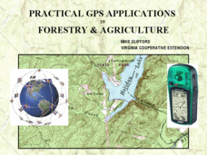
Practical GPS Applications in Forestry & Agriculture
An explanation of the Global Positioning System (GPS) and the Geographic Information System (GIS) is given in this presentation. Uses and applications are considered. How it works and sources of error are also touched upon. A large...
Curated OER
GPS Treasure Hunt
Students explore geography by participating in a treasure hunt activity. In this Global Positioning System lesson, students define the terms latitude and longitude while utilizing an electronic GPS device. Students view a PowerPoint...
Curated OER
GPS Navigation
Students search for clues given a map and a GPS. In this technology lesson, students solve a puzzle using the clues they gathered in the activity. They write a short reflection about the activity.
Curated OER
Rocks in our Backyard
Students examine igneous and sedimentary rocks. They observe and identify geological formations in their community, analyze igneous and sedimentary geological layers using a geological map, and use GPS to locate geological formations.
Curated OER
Latitude and Longitude
Learners find latitude and longitude on a map or atlas. They create maps with a cruise route. They practice plotting locations given latitiude and longitude.
Curated OER
Locating Vent Fields Using CTD Data
Students describe the way hydrothermal vents work. Students work on locating vent regions through remote collection of data about water temperature and density. Comparing density and temperatures graphs, students search for indicators...
Curated OER
Plan a Cruise Lesson Plan
Young scholars measure distances and report them in fractions, convert fractions to decimals, and multiply decimals.
Curated OER
Basic Math - Plan a Cruise
Students measure distances and report them in fractions. They convert fractions to decimals and multiply decimals.
Curated OER
Remarkable Trees of Virginia
Students draw a picture of their favorite tree from memory, and then add detail as they learn more about leaf characteristics of Virginia trees. They will use their writing skills to nominate one or more of their favorite trees to the...
Curated OER
Taking an Animal Census Grades 3-8
Students comprehend the competitive, interdependent, cyclic nature of living things in an environment. They conduct an animal census in a designated research area over a six-month period to determine what types of species are present,...
Curated OER
Mapping My Community
Ninth graders are introduced to GPS technology. They complete fieldwork as they visit a specific area of their community to identify and map types of land use in the surveyed area. They use the collected data to create a digital map.
Curated OER
GPS Receiver Basics
Young scholars practice using a GPS receiver. They walk in different directions and monitor their progress on maps. They enter specific locations and use information given to them to get them back to their original locations.


