Curated OER
What Do Maps Show?: Lesson 1 Introduction to Maps
Young scholars brainstorm a list of the different types of maps they have seen or used. Using the activity sheet, they look through a social studies book to find all the maps and to determine what they are used for. Using a poster, they...
Curated OER
Understanding Weather and Climate Patterns
Learners research the climate patterns of various locations and make predictions based on their findings. They determine the importance of latitude and longitude in weather and climate. Students create graphs displaying their collected...
Curated OER
Project Jukebox
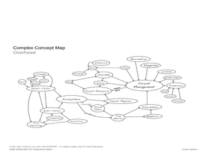
Students analyze an interview with the Climate Change Project Jukebox in order to help them undertand how to use a concept map. In this writing and climate change lesson, pairs of students log onto the Internet site for Climate...
Curated OER
Introduction to Maps
Young scholars investigate a variety of maps to explain what each one is used for.
Curated OER
Read a Fall Foliage Map
Young scholars examine the purpose of a color key and use a color key to help them read a map.
Curated OER
What Do Maps Show?
Students discover the uses for various types of maps. In this geography skills instructional activity, students discuss the type of maps that exist and what their individual features are. Students then practice using different types of...
Curated OER
Introduction to Maps
Students develop their map skills. In this geography instructional activity, students participate in an activity that requires them to survey their social studies book in order to find different types of maps and purposes for their uses.
Curated OER
Introduction to WorldWatcher: Coloring Temperature Maps
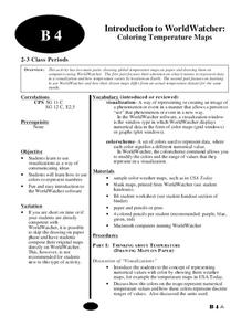
Young scholars are introduced to the software program WorldWatcher. In groups, they discover the temperature variations throughout the world and color a map according to the temperatures. They also practice using visualization to...
Curated OER
Where in the World is Cynthia San Francisco? A weather-related challenge
Students investigate concepts of weather using a guided, essential question. They collect data from satellite weather images and create models to track the progress of weather changes.
Curated OER
Chart the Weather for Cities Around the World
Young scholars orally describe Northern and Southern hemispheres, identify 7 continents, and point out specific countries and cities. They locate and record weather information.
Curated OER
Cloudy With A Chance of Meatballs
Second graders explore weather. In this weather lesson, 2nd graders read Cloudy With A Chance of Meatballs and participate in four supplemental science activities. Students participate in Internet research, create weather maps,...
Curated OER
Early Explorers
Fifth graders study early explorers. In this World history lesson, 5th graders draw an outline of a map labeling each part, build geographical features out of dough, and paint each of the land and water features.
Curated OER
Relative Location
First graders use landmarks to describe relative locations of a place. In this geography and mapping lesson plan, 1st graders draw picture maps of their bedrooms to show an object's location in relation to other objects. As an...
Curated OER
Which Way Is North?
Students investigate the concept of finding locations with the use of a compass and a map. They practice the skill of bearing and set up courses of travel to different destinations around the school grounds. Students also practice taking...
Curated OER
Transportation
Engage in an 8-day study of different modes of transportation. Your students explore the concept of location and define the physical characteristics of places, such as, land forms, bodies of water, natural resources, and weather.
Curated OER
What is Climate?
Students explore the differences between climate and weather. In this introductory lesson plan of a climate unit, students discuss the vocabulary and concepts associated with weather and climate. They build their information base for...
Curated OER
Teen America Travels New England
Students simulate the role of a travel agent to understand how to read and use road maps. They plan a bus trip through New England for a group of travelers that includes, bus travel, meals and attractions. They plan the distance that...
Curated OER
How Mountains Shape Climate
Students use raw data to make a climatograph; they explain the process of orographic precipitation and the concept of a rain shadow.
Curated OER
Quilt? What Quilt? I Don't See a Quilt!
Students analyze maps and cultures of major cities in the state of Arizona and designate different regions within the state according to geography and economy.
Curated OER
Where Is That Place?
Pupils choose a school in their state to compare their weather to. They also describe the differences between country, state, and a city. They can make flashcards to help them remember the important terms and concepts.
Curated OER
Teaching The Personality Profile
Students write a comprehensive personality profile feature that demonstrates knowledge of the Wall Street Journal formula of feature writing and the concept of show, don't tell. They experience a press conference interview situation.
Curated OER
European Climates
Ninth graders study the climate regions of Europe. In this geography skills lesson, 9th graders determine how weather and climate are influenced as they research the climate zones of specific locations and write about the ways that...
Curated OER
Stratigraphy -- Layers of Time in the Earth
Students are introduced to the process of stratification. Using the internet, they read about the Richard Beene archeological site near San Antonio. Using a map, they color code the different layers present at this site and answer...
Curated OER
Landforms All Around
Students create a "Landform Dictionary". They develop an overlay map and participate in hands-on activities to identify the key characteristics of landforms. They discuss the plant and animal life of these areas. Handouts for the lessons...


