Curated OER
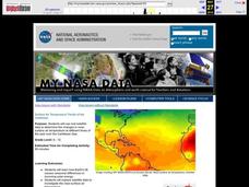
Surface Air Temperature Trends of the Caribbean
Students investigate the seasonal changes to sea surface and near-surface air temperatures near the equator. They use actual satellite data to track and graph the differences in air and sea temperatures during different seasons in the...
Curated OER
Coronado: Misfortune's Explorer
Fourth graders discuss the importance of Coronado's expedition through Texas and the trials his men endured during the journey. They view and discuss a map of Coronado's route, the effects of weather on the Great Plains, and Buffalo....
Curated OER
Hurricanes
Eighth graders gather information on hurricanes that are affecting the world at the time of the lesson. They work together in groups to collect the data and record their information in a table. They are asked questions to finish the lesson.
Curated OER
Sky Watching
Students trace how weather patterns generally move from west to east in the United States.
Curated OER
Clouds
Students explore the characteristics of clouds, their formation, symbols used in their identification, and the relationship of clouds to weather. The lesson focuses on how they are formed and their classification.
Curated OER
How Can We Locate Specific Places On Earth?
Second graders discover how to use longitude and latitude to locate specific sites on Earth. They compare old and new ways of locating specific places, and discover how latitude and longitude coordinates are used to locate places on Earth.
Curated OER
Celebrating the Solstice and Equinox
Fourth graders graph the number of daylight hors throughout the year and examine why day length varies. They discover that seasonal changes and latitude on Earth affect the number of hours of daylight in each day. Students listen to...
Curated OER
Shadow Trackers
Learners use online websites to inquire about the cycle of day and night. In this web based instructional activity, students are able to see the movement of the sun and Earth. Learners can look at different parts of the Earth as if they...
Curated OER
Modern Japan: Tsunami Relief
High schoolers participate in a lesson that is concerned with modern day tsunami relief in Japan. They conduct research and chart the regional alert centers. Students also note the worldwide effort to help those in need.
Curated OER
Under The Sea
Second graders study how a tsunami is formed by underwater events such as earthquakes, volcanoes or landslides. They discuss what they knew about living and non-living things in the ocean.
Curated OER
Planning a Tourist Resort
Students work in teams of 2 to complete the presentation portion of the assignment. They may be required to work alone or may work with their partner to complete the "Board Member's Responses."
Curated OER
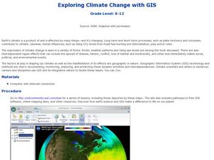
Exploring Climate Change with GIS
Students investigate climatological changes that are occurring to the Earth. For this climate change lesson, students access an assigned web site to view maps and lessons that show how climate change makes a difference to life on Earth.
Curated OER
Chinese Classroom Internet Activity
Students use the internet to complete an online activity in Chinese. Using the weather section, they research the weather conditions in Hong Kong and other popular cities in China. They answer Chinese questions in Chinese about the...
Curated OER
The Accuracy of Climate Data
Students use maps to determine how accurate climate data really is. They also answer questions using a table of data.
Curated OER
Olympic Games Snowboard Design
Pupils find travel destinations and information on countries around the world, and use their knowledge to create a snowboard design that represent the country they pick. They explore maps, weather, geography, languages, in their quest.
Curated OER
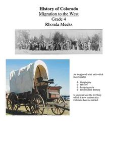
History of Colorado-Migration to the West
Fourth graders identify reasons for people moving to the Colorado Territory and examine how moving in the 1800's is different than moving today. They also practice reading maps and gathering information from maps, as well as, describe...
Curated OER
Earth's Surfaces
Students identify and define geology and earth surface vocaulary and their meanings to classify rocks and explore caves and their properties. Students find rocks and test them according to Moh's scale. They create a color coded earth...
Curated OER
Rain Drops Keep Falin' On My Drainage Basin
Students compile information about rainfall, lake elevations and releases of water from Tuttle Creek reservoir into maps, graphs and charts.
Curated OER
Treasure Hunt Region
Students are introduced to new geography related vocabulary words. In groups, they focus on a different region of the school and develop a new name for it. They create a treasure map for another group to use in the region of the school...
Curated OER
Our State Road Trip
Students take a virtual tour of the country of China instead of a state. Using the Internet, they examine the differences between a political and physical map and use latitude and longitude to locate specific places. They also research...
Curated OER
Trekking to Timbuktu: The Geography of Mali - Student Version
Eleventh graders locate Mali on a world map, describe the landscape and climate of Mali, and locate the city of Timbuktu and describe the local weather. They compare life along the Niger in ancient times to that of today
Curated OER
Stratigraphy -- Layers of Time in the Earth
Students are introduced to the process of stratification. Using the internet, they read about the Richard Beene archeological site near San Antonio. Using a map, they color code the different layers present at this site and answer...
Curated OER
Texas Week
Students explore Texas in the past and present. They pick out cities on a map and find information and analyze an Internet site.
Curated OER
Adapted to Fire
Fourth graders explore forest species' adaptations to fire by participating in a scavenger hunt and mapping a burned forest. Students create maps and explore how indigenous species adapted to living with fire.
Other popular searches
- Reading Weather Maps
- Interpreting Weather Maps
- Interpret Weather Maps
- Surface Weather Maps
- Creating Weather Maps
- Weather Maps With Fronts
- Pressure and Weather Maps
- Analyzing Weather Maps
- Construct Weather Maps
- Winds and Weather Maps
- Interactive Weather Maps
- Just Interpret Weather Maps
