Curated OER
Comparing Temperatures and Latitudes
Eighth graders collect weather data from a variety of cities at the same latitudes, but on different continents. They organize data using spreadsheet program, generate graphs, and incorporate into a word processing document. Students...
Curated OER
Weather Patterns
Students research to determine weather patterns and natural hazards most likely to affect their region.
Curated OER
Weather Reporter
Fourth graders explore the components of a weather map, mark cities on the map and place the appropriate temperatures and weather conditions occurring in the cities on the weather map created.
Curated OER
A Comparison of Cloud Coverage Over Africa
Students use a NASA satellite data to contrast amounts of cloud coverage over different climate regions in Africa. They explore how Earth's major air circulations affect global weather patterns, and relate to local weather patterns.
Curated OER
Settlement Exploration: Then and Now
NASA has crafted an imaginative and memorable series of lessons, "NASA and Jamestown Education Module." This lesson is one of the five components. In it, middle schoolers connect history and science by comparing the settlement of...
PBS
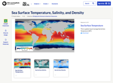
Sea Surface Temperature, Salinity, and Density
Earth's vast ocean is full of mysteries! Science scholars discover the big-picture properties that influence its characteristics at different latitudes using a lesson plan from PBS's Weather and Climate series. After completing a...
Curated OER
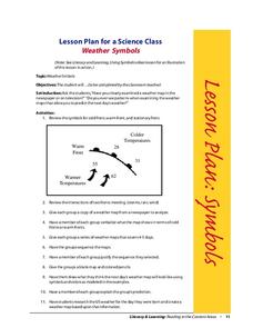
Weather Symbols
Learners study weather symbols. In this weather symbols lesson, students review the symbols for cold, warm, and stationary fronts. Learners use a weather map to study the weather symbols, complete a weather illustration and prediction...
Curated OER
Creating Station Models
Students review weather conditions at various cities and create station models on a weather map.
Curated OER
Meteorologist for the Day
Fourth graders examine the symbols used on weather maps. They analyze a newspaper weather forecast and identify and discuss the various symbols used on the map. Next, they prepare a weather map for their own city using the symbols...
Curated OER
Weather, Migrations, and Plants
Young scholars research the effects of day-to-day weather on animal migrations, plant growth and other seasonal events. They consult maps, observe and record local conditions, keep journals and use their collected data check hypotheses.
Curated OER
Creating Station Models
Students work in groups to interpret weather maps. They use latitude and longitude readings to complete a worksheet together and turn in the worksheet along with the maps and a rubric.
Curated OER
Weather
Students describe the weather and temperature in the city, state, and/or country in which they live during the 4 seasons.
Curated OER
Weather In The World
Students investigate the weather in different places in the world. In this algebra lesson, students use technology to gain an understanding of how to study integers. They add and subtract integers on a number line.
Curated OER
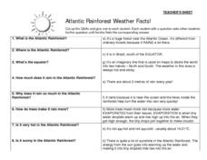
Atlantic Rainforest Weather Facts!
In this rainforest fact worksheet, young scholars learn about rainforest weather by participating in a question/answer group activity. There are 8 questions on small cards and 8 corresponding answers. Students with questions circulate...
Curated OER
Make Your Own "Weather" Map
Students create their own "weather" map using data from x-ray sources. They analyze and discuss why it is important to organize data in a fashion in which is easy to read. They compare and contrast different x-ray sources using a stellar...
Curated OER
Will There Be a White Christmas This Year?
Students examine historical weather data, and create map and color key that illustrates the likelihood of a white Christmas in different locations across the United States.
Curated OER
Cloudy With A Chance of Meatballs
Second graders explore weather. In this weather lesson, 2nd graders read Cloudy With A Chance of Meatballs and participate in four supplemental science activities. Students participate in Internet research, create weather maps,...
Curated OER
Weather
Second graders study the basic components of weather. They construct a thermometer and anemometer to measure temperatures, precipitation, and wind speed. In addition, 2nd graders discover how to find these components on weather maps.
Curated OER
Mapping China
Students identify cities in China on a map. In this map skills instructional activity, students locate the continent of Asia and the country of China. Students use a blank map to label China and bordering countries.
Curated OER
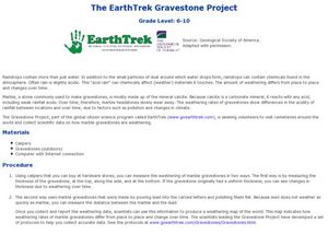
EarthTrek Gravestone Project
Students explore the effects of acid rain. In this acid rain lesson, students investigate the effects of the weathering from acid rain in different places. Students visit cemetaries to collect data about the effects of acid rain on the...
Curated OER
Weather
Fourth graders study a map and locate cities, read information and create a chart. In this weather lesson students place appropriate weather information on a map and write a script using their information to relay the weather to...
Curated OER
Clouds and Your Weather
Seventh graders identify clouds and the weather associated with them. They use informational articles and personal weather observations to learn about the relationships between weather fronts and clouds.
Curated OER
Weather Patterns
Students collect weather data over a thirty day period to gain an increased understanding of the weather patterns in their area. Once the data is collected, students post their finding online using a web tool. Finally, students attempt...
Other popular searches
- Reading Weather Maps
- Interpreting Weather Maps
- Interpret Weather Maps
- Surface Weather Maps
- Creating Weather Maps
- Weather Maps With Fronts
- Pressure and Weather Maps
- Analyzing Weather Maps
- Construct Weather Maps
- Winds and Weather Maps
- Interactive Weather Maps
- Just Interpret Weather Maps


