Library of Congress
Loc: World War Ii Military Situation Maps
World War II Military Situation Maps contains maps showing troop positions beginning on June 6, 1944 to July 26, 1945. Starting with the D-Day Invasion, the maps give daily details on the military campaigns in Western Europe, showing the...
University of Texas at Austin
Perry Castaneda Library Map Collection: Historical Maps of Europe
This collection from the University of Texas Library Online of historical maps contains a wide variety of maps from various parts of Europe and from different parts of history. Each map is accompanied by a brief description and is clear...
Curated OER
Educational Technology Clearinghouse: Maps Etc: Central and Western Europe, 1920
Map of Central and Western Europe after the Treaty of Versailles at the end of WWI. The map includes railroads, canals, major cities and capitals, and the country boundaries established by the Treaties of Versailles, proposed boundaries...
Curated OER
Etc: Maps Etc: Western Europe During the Third Inter Glacial Stage, 25,000 Bce
Map of Western Europe, at a time when sea levels were much lower and the British Isles were connected with the mainland. Major river routes are shown extending to the theoretical coastline of the period. According to the authors in 1916,...
Other
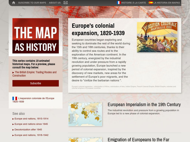
The Map as History: Europe's Colonial Expanision 1820 1939
European countries began exploring and seeking to dominate the rest of the world during the 15th and 16th centuries, thanks to their ability to control sea routes and to the discovery of the American continent. In the 19th century,...
Curated OER
Us Troops Were Rushed to Western Europe in the 1950s to Deter Soviet Expansion
A fantastic history of NATO. From its inception after WWII to its call to action during the Kosovo crisis, the BBC does a great job of giving readers a well-rounded look at the institution. Includes a map with all member countries as...
Curated OER
[ Image: Nato Tanks Are Used to Bolster the Defence of Western Europe]
A fantastic history of NATO. From its inception after WWII to its call to action during the Kosovo crisis, the BBC does a great job of giving readers a well-rounded look at the institution. Includes a map with all member countries as...
Other
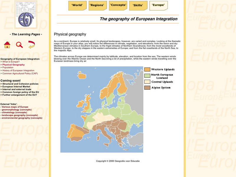
The Learning Pages: Geography of European Integration
This page has a map showing the 4 different types of land located in Europe. Information is provided on Europe as well as links to more maps and information.
Curated OER
Educational Technology Clearinghouse: Maps Etc: Europe, Post Wwi, 1920
Map of Central and Western Europe after the Treaty of Versailles at the end of WWI. The map includes railroads, canals, shipping routes, major cities and capitals, and the country boundaries established by the Treaties of Versailles,...
Curated OER
Etc: Maps Etc: Political Boundaries in Europe, 1920
Map of Central and Western Europe after the Treaty of Versailles at the end of WWI. The map includes railroads, canals, shipping routes, major cities and capitals, and the country boundaries established by the Treaties of Versailles,...
Curated OER
Educational Technology Clearinghouse: Maps Etc: Europe, 1920
Map of Central and Western Europe after the Treaty of Versailles at the end of WWI. The map includes railroads, canals, shipping routes, major cities and capitals, and the country boundaries established by the Treaties of Versailles,...
Curated OER
Educational Technology Clearinghouse: Maps Etc: Russia, 1920
A map from 1920 of western Russia showing the political divisions within the country at the time. The map is color-coded to show the boundaries of European Russia, including the territories of Finland, the Baltic Provinces, Poland, White...
Other
Smis: Daily Satellite Photo: European Russia, Western Siberia, North East Europe
This site offers weather maps for three areas: European Russia, Western Siberia, and Northeast Europe. The maps show very current weather conditions for each area.
Curated OER
Educational Technology Clearinghouse: Maps Etc: Europe and Western Asia, 1883
A map from 1883 of Europe and western Asia showing country borders and capitals, principal cities, mountain systems, and rivers.
Curated OER
Etc: Maps Etc: Europe After the Congress of Vienna, 1815
A color map of Europe after the Congress of Vienna in 1815, which redrew the continent's political boundaries after the French Revolution, Napoleonic Wars, and the dissolution of the Holy Roman Empire. This map is color-coded to show...
Curated OER
Educational Technology Clearinghouse: Maps Etc: Pre Colonial Africa, 1872
A map of Africa showing the continent prior to the Berlin Conference of 1885, when the most powerful countries in Europe at the time convened to make their territorial claims on Africa and establish their colonial borders at the start of...
Curated OER
Etc: Maps Etc: Africa Before the Berlin Conference, 1884
This is an interesting map of Africa showing the continent before the Berlin Conference of 1885, when the most powerful countries in Europe at the time convened to make their territorial claims on Africa and establish their colonial...
Curated OER
Educational Technology Clearinghouse: Maps Etc: Pre Colonial Africa, 1885
A map of the African continent prior to the Berlin Conference of 1885, when the most powerful countries in Europe at the time convened to make their territorial claims on Africa and establish their colonial borders at the start of the...
Curated OER
Educational Technology Clearinghouse: Maps Etc: British Isles, 1906
A map of the British Isles from 1906, showing the terrain, rivers, and coastal features of Ireland, Scotland, England, and Wales. Major cities are shown, and the map includes an inset map of the Shetland and Orkney Islands, a locator map...
Curated OER
Etc: Maps Etc: Population of North America, 1898
A map from 1898 showing the population distribution of North America, Central America, and Caribbean to Puerto Rico. The map shows areas of sparse to heavily populated concentrations at the time. "Many thousands of white men from western...
Other
Andorra
This is a map of Andorra that includes all of the major cities and rivers. Also provides a history of Andorra's government.


