Curated OER
Physical and Human Geography Review Worksheet and Study Guide
In this geography skills worksheet, students respond to 30 short answer questions pertaining to physical and human geography.
Curated OER
Europe Map
In this world geography worksheet, students study the map of Europe and locate the 48 countries within the continent. Students write the names on the provided lines.
Curated OER
Ocean World
In this online interactive geography skills worksheet, students answer 5 multiple choice questions regarding El Nino. Students may submit their answers to be scored.
Curated OER
World Climates Study Guide
In this geography skills worksheet, students respond to 24 fill in the blank and multiple choice questions about the climate regions and characteristics of the world.
Curated OER
Decolonization in Asia
Pin point areas in Asia that went through decolonization and regained independence from colonial rule. There are 32 countries and bodies of water to identify on the provided map.
Curated OER
The Expansion of Islam to 750
Track the expansion of Islam throughout the Mediterranean and Near East. Locate and label 17 different areas that adopted the tenets of Islam.
Curated OER
Map of Africa
Using a completed map (not provided), pupils will use this map to fill in the geographic features of Africa. An appropriate map can be printed using the Internet and placed under a document camera for the class to reference.
Curated OER
The Barbarian Invasions of the Roman Empire
Fifteen different locations to map and correctly label. Use the provided list to show major areas of Barbarian invasions occurring during the Roman Empire.
Curated OER
The Spread of Printing
Document the spread of printing, which occurred in the 1500s. Use the provided list of water ways, countries, and cities to label specified locations on the map.
Curated OER
The Netherlands: map
Use the provided list to label a map of Europe and the Netherlands. There are 77 locations to label. You have to know your stuff to fill out this challenging map.
Curated OER
European Language Groups, 1850
Document the linguistic diversity and major language groups common to Europe in 1850. A map and a list of regions, countries, and water ways is provided.
Curated OER
The Crimean War
Use the list of cities, countries, and water ways to correctly label a map of the regions associated with the Crimean War. There are approximately 20 locations to locate and identify.
Curated OER
World Capitals Quiz
In this online interactive geography quiz learning exercise, students respond to 195 identification questions about the capital cities of countries in the world. Students have 12 minutes to complete the quiz.
Curated OER
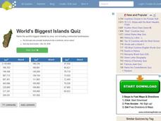
World's Biggest Islands Quiz
In this online interactive geography quiz worksheet, students respond to 20 identification questions about the largest islands in the world. Students have 4 minutes to complete the quiz.
Curated OER
World Continents Map Quiz
In this online interactive geography quiz learning exercise, students respond to 7 identification questions regarding the continents of the world.
Ms. Catsos
Ancient Rome Map Worksheet
It wasn't just the great leaders of ancient Rome that shaped their civilization—the geography of the region played a major role as well. After first identifying major land masses, bodies of water, and city states on a map of Europe,...
Curated OER
Natural Features of Countries Quiz
In this online interactive geography quiz worksheet, students examine the chart that includes the names of 20 physical features located throughout the world. Students identify the names of the countries where the features are...
Curated OER
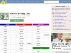
World Currency Quiz
In this online interactive geography quiz worksheet, students respond to 81 identification questions about world currencies. Students have 10 minutes to complete the quiz.
Curated OER
Capitals of the World
In this geography worksheet, students write the capitals of 20 countries. Countries include England, Portugal, Australia, and Canada.
Curated OER
The Physical World: Continents and Oceans
In this world map activity, study the map of the continents and oceans. Students label each of the 12 sections of the world map.
Curated OER
World's Longest Rivers Map Quiz
In this online interactive geography quiz worksheet, learners respond to 40 identification questions about the world's largest rivers.
Curated OER
World Lakes Map Quiz
In this online interactive geography quiz worksheet, students respond to 15 identification questions regarding major world lakes.
Curated OER
World Mountains Map Quiz
In this online interactive geography quiz activity, students respond to 10 identification questions regarding some of the world's mountain ranges.
Curated OER
The United States and Canada Review Worksheet and Study Guide
For this geography skills worksheet, students respond to 34 short answer questions about the geographic features and climates found in the United States and Canada.


