Hi, what do you want to do?
Curated OER
Europe Before and after WWI
Eighth graders compare and contrast maps of Europe before and after World War I. In this World War I lesson, 8th graders color and label maps of Europe prior to the war and after it. The historical maps can be accessed online.
Curated OER
Map Skills
High schoolers examine the nations, battlefields, troop movement of the Germans through Belgium and the location of both fronts during World War I by creating a map. They visualize the strength of the Germans early in the war.
Curated OER
Armenian Genocide
As your historians examine the beginnings of WWI, ensure they are familiar with the Armenian Genocide. This basic introductory lesson plan utilizes teacher-led discussion, map analysis, and a Socratic seminar. Not much detail is offered...
Curated OER
Create a Migrant's Scrapbook from the First Great Migration
Help young historians personally engage in the stories of African Americans during the Great Migration! Assessing a migration route map, learners create a migrant character's experience, adding details while studying primary sources. A...
Curated OER
World War I
Eighth graders examine the condition of the world from 1880 until the start of World War I. After watching a PowerPoint presentation, they discuss the causes and effects of the war and complete a study guide with a partner. To end the...
Curated OER
The Russian Revolution
Students complete a matching game based on geographic features of Russia and label a map with these features. In this geography and politics lesson, students identify resources and populations in Russia and complete a T-Chart on a video...
Curated OER
Selling Warfare - Propaganda Posters
Students examine the use and purpose of propaganda posters during World War I. They work in groups to create a propaganda poster supporting a nation's war effort.
Curated OER
Educational Technology Clearinghouse: Maps Etc: Africa After Wwi, 1921
Political map of Africa shortly after WWI showing boundary changes, including losses of German territory after the Treaty of Versailles. German Southwest Africa is shown as part of the Union of South Africa, and German East Africa is...
Curated OER
Educational Technology Clearinghouse: Maps Etc: Post Wwi Northern Africa, 1920
A political map of the northern part of the African continent after WWI with reference to territories controlled by European countries and showing the former German territories ceded by the Treaty of Versailles to France and Britain....
Curated OER
Educational Technology Clearinghouse: Maps Etc: Post Wwi Africa, 1920
A political map of Africa in 1920 showing colonial possessions of the British, French, Italian, Portuguese, Spanish, and Belgians, including the former German colonies, lost after WWI, per the Treaty of Versailles.
Curated OER
Etc: Maps Etc: Political Boundaries in Europe, 1920
Map of Central and Western Europe after the Treaty of Versailles at the end of WWI. The map includes railroads, canals, shipping routes, major cities and capitals, and the country boundaries established by the Treaties of Versailles,...
Curated OER
Etc: Maps Etc: European Possessions of Africa, 1922
A political map of Africa showing European possessions after WWI and the ceding of German possessions in accordance to the Treaty of Versailles. The inset map details the Cape Verde Islands and Senegal, Gambia, and Portuguese Guinea.
Curated OER
Educational Technology Clearinghouse: Maps Etc: Germany, 1871 1914
A map of Germany, from 1871 after the Franco-Prussian War and creation of the German Empire, to 1914 and the beginning of WWI. The map shows the German and Prussian territories unified by Otto von Bismarck, including major cities and...
National Geographic
National Geographic: European Borders Through History
Lesson in which students use maps to explore how European political borders have changed over time. Maps after WWI, WWII and European Union provided for comparison.
Curated OER
Educational Technology Clearinghouse: Maps Etc: Africa Prior to Wwi, 1914
A political sketch map of Africa just prior to WWI in 1914, showing the colonial possessions of European powers established at the Berlin Conference of 1885. The map shows the territorial claims of the British, French, German,...
World War 1
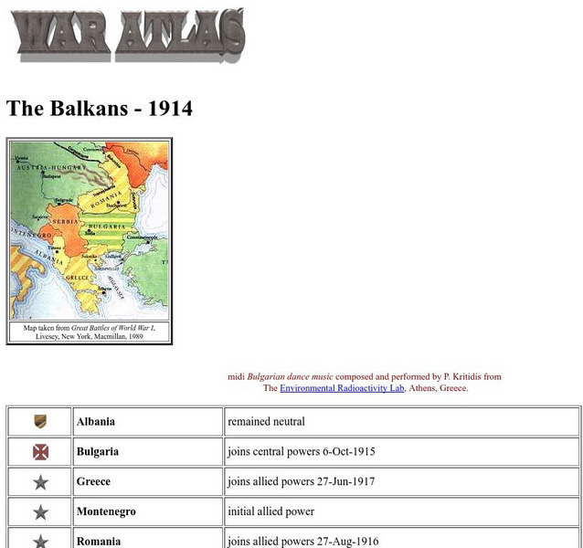
Worldwar1.com: Trenches on the Web: War Atlas: The Balkans 1914
Contains a map of the Balkans, a list of the countries there, and their political positions in World War I.


