Lesson Planet
Search educational resources
  • Sign In Try It Free
  • AI Teacher Tools
    • Discover Resources Search reviewed educational resources by keyword, subject, grade, type, and more
    • Curriculum Manager (My Content) Manage saved and uploaded resources and folders To Access the Curriculum Manager Sign In or Join Now
    • Browse Resource Directory Browse educational resources by subject and topic
    • Curriculum Calendar Explore curriculum resources by date
    • Lesson Planning Articles Timely and inspiring teaching ideas that you can apply in your classroom
    • Our Story
    • Frequently Asked Questions
    • Testimonials
    • Contact Us
  • Pricing
  • School Access
    • Your school or district can sign up for Lesson Planet — with no cost to teachers
      Learn More
  • Sign In
  • Try It Free

Hi, what do you want to do?

Create a lesson plan
Generate resources with 80+ AI teacher tools
Search 200,000 instructional videos
Find a teaching resource
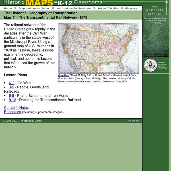
Newberry: Historical Geography: Map 11: The Transcontinental Rail Network, 1878 Lesson PlanNewberry: Historical Geography: Map 11: The Transcontinental Rail Network, 1878 Lesson Plan
Publisher
The Newberry Library
Resource Details
Curator Rating
Educator Rating
Not yet Rated
Grade
K - 1st
Subjects
Social Studies & History
2 more...
Resource Type
Lesson Plans
Audiences
For Administrator Use
1 more...
Lexile Measures
1410L
Lesson Plan

Newberry: Historical Geography: Map 11: The Transcontinental Rail Network, 1878

Curated by ACT

Lesson for K-12 using historical maps examine the geographic, political, and economic factors that influenced the growth of railroads.

3 Views 5 Downloads

Additional Tags

transcontinental railroad, geography of transportation, building a transcontinental railroad

Classroom Considerations

  • Knovation Readability Score: 5 (1 low difficulty, 5 high difficulty)

See similar resources:

Handout

Arthur’s World Neighborhood: Bibliography for Kids

PBS
Support young learners as they expand their cultural awareness with this list of children's literature on countries from around the globe. Including both fictional and non-fictional texts. This resource will help...
1st - 5th Social Studies & History
CCSS: Adaptable
Lesson Plan

Introduction to the World Map

World Maps Online
Students identify the differences between maps and globes. In this map skills instructional activity, students are shown a globe and a map and recognize the differences. Students use post-it notes to locate several locations on the world...
K - 3rd Social Studies & History
Activity

Around the Block

PBS
Arthur and his friends help children explore the concepts of family, community, and diversity in a fun series of activities. From performing peer interviews to mapping out the different places learners have lived or visited, this...
K - 4th Social & Emotional Learning
CCSS: Adaptable
Printables

Map of The USA Jigsaw Puzzle

Mr. Printables
Encourage young learners to explore the United States with this printable map puzzle. A fun activity that engages children in learning US geography.
1st - 5th Social Studies & History
Lesson Plan

Newberry: Environmental History: Map 8: Mining in South Dakota, 1878

The Newberry Library
Lessons for K-12 based on a series of maps teaches students about the environmental changes resulting from mining in South Dakota, 1878.
K - 1st Social Studies & History
Lesson Plan

Newberry: Historical Geography of Transportation: Map 10: United States, 1835

The Newberry Library
Lessons K-12 examining the role of transportation systems in the development and settlement of the lands between the Appalachian Mountains and the Mississippi River.
K - 1st Social Studies & History
Lesson Plan

Newberry: Political and Military History: Map 15: The World at War, 1944

The Newberry Library
Lesson for K-12 using historical map teaches students about the relationship between perspectives of the world and map projections.
K - 1st Social Studies & History
Lesson Plan

Newberry: Exploration and Encounter: Map 1: The World Columbus Knew in 1482

The Newberry Library
Newberry Library presents historical map on the Age of Exploration with lesson plans for all ages k-12. Includes curator notes and a wealth of supplemental resource material.
K - 1st Social Studies & History
Lesson Plan

Newberry: Exploration and Encounter: Map 2: Indian Map of the Southeast, 1721

The Newberry Library
K-12 lessons using historical maps from Newberry Library presents an Indian map of the Southeast, ca. 1721. Students use maps to understand how spatial relationships are represented. Links to supplemental resources and reference material.
K - 1st Social Studies & History
Unit Plan

The United Kingdom

Core Knowledge Foundation
Scotland, Northern Ireland, Wales, and England are four countries united by more than a monarchy. Academics explore the geography of the nations that make up the United Kingdom.  The resource is broken into six lessons focusing on...
1st - 2nd Social Studies & History
Try It Free
© 1999-2026 Learning Explorer, Inc.
Teacher Lesson Plans, Worksheets and Resources

Sign up for the Lesson Planet Monthly Newsletter

Open Educational Resources (OER)

  • Health
  • Language Arts
  • Languages
  • Math
  • Physical Education
  • Science
  • Social Studies
  • Special Education
  • Visual and Performing Arts
View All Lesson Plans

Discover Resources

  • Our Review Process
  • How it Works
  • How to Search
  • Create a Collection

Manage Curriculum

  • Edit a Collection
  • Assign to Students
  • Manage My Content
Contact Us Site Map Privacy Policy Terms of Use